Enable Location

We need your location to show you interesting places around you

Discover nearby places

Find interesting locations and hidden gems around you

Precise directions

Get accurate directions and distances to places

Your location is never shared with other users. It's only used when you tap the location button.

Eaton

Log in to your account

Start exploring — it's free

Trusted by 63,839 travelers worldwide

Continue with Google
Continue with Apple
or

We will send you a code to connect

By continuing, you accept our Terms and Conditions and our Privacy Policy

Check your inbox

We've sent a pincode in your inbox. Please enter the code below.

Discussion Reviews 1 Photos
15.9k Popularity

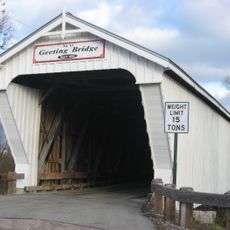
Eaton, city in Ohio, United States
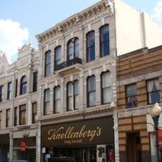
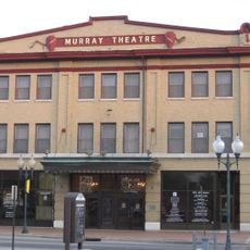
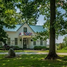
Eaton is a city and county seat in Preble County, Ohio, serving as the administrative and social hub of the county. The downtown district contains historic buildings, local shops, restaurants, and green spaces that together form a walkable center where people gather and spend time.

Eaton was founded in the early 1800s by William Bruce and has a history spanning over 200 years. The downtown buildings and local markers tell the story of how the city developed from an early settlement into the county seat it is today.

The name Eaton reflects its founding era in the early 1800s and its role as a county seat. Today, the downtown serves as a gathering place where residents support local shops and restaurants while participating in community events that strengthen local bonds.

Downtown Eaton is easy to explore on foot, with shops, restaurants, and parks located close together in a compact area. The city sits just 5 miles (8 kilometers) from Interstate 70, making it convenient for travelers passing through the region.

The Adopt-A-Pot program allows individuals and businesses to decorate and plant flowers in containers along downtown streets. This grassroots initiative brightens the public space and reflects the community's commitment to maintaining and improving the area together.

The community of curious travelers

AroundUs brings together thousands of curated places, local tips, and hidden gems, enriched daily by 60,000 contributors worldwide.

Start exploring
Location
Inception
1806
Elevation above the sea
317 m
GPS coordinates
39.74750,-84.63390
Latest update
February 19, 2026 23:20
Around this place
Hueston Woods State Park
United States of America

Hueston Woods State Park

21.3 km
Eaton High School
United States of America

Eaton High School

2.1 km
Roberts Covered Bridge
United States of America

Roberts Covered Bridge

886 m
Reid Memorial Presbyterian Church
United States of America

Reid Memorial Presbyterian Church

23.6 km
Richmond Railroad Station Historic District
United States of America

Richmond Railroad Station Historic District

24 km
Abram Gaar House and Farm
United States of America

Abram Gaar House and Farm

22.9 km
Brubaker Covered Bridge
United States of America

Brubaker Covered Bridge

13.1 km
Christopher C. Walker House and Farm
United States of America

Christopher C. Walker House and Farm

24.1 km
Old Richmond Historic District
United States of America

Old Richmond Historic District

23.6 km
Starr Historic District
United States of America

Starr Historic District

23 km
Richmond Downtown Historic District
United States of America

Richmond Downtown Historic District

23.8 km
Forest Hills Country Club
United States of America

Forest Hills Country Club

21.1 km
Henry and Alice Gennett House
United States of America

Henry and Alice Gennett House

22.7 km
Christman Covered Bridge
United States of America

Christman Covered Bridge

3.1 km
Reeveston Place Historic District
United States of America

Reeveston Place Historic District

23.2 km
Hopewell Associate Reformed Presbyterian Church
United States of America

Hopewell Associate Reformed Presbyterian Church

19.4 km
Richmond Civic Theater
United States of America

Richmond Civic Theater

23.6 km
East Main Street-Glen Miller Park Historic District
United States of America

East Main Street-Glen Miller Park Historic District

21.9 km
Bethel A.M.E. Church
United States of America

Bethel A.M.E. Church

24 km
Warnke Covered Bridge
United States of America

Warnke Covered Bridge

17.4 km
Geeting Covered Bridge
United States of America

Geeting Covered Bridge

11.1 km
Acton House
United States of America

Acton House

505 m
Harshman Covered Bridge
United States of America

Harshman Covered Bridge

12.6 km
Unzicker-Cook House
United States of America

Unzicker-Cook House

23.5 km
Andrew F. Scott House
United States of America

Andrew F. Scott House

23.8 km
Model T Museum
United States of America

Model T Museum

24 km
Preble County Historical Society and Nature Reserve
United States of America

Preble County Historical Society and Nature Reserve

12.4 km
Dixon's Branch Bridge
United States of America

Dixon's Branch Bridge

13.8 km
Show the full map
Reviews
Share your experience

No review yet

Discussions
Start a discussion...

No discussion yet

« Eaton - city in Ohio, United States » is provided by Around Us (aroundus.com). Images and texts are derived from Wikimedia project under a Creative Commons license. You are allowed to copy, distribute, and modify copies of this page, under the conditions set by the license, as long as this note is clearly visible.

Discover hidden gems everywhere you go!

From secret cafés to breathtaking viewpoints, skip the crowded tourist spots and find places that match your style. Our app makes it easy with voice search, smart filtering, route optimization, and insider tips from travelers worldwide. Download now for the complete mobile experience.

Around Us App Screenshot

A unique approach to discovering new places

Le Figaro

All the places worth exploring

France Info

A tailor-made excursion in just a few clicks

20 Minutes

Around Us
Travel Guide & Maps
Download

Send to your phone

QR Code
1

Open the camera app on your mobile.

2

Point at the QR code with your camera. A notification will appear.

3

Tap the notification to open the link.