Chest opened
+${chestReward.xp} XP
Explorer
NOUVEAU ×${chestReward.collectible.quantity}
tapez pour fermer
Chest locked

Open chests in the app

Around Us is built for your phone — chests unlock when you walk, explore and capture nearby places.

Enable Location

We need your location to show you interesting places around you

Discover nearby places

Find interesting locations and hidden gems around you

Precise directions

Get accurate directions and distances to places

Your location is never shared with other users. It's only used when you tap the location button.

Log in to your account

Start exploring — it's free

Trusted by 72,893 travelers worldwide

Continue with Google
Continue with Apple
or

We will send you a code to connect

By continuing, you accept our Terms and Conditions and our Privacy Policy

Check your inbox

We've sent a pincode in your inbox. Please enter the code below.

Discussion Reviews Photo
10.7k Popularity

Goshen, Administrative division in Indiana, United States.

Goshen is a city in northern Indiana that serves as the county seat of Elkhart County and sits near the Michigan border. It is located within the larger South Bend-Elkhart-Mishawaka region and functions as a central community for the area.

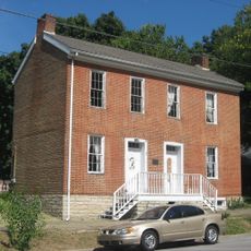
The area was originally home to the Miami, Peoria, and Potawatomi peoples before European settlers founded the city in 1831. This Native American heritage continues to shape the history and identity of the region today.

The annual Elkhart County 4-H Fair draws thousands of visitors who come to see livestock shows, craft booths, and local artisan displays. The event reflects the rural tradition and agricultural roots that remain important to the community.

The municipal airport southeast of downtown provides convenient access for private aircraft and regional transportation connections. The downtown area is walkable and easy to navigate, with local shops and restaurants throughout.

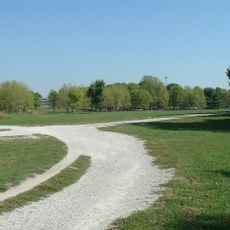
The Pumpkinvine Nature Trail runs from the city to Middlebury and Shipshewana along a former railroad line. The path demonstrates how a historic rail route has been converted into a modern recreational way through rural countryside.

The community of curious travelers

AroundUs brings together thousands of curated places, local tips, and hidden gems, enriched daily by 60,000 contributors worldwide.

Start exploring
GPS coordinates
38.40268,-85.58129
Latest update
December 10, 2025 15:52
Around this place
Rose Island
United States of America

Rose Island

4.4 km
United States of America

Indiana Army Ammunition Plant

9.5 km
Zachary Taylor National Cemetery
United States of America

Zachary Taylor National Cemetery

14.9 km
Locust Grove
United States of America

Locust Grove

14.7 km
E. P. "Tom" Sawyer State Park
United States of America

E. P. "Tom" Sawyer State Park

13.3 km
Zachary Taylor House
United States of America

Zachary Taylor House

14.9 km
Charlestown State Park
United States of America

Charlestown State Park

5.2 km
Lincliff
United States of America

Lincliff

13.8 km
Boxhill
United States of America

Boxhill

13.1 km
John Work House and Mill Site
United States of America

John Work House and Mill Site

9.8 km
Pewee Valley Confederate Cemetery
United States of America

Pewee Valley Confederate Cemetery

14.4 km
Prather Site
United States of America

Prather Site

10.3 km
Bellevoir-Ormsby Village
United States of America

Bellevoir-Ormsby Village

15.1 km
Von Allmen Dairy Farm House
United States of America

Von Allmen Dairy Farm House

10 km
Patriots Peace Memorial
United States of America

Patriots Peace Memorial

15.5 km
Midlands
United States of America

Midlands

14.2 km
Harrods Creek Baptist Church and Rev. William Kellar House
United States of America

Harrods Creek Baptist Church and Rev. William Kellar House

7.8 km
Thomas Downs House
United States of America

Thomas Downs House

8.3 km
Benjamin Ferguson House
United States of America

Benjamin Ferguson House

8.3 km
Saint James' Episcopal Church
United States of America

Saint James' Episcopal Church

13.1 km
Watson House
United States of America

Watson House

8.4 km
Rogers Clark Ballard Memorial School
United States of America

Rogers Clark Ballard Memorial School

11.4 km
Wooldridge-Rose House
United States of America

Wooldridge-Rose House

12.4 km
Hausgen House
United States of America

Hausgen House

15.5 km
Bondurant-Hustin House
United States of America

Bondurant-Hustin House

13.1 km
Albert E. Clore House
United States of America

Albert E. Clore House

10.5 km
Confederate Memorial in Peewee Valley
United States of America

Confederate Memorial in Peewee Valley

14.3 km
Glenview Historic District
United States of America

Glenview Historic District

12.1 km
Show the full map
Reviews
Share your experience

No review yet

Discussions
Start a discussion...

No discussion yet

« Goshen - Administrative division in Indiana, United States » is provided by Around Us (aroundus.com). Images and texts are derived from Wikimedia project under a Creative Commons license. You are allowed to copy, distribute, and modify copies of this page, under the conditions set by the license, as long as this note is clearly visible.

Discover hidden gems everywhere you go!

From secret cafés to breathtaking viewpoints, skip the crowded tourist spots and find places that match your style. Our app makes it easy with voice search, smart filtering, route optimization, and insider tips from travelers worldwide. Download now for the complete mobile experience.

Around Us App Screenshot

A unique approach to discovering new places

Le Figaro

All the places worth exploring

France Info

A tailor-made excursion in just a few clicks

20 Minutes

Around Us
Travel Guide & Maps
Download

Send to your phone

QR Code
1

Open the camera app on your mobile.

2

Point at the QR code with your camera. A notification will appear.

3

Tap the notification to open the link.