Enable Location

We need your location to show you interesting places around you

Discover nearby places

Find interesting locations and hidden gems around you

Precise directions

Get accurate directions and distances to places

Your location is never shared with other users. It's only used when you tap the location button.

Chesapeake and Ohio Canal

Log in to your account

Join the adventure

Create your free account and start exploring (like 60k+ others)

We will send you a code to connect

or
Continue with Google
Continue with Apple
By continuing, you accept our Terms and Conditions and our Privacy Policy

Check your inbox

We've sent a pincode in your inbox. Please enter the code below.

Chesapeake and Ohio Canal

Chesapeake and Ohio Canal, Historic canal system in Washington and Montgomery Counties, United States.

Description

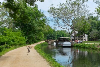
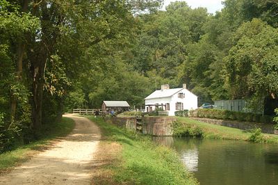
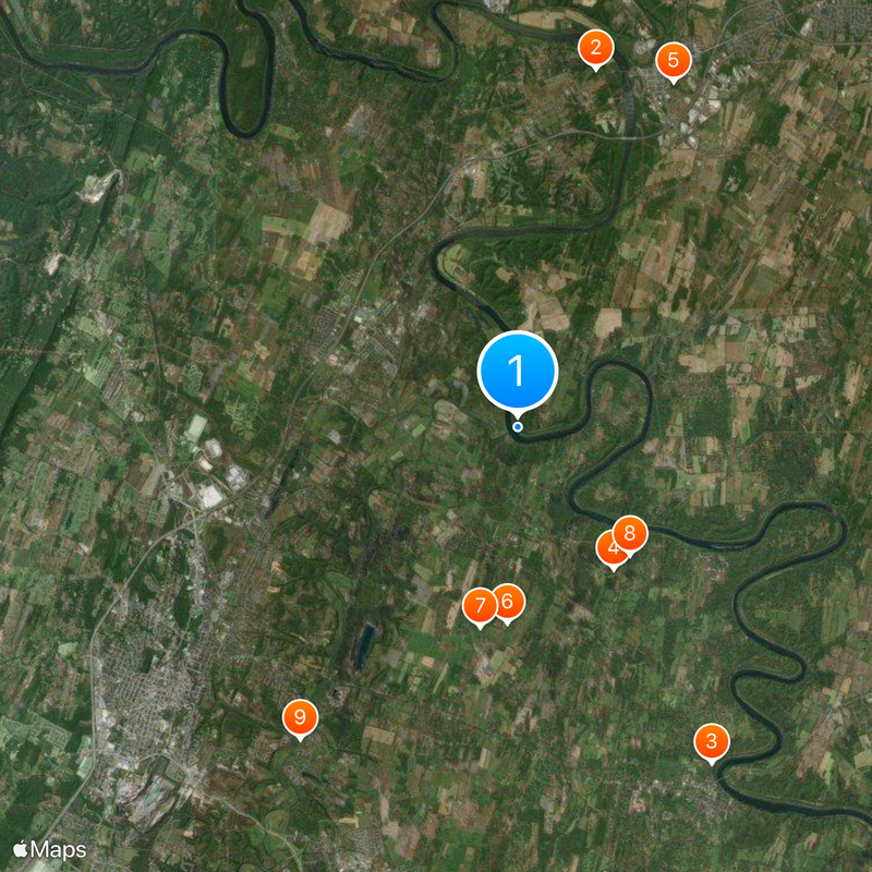
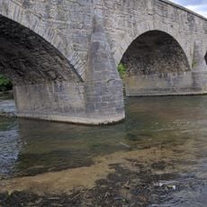
The Chesapeake and Ohio Canal is a historic waterway in Maryland and the District of Columbia that follows the Potomac River for almost 185 miles. The system includes dozens of locks and several stone aqueducts that manage the elevation difference between Georgetown and Cumberland.

History

Construction began in 1828 under President John Quincy Adams, who laid the cornerstone for the project. The waterway remained in operation until 1924 and served primarily to transport coal from the West Virginia mountains to Washington.

Culture

The waterway's name recalls the intended connection between Chesapeake Bay and the Ohio River, a link that was never completed. Today the preserved towpath serves as a meeting place for cyclists, hikers and runners who appreciate the quiet riverside setting.

Practical

The towpath can be walked or cycled along its entire length, with different sections offering varying levels of difficulty. The Great Falls Tavern Visitor Center in Maryland provides information and collects an entrance fee for access to that area.

Did you know?

The Paw Paw Tunnel stretches almost a kilometer through solid rock and was dug by hand to bypass a large river bend. This underground passage saved the construction of nearly six miles of additional canal along the twists of the Potomac.

i
i
Location
i
i
Location
i
Location
i
Inception
July 4, 1828
i
GPS coordinates
39.51694,-77.86250
i
Latest update
December 13, 2025 16:25

AroundUs brings together thousands of curated places, local tips, and hidden gems, enriched daily by 60,000 contributors worldwide. Discover all places nearby (Washington County).

Around this place
Maidstone-on-the-Potomac
United States of America

Maidstone-on-the-Potomac

9.4 km
Van Swearingen-Shepherd House
United States of America

Van Swearingen-Shepherd House

10 km
George Washington Hollida House
United States of America

George Washington Hollida House

4.4 km
Springfield Farm
United States of America

Springfield Farm

9.7 km
Swan Pond Manor Historic District
United States of America

Swan Pond Manor Historic District

5 km
Swan Pond
United States of America

Swan Pond

5.2 km
Jones Mill Run Historic District
United States of America

Jones Mill Run Historic District

4.4 km
Van Metre Ford Stone Bridge
United States of America

Van Metre Ford Stone Bridge

9.8 km
Owen Tudor Hedges House
United States of America

Owen Tudor Hedges House

7.6 km
Edward Colston House
United States of America

Edward Colston House

9.6 km
Opequon Golf Club
United States of America

Opequon Golf Club

9.8 km
White Bush
United States of America

White Bush

5.8 km
Williamsport Historic District
United States of America

Williamsport Historic District

9.9 km
Harlan Spring Historic District
United States of America

Harlan Spring Historic District

8.8 km
Thomas VanMetre House
United States of America

Thomas VanMetre House

10 km
Priscilla Strode Turner House
United States of America

Priscilla Strode Turner House

1.8 km
Marlowe Consolidated School
United States of America

Marlowe Consolidated School

7.8 km
Elmwood
United States of America

Elmwood

9.3 km
Charles Downs II House
United States of America

Charles Downs II House

6.7 km
Spring Mills Historic District
United States of America

Spring Mills Historic District

9.2 km
Elizabeth Kunkel House
United States of America

Elizabeth Kunkel House

8 km
Hughes-Cunningham House
United States of America

Hughes-Cunningham House

8.7 km
Overlook
United States of America

Overlook

8.8 km
Orndoff-Cross House
United States of America

Orndoff-Cross House

9 km
Rush-Miller House
United States of America

Rush-Miller House

7.8 km
Strode-Morrison-Tabler House and Farm
United States of America

Strode-Morrison-Tabler House and Farm

1.3 km
Decatur Hedges House
United States of America

Decatur Hedges House

9.4 km
Salisbury Street Bridge
United States of America

Salisbury Street Bridge

9.7 km
Show the full map
« Chesapeake and Ohio Canal - Historic canal system in Washington and Montgomery Counties, United States » is provided by Around Us (aroundus.com). Images and texts are derived from Wikimedia project under a Creative Commons license. You are allowed to copy, distribute, and modify copies of this page, under the conditions set by the license, as long as this note is clearly visible.

Discover hidden gems everywhere you go!

From secret cafés to breathtaking viewpoints, skip the crowded tourist spots and find places that match your style. Our app makes it easy with voice search, smart filtering, route optimization, and insider tips from travelers worldwide. Download now for the complete mobile experience.

Around Us App Screenshot

A unique approach to discovering new places

Le Figaro

All the places worth exploring

France Info

A tailor-made excursion in just a few clicks

20 Minutes

Around Us
Travel Guide & Maps
Download

Send to your phone

QR Code
1

Open the camera app on your mobile.

2

Point at the QR code with your camera. A notification will appear.

3

Tap the notification to open the link.