Chest opened
+${chestReward.xp} XP
Explorer
NOUVEAU ×${chestReward.collectible.quantity}
tapez pour fermer
Chest locked

Open chests in the app

Around Us is built for your phone — chests unlock when you walk, explore and capture nearby places.

Enable Location

We need your location to show you interesting places around you

Discover nearby places

Find interesting locations and hidden gems around you

Precise directions

Get accurate directions and distances to places

Your location is never shared with other users. It's only used when you tap the location button.

Lansford

Log in to your account

Start exploring — it's free

Trusted by 72,887 travelers worldwide

Continue with Google
Continue with Apple
or

We will send you a code to connect

By continuing, you accept our Terms and Conditions and our Privacy Policy

Check your inbox

We've sent a pincode in your inbox. Please enter the code below.

Discussion Reviews 1 Photos
11k Popularity

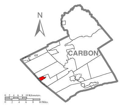
Lansford, Municipality in Carbon County, Pennsylvania, United States

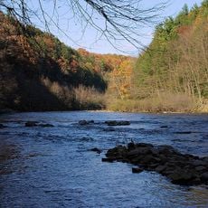
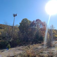
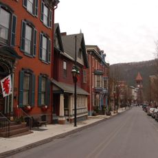
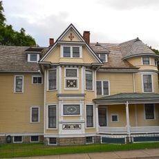
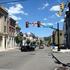
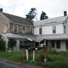
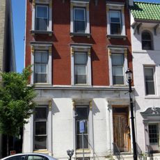
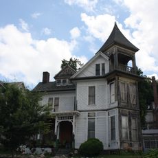
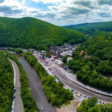
Lansford is a small borough situated in the Coal Region of Pennsylvania, nestled among forested hills. The community features residential streets lined with historic homes and a modest downtown area that reflects its past.

The settlement developed in the 1800s around anthracite coal mining, which became the economic foundation of the area. It took its name from Asa Lansford Foster, someone who championed the merging of nearby communities.

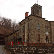
The No. 9 Mine and Museum displays mining equipment, tools, and photographs that document the evolution of coal extraction methods in Pennsylvania.

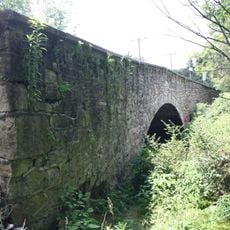
U.S. Route 209 and Pennsylvania Route 902 connect the town to surrounding areas, making it accessible to visit. The local roads are straightforward to navigate, allowing for easy walking exploration on foot.

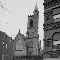
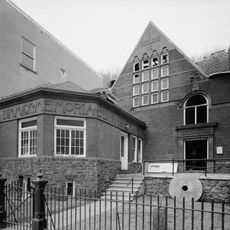
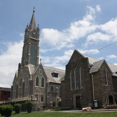
The Welsh Congregational Church on West Abbott Street, built in 1850, is the oldest religious structure in town. It stands as evidence of Welsh immigrants who settled in the mining community and put down roots there.

The community of curious travelers

AroundUs brings together thousands of curated places, local tips, and hidden gems, enriched daily by 60,000 contributors worldwide.

Start exploring
GPS coordinates
40.83190,-75.88238
Latest update
December 8, 2025 13:43
Around this place
Hawk Mountain
United States of America

Hawk Mountain

22.3 km
Lehigh Gorge State Park
United States of America

Lehigh Gorge State Park

18.2 km
Asa Packer Mansion
United States of America

Asa Packer Mansion

12.7 km
Harry Packer Mansion
United States of America

Harry Packer Mansion

12.7 km
Locust Lake State Park
United States of America

Locust Lake State Park

22.5 km
Angela Park
United States of America

Angela Park

23.3 km
Tuscarora State Park
United States of America

Tuscarora State Park

12.5 km
Leaser Lake
United States of America

Leaser Lake

18.6 km
Carbon County Jail
United States of America

Carbon County Jail

12 km
Jeddo Tunnel
United States of America

Jeddo Tunnel

21.4 km
Old Mauch Chunk Historic District
United States of America

Old Mauch Chunk Historic District

12.2 km
St. Mark's Episcopal Church
United States of America

St. Mark's Episcopal Church

12.5 km
St. Gabriel's Catholic Parish Complex
United States of America

St. Gabriel's Catholic Parish Complex

15 km
Israel Platt Pardee Mansion
United States of America

Israel Platt Pardee Mansion

16.2 km
Markle Banking & Trust Company Building
United States of America

Markle Banking & Trust Company Building

15.6 km
Summit Hill High School
United States of America

Summit Hill High School

914 m
Dimmick Memorial Library
United States of America

Dimmick Memorial Library

12.5 km
Tamaqua Historic District
United States of America

Tamaqua Historic District

7.3 km
Frederick and Catherine Leaser Farm
United States of America

Frederick and Catherine Leaser Farm

17.7 km
Lansford Historic District
United States of America

Lansford Historic District

96 m
Anthracite Bank Building
United States of America

Anthracite Bank Building

8.6 km
George Ormrod House
United States of America

George Ormrod House

8.6 km
New Ringgold Gristmill
United States of America

New Ringgold Gristmill

18.9 km
Trexler Historic District
United States of America

Trexler Historic District

22 km
Bridge in Albany Township
United States of America

Bridge in Albany Township

22 km
Bridge in Heidelberg Township
United States of America

Bridge in Heidelberg Township

20.6 km
Jim Thorpe Lehigh River Access
United States of America

Jim Thorpe Lehigh River Access

12.9 km
Eagle Rock Ski Resort
United States of America

Eagle Rock Ski Resort

21.6 km
Show the full map
Reviews
Share your experience

No review yet

Discussions
Start a discussion...

No discussion yet

« Lansford - Municipality in Carbon County, Pennsylvania, United States » is provided by Around Us (aroundus.com). Images and texts are derived from Wikimedia project under a Creative Commons license. You are allowed to copy, distribute, and modify copies of this page, under the conditions set by the license, as long as this note is clearly visible.

Discover hidden gems everywhere you go!

From secret cafés to breathtaking viewpoints, skip the crowded tourist spots and find places that match your style. Our app makes it easy with voice search, smart filtering, route optimization, and insider tips from travelers worldwide. Download now for the complete mobile experience.

Around Us App Screenshot

A unique approach to discovering new places

Le Figaro

All the places worth exploring

France Info

A tailor-made excursion in just a few clicks

20 Minutes

Around Us
Travel Guide & Maps
Download

Send to your phone

QR Code
1

Open the camera app on your mobile.

2

Point at the QR code with your camera. A notification will appear.

3

Tap the notification to open the link.