Enable Location

We need your location to show you interesting places around you

Discover nearby places

Find interesting locations and hidden gems around you

Precise directions

Get accurate directions and distances to places

Your location is never shared with other users. It's only used when you tap the location button.

Hoosac Tunnel

Log in to your account

Start exploring — it's free

Trusted by 63,376 travelers worldwide

Continue with Google
Continue with Apple
or

We will send you a code to connect

By continuing, you accept our Terms and Conditions and our Privacy Policy

Check your inbox

We've sent a pincode in your inbox. Please enter the code below.

Discussion Reviews 1 Photos
48.7k Popularity

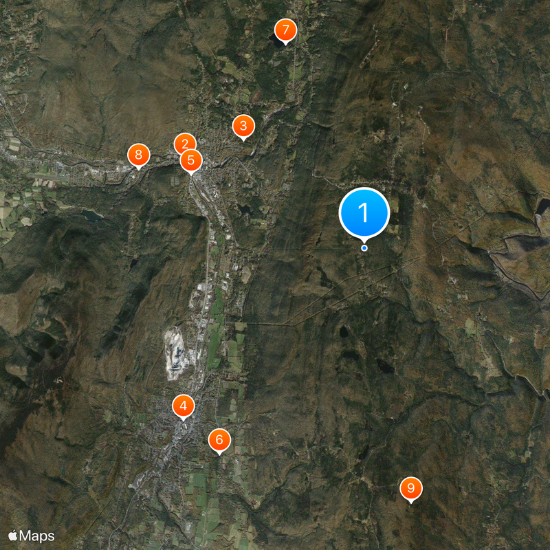
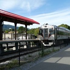
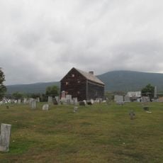
Hoosac Tunnel, Railway tunnel in North Adams and Florida, United States.

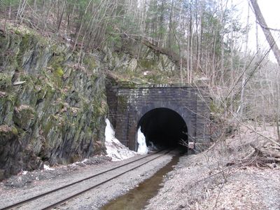
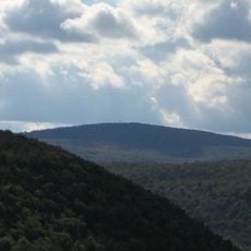
The Hoosac Tunnel cuts through the Hoosac Mountain Range for about 7.6 km, connecting North Adams with Florida in western Massachusetts. The structure was built using multiple shafts and includes ventilation systems to circulate air through the underground passage.

Work on the tunnel started in 1851 and took about 24 years to finish, with crews using new blasting methods during excavation. The project was extremely hazardous and resulted in significant loss of life during construction.

The tunnel earned recognition as a Historic Civil Engineering Landmark in 1975 because it pioneered the use of nitroglycerin and electric blasting caps in American tunnel construction. These innovations transformed how underground projects were built across the country.

The east entrance is located where Whitcomb Hill Road and River Road meet in Florida, with the opening visible about half a mile to the northwest of that intersection. Visitors can view the tunnel opening from outside, but note that entering the active tunnel is not permitted.

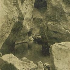
A central shaft located in the tunnel's middle contains original ventilation fans that pump air through the long underground system during operation. A memorial marker at this spot honors 13 miners who died in an explosion during excavation work in 1867.

The community of curious travelers

AroundUs brings together thousands of curated places, local tips, and hidden gems, enriched daily by 60,000 contributors worldwide.

Start exploring
Location
Location
Inception
1870s
Official opening
1876
Length
7,645 m
GPS coordinates
42.67500,-73.04528
Latest update
December 14, 2025 19:06
Around this place
Massachusetts Museum of Contemporary Art
United States of America

Massachusetts Museum of Contemporary Art

6.5 km
Natural Bridge State Park
United States of America

Natural Bridge State Park

5.3 km
Berkshire Scenic Railway Museum
United States of America

Berkshire Scenic Railway Museum

8.1 km
Western Gateway Heritage State Park
United States of America

Western Gateway Heritage State Park

6.1 km
Anthony House
United States of America

Anthony House

8.1 km
Clarksburg State Park
United States of America

Clarksburg State Park

7.1 km
Wells House
United States of America

Wells House

7.8 km
United States of America

Borden Mountain

8.4 km
Blackinton Historic District
United States of America

Blackinton Historic District

5 km
The Boardman
United States of America

The Boardman

5.3 km
Pittsfield and North Adams Railroad
United States of America

Pittsfield and North Adams Railroad

8.5 km
Quaker Meetinghouse
United States of America

Quaker Meetinghouse

8.5 km
Hillside Cemetery
United States of America

Hillside Cemetery

7 km
Church Street Historic District
United States of America

Church Street Historic District

5.6 km
Hathaway Tenement
United States of America

Hathaway Tenement

6.9 km
Hoosac Street School
United States of America

Hoosac Street School

7.9 km
St. Joseph's School
United States of America

St. Joseph's School

5.9 km
Freeman's Grove Historic District
United States of America

Freeman's Grove Historic District

5.8 km
Charles Browne House
United States of America

Charles Browne House

4.3 km
Armstrong House
United States of America

Armstrong House

6.6 km
Crowley House
United States of America

Crowley House

7.3 km
Church Street-Caddy Hill Historic District
United States of America

Church Street-Caddy Hill Historic District

5.6 km
Sykes House
United States of America

Sykes House

7.7 km
Normal School Historic District
United States of America

Normal School Historic District

5 km
Western Summit
United States of America

Western Summit

3 km
Monument Square-Eagle Street Historic District
United States of America

Monument Square-Eagle Street Historic District

5.9 km
Campers Beach
United States of America

Campers Beach

4 km
Savoy Mountain State Forest
United States of America

Savoy Mountain State Forest

8.3 km
Show the full map
Reviews
Share your experience

No review yet

Discussions
Start a discussion...

No discussion yet

« Hoosac Tunnel - Railway tunnel in North Adams and Florida, United States » is provided by Around Us (aroundus.com). Images and texts are derived from Wikimedia project under a Creative Commons license. You are allowed to copy, distribute, and modify copies of this page, under the conditions set by the license, as long as this note is clearly visible.

Discover hidden gems everywhere you go!

From secret cafés to breathtaking viewpoints, skip the crowded tourist spots and find places that match your style. Our app makes it easy with voice search, smart filtering, route optimization, and insider tips from travelers worldwide. Download now for the complete mobile experience.

Around Us App Screenshot

A unique approach to discovering new places

Le Figaro

All the places worth exploring

France Info

A tailor-made excursion in just a few clicks

20 Minutes

Around Us
Travel Guide & Maps
Download

Send to your phone

QR Code
1

Open the camera app on your mobile.

2

Point at the QR code with your camera. A notification will appear.

3

Tap the notification to open the link.