Pittsfield and North Adams Railroad

Log in to your account

AroundUs is a community-driven map of interesting places, built by curious explorers like you. It grows with every review, story, and photo you share.
Connect to save your favorite spots, contribute locations, and create personalized routes.
Continue with Google
Continue with Apple
Continue with X
Continue with Facebook
Continue with email
By continuing, you accept our Terms and Conditions and our Privacy Policy
Create an account

Pittsfield and North Adams Railroad

Add to collection
Map
Suggest a change
Share

Pittsfield and North Adams Railroad, Historical railroad route in Berkshire County, Massachusetts.

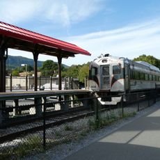
The Pittsfield and North Adams Railroad was a rail line in western Massachusetts that connected multiple towns between its namesake cities, carrying both passengers and freight regularly. The route extended roughly 18.5 miles through Berkshire County and served as a key connection for the region.

The line was chartered in 1842 and completed in 1846, initially operating under its own name. Over time, it changed hands among several major railroad companies, including the Western Railroad, Boston and Albany Railroad, and New York Central Railroad.

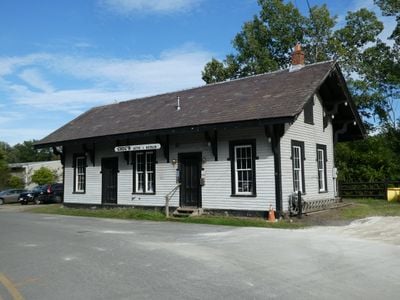
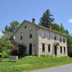
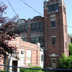
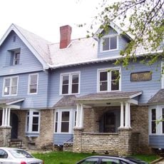
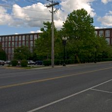
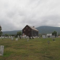
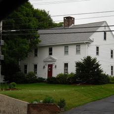
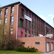
The stations along the route display architectural styles from the Queen Anne and Romanesque periods, typical of 19th-century construction. You can still see these buildings today and understand how important they were to the region's development.

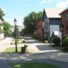
The former rail bed now serves as the Ashuwillticook Rail Trail, which is open for walking, cycling, and other outdoor activities year-round. The trail is accessible and well-maintained, making it easy to explore the historic corridor on foot or by bike.

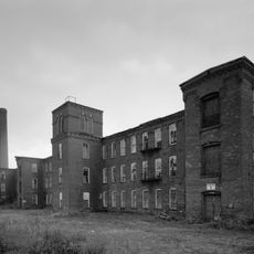
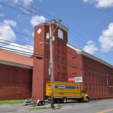
Limestone quarrying thrived along the route, with the rail line serving as the primary way to transport extracted stone to markets. This mineral trade made the railroad essential to the industrial economy of western Massachusetts during the 19th century.

GPS coordinates: 42.62180,-73.11907

Latest update: December 14, 2025 18:10

Photos
Around this place
Mount Greylock
United States of America

Mount Greylock

4.2 km
Mount Greylock State Reservation
United States of America

Mount Greylock State Reservation

5.2 km
Berkshire Scenic Railway Museum
United States of America

Berkshire Scenic Railway Museum

416 m
Western Gateway Heritage State Park
United States of America

Western Gateway Heritage State Park

8.3 km
Mount Fitch
United States of America

Mount Fitch

5 km
Anthony House
United States of America

Anthony House

1.5 km
Wells House
United States of America

Wells House

8.6 km
United States of America

Borden Mountain

7.9 km
Blackinton Historic District
United States of America

Blackinton Historic District

7.8 km
Stafford Hill Memorial
United States of America

Stafford Hill Memorial

5.3 km
The Boardman
United States of America

The Boardman

7.9 km
Berkshire Mill No. 1
United States of America

Berkshire Mill No. 1

403 m
Quaker Meetinghouse
United States of America

Quaker Meetinghouse

835 m
Church Street Historic District
United States of America

Church Street Historic District

8.4 km
Freeman's Grove Historic District
United States of America

Freeman's Grove Historic District

8.1 km
Charles Browne House
United States of America

Charles Browne House

6.6 km
Cheshire Town Hall Complex
United States of America

Cheshire Town Hall Complex

7.6 km
Crowley House
United States of America

Crowley House

8.7 km
Renfrew Mill No. 2
United States of America

Renfrew Mill No. 2

2 km
Church Street-Caddy Hill Historic District
United States of America

Church Street-Caddy Hill Historic District

8.4 km
Sykes House
United States of America

Sykes House

8.7 km
Summer Street Historic District
United States of America

Summer Street Historic District

395 m
Normal School Historic District
United States of America

Normal School Historic District

7.8 km
Phillips Woolen Mill
United States of America

Phillips Woolen Mill

2.1 km
Hall's Tavern
United States of America

Hall's Tavern

7.6 km
Monument Square-Eagle Street Historic District
United States of America

Monument Square-Eagle Street Historic District

8.4 km
Norad Mill
United States of America

Norad Mill

8.7 km
Savoy Mountain State Forest
United States of America

Savoy Mountain State Forest

7.8 km
Show the full map
Reviews

Visited this place? Tap the stars to rate it and share your experience / photos with the community! Try now! You can cancel it anytime.

« Pittsfield and North Adams Railroad - Historical railroad route in Berkshire County, Massachusetts » is provided by Around Us (aroundus.com). Images and texts are derived from Wikimedia project under a Creative Commons license. You are allowed to copy, distribute, and modify copies of this page, under the conditions set by the license, as long as this note is clearly visible.

Discover hidden gems everywhere you go!

From secret cafés to breathtaking viewpoints, skip the crowded tourist spots and find places that match your style. Our app makes it easy with voice search, smart filtering, route optimization, and insider tips from travelers worldwide. Download now for the complete mobile experience.

Around Us App Screenshot

A unique approach to discovering new places

Le Figaro

All the places worth exploring

France Info

A tailor-made excursion in just a few clicks

20 Minutes