Enable Location

We need your location to show you interesting places around you

Discover nearby places

Find interesting locations and hidden gems around you

Precise directions

Get accurate directions and distances to places

Your location is never shared with other users. It's only used when you tap the location button.

Savoy Mountain State Forest

Log in to your account

Start exploring — it's free

Trusted by 62,474 travelers worldwide

Continue with Google
Continue with Apple
or

We will send you a code to connect

By continuing, you accept our Terms and Conditions and our Privacy Policy

Check your inbox

We've sent a pincode in your inbox. Please enter the code below.

Savoy Mountain State Forest

Savoy Mountain State Forest, State park and forest in northwestern Massachusetts, United States

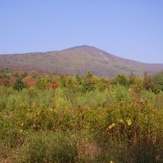
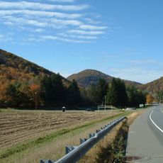
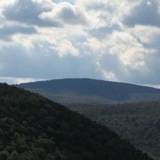
Savoy Mountain State Forest is a large woodland area stretching across the Hoosac Mountain Range in northwestern Massachusetts. It contains multiple mountain peaks, several ponds, and a network of trails that vary in difficulty and length.

This forest was established as a conservation area in 1918 on abandoned farmland in the region. It was expanded and developed through projects by the Civilian Conservation Corps, which shaped its current layout and infrastructure.

Ancient hemlock and spruce trees form the heart of this forest, creating a sense of timeless woodland. These old-growth stands define the place as a refuge where nature has been left largely untouched.

The forest offers camping and simple cabin accommodations for overnight stays, with varying levels of comfort. The best time to visit is from May through October, when the weather is mild and facilities are fully open.

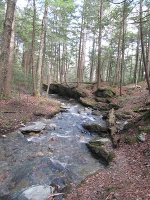
Two waterfalls grace the forest landscape: Parker Brook Falls and Tannery Falls, each creating a notable natural feature. Tannery Falls drops in a steep cascade and becomes a destination that many hikers seek out along their routes.

The community of curious travelers

AroundUs brings together thousands of curated places, local tips, and hidden gems, enriched daily by 60,000 contributors worldwide.

Start exploring
Location
Inception
1918
GPS coordinates
42.60160,-73.02810
Latest update
December 15, 2025 13:21
Around this place
Mount Greylock
United States of America

Mount Greylock

12 km
Mohawk Trail
United States of America

Mohawk Trail

7.5 km
Mount Greylock State Reservation
United States of America

Mount Greylock State Reservation

12.1 km
Berkshire Scenic Railway Museum
United States of America

Berkshire Scenic Railway Museum

7.7 km
Hail To The Sunrise Statue
United States of America

Hail To The Sunrise Statue

10.3 km
Western Gateway Heritage State Park
United States of America

Western Gateway Heritage State Park

12.7 km
Mount Fitch
United States of America

Mount Fitch

12.4 km
Anthony House
United States of America

Anthony House

6.3 km
United States of America

Borden Mountain

118 m
Blackinton Historic District
United States of America

Blackinton Historic District

11.6 km
Stafford Hill Memorial
United States of America

Stafford Hill Memorial

7.8 km
The Boardman
United States of America

The Boardman

11.9 km
Berkshire Mill No. 1
United States of America

Berkshire Mill No. 1

7.9 km
Pittsfield and North Adams Railroad
United States of America

Pittsfield and North Adams Railroad

7.8 km
Quaker Meetinghouse
United States of America

Quaker Meetinghouse

8.5 km
Church Street Historic District
United States of America

Church Street Historic District

12.4 km
Windsor Print Works
United States of America

Windsor Print Works

12.7 km
Freeman's Grove Historic District
United States of America

Freeman's Grove Historic District

12.4 km
Charles Browne House
United States of America

Charles Browne House

10.3 km
Cheshire Town Hall Complex
United States of America

Cheshire Town Hall Complex

11.9 km
Coleman Bridge
United States of America

Coleman Bridge

8.2 km
Renfrew Mill No. 2
United States of America

Renfrew Mill No. 2

7.6 km
Church Street-Caddy Hill Historic District
United States of America

Church Street-Caddy Hill Historic District

12.4 km
Summer Street Historic District
United States of America

Summer Street Historic District

7.5 km
Normal School Historic District
United States of America

Normal School Historic District

11.7 km
Phillips Woolen Mill
United States of America

Phillips Woolen Mill

8.8 km
Hall's Tavern
United States of America

Hall's Tavern

12.1 km
Monument Square-Eagle Street Historic District
United States of America

Monument Square-Eagle Street Historic District

12.6 km
Show the full map
« Savoy Mountain State Forest - State park and forest in northwestern Massachusetts, United States » is provided by Around Us (aroundus.com). Images and texts are derived from Wikimedia project under a Creative Commons license. You are allowed to copy, distribute, and modify copies of this page, under the conditions set by the license, as long as this note is clearly visible.

Discover hidden gems everywhere you go!

From secret cafés to breathtaking viewpoints, skip the crowded tourist spots and find places that match your style. Our app makes it easy with voice search, smart filtering, route optimization, and insider tips from travelers worldwide. Download now for the complete mobile experience.

Around Us App Screenshot

A unique approach to discovering new places

Le Figaro

All the places worth exploring

France Info

A tailor-made excursion in just a few clicks

20 Minutes

Around Us
Travel Guide & Maps
Download

Send to your phone

QR Code
1

Open the camera app on your mobile.

2

Point at the QR code with your camera. A notification will appear.

3

Tap the notification to open the link.