Chest opened
+${chestReward.xp} XP
Explorer
NOUVEAU ×${chestReward.collectible.quantity}
tapez pour fermer
Chest locked

Open chests in the app

Around Us is built for your phone — chests unlock when you walk, explore and capture nearby places.

Enable Location

We need your location to show you interesting places around you

Discover nearby places

Find interesting locations and hidden gems around you

Precise directions

Get accurate directions and distances to places

Your location is never shared with other users. It's only used when you tap the location button.

Log in to your account

Start exploring — it's free

Trusted by 72,885 travelers worldwide

Continue with Google
Continue with Apple
or

We will send you a code to connect

By continuing, you accept our Terms and Conditions and our Privacy Policy

Check your inbox

We've sent a pincode in your inbox. Please enter the code below.

12th Street Bridge
Discussion Reviews Photo
1.5k Popularity

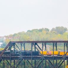
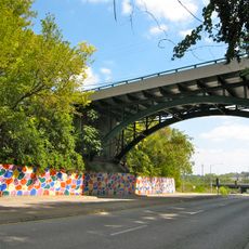
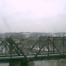
12th Street Bridge, Road bridge in Kansas City, United States.

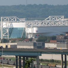
The 12th Street Bridge is a road crossing that spans the Kansas River with two traffic lanes connecting different parts of the city. The current structure uses a modern girder system that resulted from renovations carried out in the early 2000s.

An iron bridge first stood here starting in 1909, but flooding later caused serious damage that forced a complete rebuilding of the structure. The reconstruction proved necessary to restore the connection between the city's sections.

The bridge connects neighborhoods on both sides of the river and plays a role in how people move through the city each day. It has become a familiar landmark that shows how the two bank communities depend on each other.

The bridge serves as a main traffic route, so crossing is easiest during regular daytime hours when traffic flow is steady and predictable. During heavy rain, water conditions in the river can change, so it is wise to be cautious when weather is poor.

A fire incident in the past caused significant damage to the structure, resulting in parts of the wooden deck collapsing into the river below. This event became a turning point that led to improved safety standards for bridge construction in the area.

The community of curious travelers

AroundUs brings together thousands of curated places, local tips, and hidden gems, enriched daily by 60,000 contributors worldwide.

Start exploring
Location
Official opening
1909
GPS coordinates
39.07340,-94.64000
Latest update
December 14, 2025 14:20
Around this place
Hy-Vee Arena
United States of America

Hy-Vee Arena

3.6 km
Sauer Castle
United States of America

Sauer Castle

755 m
Joe’s Kansas City Bar-B-Que
United States of America

Joe’s Kansas City Bar-B-Que

3.6 km
The Scout
United States of America

The Scout

4.1 km
Uptown Theater
United States of America

Uptown Theater

4.5 km
Memorial Hall
United States of America

Memorial Hall

4.5 km
BMA Tower
United States of America

BMA Tower

4.1 km
Clarence Sondern House
United States of America

Clarence Sondern House

3.8 km
Thomas Hart Benton Home and Studio State Historic Site
United States of America

Thomas Hart Benton Home and Studio State Historic Site

3.9 km
United States of America

Penn Valley Park

4.4 km
Rosedale World War I Memorial Arch
United States of America

Rosedale World War I Memorial Arch

2.4 km
Scottish Rite Temple
United States of America

Scottish Rite Temple

4.7 km
Vox Theatre
United States of America

Vox Theatre

1.9 km
Argentine Carnegie Library
United States of America

Argentine Carnegie Library

1.8 km
United States of America

Imperial Brewing Company Brewery

3.2 km
Fire Station No. 9
United States of America

Fire Station No. 9

3.4 km
Knickerbocker Apartments
United States of America

Knickerbocker Apartments

4.3 km
Highline Bridge
United States of America

Highline Bridge

2.8 km
Sacred Heart Church, School and Rectory
United States of America

Sacred Heart Church, School and Rectory

3.9 km
I-670 Viaduct
United States of America

I-670 Viaduct

3.7 km
Shawnee Street Overpass
United States of America

Shawnee Street Overpass

1.7 km
Pilgrim Lutheran Church for the Deaf of Greater Kansas City and Parsonage
United States of America

Pilgrim Lutheran Church for the Deaf of Greater Kansas City and Parsonage

4.4 km
Jensen-Salsbery Laboratories
United States of America

Jensen-Salsbery Laboratories

4.5 km
H.W. Gates Funeral Home
United States of America

H.W. Gates Funeral Home

3.5 km
Union Pacific Intermodal Bridge
United States of America

Union Pacific Intermodal Bridge

3.6 km
Kansas City Terminal Railway Company Roundhouse Historic District
United States of America

Kansas City Terminal Railway Company Roundhouse Historic District

3.4 km
Money Museum
United States of America

Money Museum

4.6 km
Argentine Connection Bridge
United States of America

Argentine Connection Bridge

3.2 km
Show the full map
Reviews
Share your experience

No review yet

Discussions
Start a discussion...

No discussion yet

« 12th Street Bridge - Road bridge in Kansas City, United States » is provided by Around Us (aroundus.com). Images and texts are derived from Wikimedia project under a Creative Commons license. You are allowed to copy, distribute, and modify copies of this page, under the conditions set by the license, as long as this note is clearly visible.

Discover hidden gems everywhere you go!

From secret cafés to breathtaking viewpoints, skip the crowded tourist spots and find places that match your style. Our app makes it easy with voice search, smart filtering, route optimization, and insider tips from travelers worldwide. Download now for the complete mobile experience.

Around Us App Screenshot

A unique approach to discovering new places

Le Figaro

All the places worth exploring

France Info

A tailor-made excursion in just a few clicks

20 Minutes

Around Us
Travel Guide & Maps
Download

Send to your phone

QR Code
1

Open the camera app on your mobile.

2

Point at the QR code with your camera. A notification will appear.

3

Tap the notification to open the link.