Chest opened
+${chestReward.xp} XP
Explorer
NOUVEAU ×${chestReward.collectible.quantity}
tapez pour fermer
Chest locked

Open chests in the app

Around Us is built for your phone — chests unlock when you walk, explore and capture nearby places.

Enable Location

We need your location to show you interesting places around you

Discover nearby places

Find interesting locations and hidden gems around you

Precise directions

Get accurate directions and distances to places

Your location is never shared with other users. It's only used when you tap the location button.

Log in to your account

Start exploring — it's free

Trusted by 72,877 travelers worldwide

Continue with Google
Continue with Apple
or

We will send you a code to connect

By continuing, you accept our Terms and Conditions and our Privacy Policy

Check your inbox

We've sent a pincode in your inbox. Please enter the code below.

Black Bottom
Discussion Reviews Photo
39.3k Popularity

Black Bottom, Former residential district in Detroit, United States

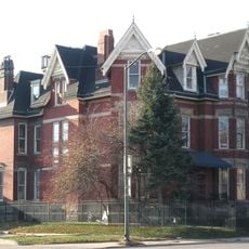
Black Bottom was an eastern residential neighborhood in Detroit bounded by Gratiot Avenue, Brush Street, the Detroit River, and the Grand Trunk railroad tracks. The district featured wooden frame houses and street-level businesses that formed the foundation of daily life.

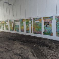
French settlers named the area after its dark, fertile soil, which was later converted into a drainage system. The neighborhood subsequently developed into a significant center for the African American community before facing demolition in the 1950s.

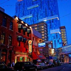
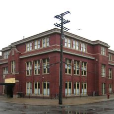
From the 1930s through 1940s, the neighborhood served as a hub for African American-owned businesses, including music venues, restaurants, medical offices, and hotels. The New Bethel Baptist Church stood at the heart of community life and drew people from across the city.

The neighborhood was fully walkable and offered ten restaurants, eight grocery stores, seventeen physician offices, and six drugstores to serve residents' daily needs. All these services were locally available, making trips to other parts of the city unnecessary.

Nobel Peace Prize recipient Ralph Bunche and future Detroit mayor Coleman Young both came from this neighborhood and later shaped the city's future. These two figures demonstrate the deep influence this community held over Detroit's direction.

The community of curious travelers

AroundUs brings together thousands of curated places, local tips, and hidden gems, enriched daily by 60,000 contributors worldwide.

Start exploring
Location
GPS coordinates
42.34056,-83.04083
Latest update
March 5, 2026 21:06
Around this place
Ford Field
United States of America

Ford Field

394 m
Comerica Park
United States of America

Comerica Park

658 m
Detroit Athletic Club
United States of America

Detroit Athletic Club

637 m
Detroit Opera House
United States of America

Detroit Opera House

789 m
Greektown Casino Hotel
United States of America

Greektown Casino Hotel

675 m
Dequindre Cut
United States of America

Dequindre Cut

737 m
David Broderick Tower
United States of America

David Broderick Tower

889 m
Music Hall Center for the Performing Arts
United States of America

Music Hall Center for the Performing Arts

571 m
Gem Theatre
United States of America

Gem Theatre

501 m
Metropolitan Building
United States of America

Metropolitan Building

878 m
Blue Cross Blue Shield of Michigan Building
United States of America

Blue Cross Blue Shield of Michigan Building

708 m
1300 Lafayette East Cooperative
United States of America

1300 Lafayette East Cooperative

679 m
Harmonie Club
United States of America

Harmonie Club

668 m
Elwood Bar
United States of America

Elwood Bar

554 m
United States of America

Hall of Justice

385 m
Globe Tobacco Building
United States of America

Globe Tobacco Building

850 m
Detroit Cornice and Slate Company Building
United States of America

Detroit Cornice and Slate Company Building

681 m
Harmonie Centre
United States of America

Harmonie Centre

743 m
Merchants Building
United States of America

Merchants Building

769 m
Century Theatre
United States of America

Century Theatre

556 m
Harvard Square Center
United States of America

Harvard Square Center

742 m
Lafayette Towers Apartments West
United States of America

Lafayette Towers Apartments West

646 m
Chestnut Street Bridge
United States of America

Chestnut Street Bridge

718 m
Jerome H. Remick and Company Building
United States of America

Jerome H. Remick and Company Building

846 m
Antietam Avenue Bridge
United States of America

Antietam Avenue Bridge

730 m
Nellie Leland School
United States of America

Nellie Leland School

281 m
Croul-Palms House
United States of America

Croul-Palms House

883 m
Russell Alger Memorial Fountain
United States of America

Russell Alger Memorial Fountain

850 m
Show the full map
Reviews
Share your experience

No review yet

Discussions
Start a discussion...

No discussion yet

« Black Bottom - Former residential district in Detroit, United States » is provided by Around Us (aroundus.com). Images and texts are derived from Wikimedia project under a Creative Commons license. You are allowed to copy, distribute, and modify copies of this page, under the conditions set by the license, as long as this note is clearly visible.

Discover hidden gems everywhere you go!

From secret cafés to breathtaking viewpoints, skip the crowded tourist spots and find places that match your style. Our app makes it easy with voice search, smart filtering, route optimization, and insider tips from travelers worldwide. Download now for the complete mobile experience.

Around Us App Screenshot

A unique approach to discovering new places

Le Figaro

All the places worth exploring

France Info

A tailor-made excursion in just a few clicks

20 Minutes

Around Us
Travel Guide & Maps
Download

Send to your phone

QR Code
1

Open the camera app on your mobile.

2

Point at the QR code with your camera. A notification will appear.

3

Tap the notification to open the link.