Chest opened
+${chestReward.xp} XP
Explorer
NOUVEAU ×${chestReward.collectible.quantity}
tapez pour fermer
Chest locked

Open chests in the app

Around Us is built for your phone — chests unlock when you walk, explore and capture nearby places.

Enable Location

We need your location to show you interesting places around you

Discover nearby places

Find interesting locations and hidden gems around you

Precise directions

Get accurate directions and distances to places

Your location is never shared with other users. It's only used when you tap the location button.

Log in to your account

Start exploring — it's free

Trusted by 72,878 travelers worldwide

Continue with Google
Continue with Apple
or

We will send you a code to connect

By continuing, you accept our Terms and Conditions and our Privacy Policy

Check your inbox

We've sent a pincode in your inbox. Please enter the code below.

Dogtown
Discussion Reviews Photo
14.1k Popularity

Dogtown, Irish neighborhood in St. Louis, US

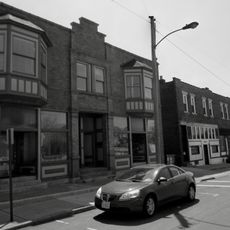
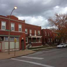
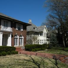
Dogtown is a neighborhood located south of Forest Park that encompasses four districts: Clayton-Tamm, Franz Park, Hi-Pointe, and Cheltenham. The area blends traditional brick houses with modern developments and extends from Oakland Avenue in the north to Manchester Avenue in the south.

The area received its name in the mid-1800s when it functioned as a mining community with numerous small clay and coal mines scattered throughout. This mining activity shaped the neighborhood's early development and growth.

The neighborhood celebrates its Irish roots with one of the city's largest St. Patrick's Day parades, which centers around St. James the Greater Church. The Irish community has shaped the character of this place for generations.

The neighborhood is easily accessible with Macklind Avenue marking the eastern boundary and McCausland Avenue to the west. Visitors will find a mix of established businesses and local gathering spots connecting the various districts together.

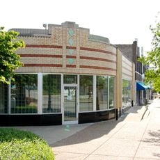
The Hi-Pointe Theater was built in 1922 and sits at the highest elevation point in St. Louis, where it serves as a neighborhood landmark. The building is a rare example of a well-maintained theater from that era.

The community of curious travelers

AroundUs brings together thousands of curated places, local tips, and hidden gems, enriched daily by 60,000 contributors worldwide.

Start exploring
Location
GPS coordinates
38.62583,-90.29333
Latest update
March 5, 2026 21:06
Around this place
Forest Park
United States of America

Forest Park

1.6 km
Missouri Botanical Garden
United States of America

Missouri Botanical Garden

3.3 km
Saint Louis Zoo
United States of America

Saint Louis Zoo

1.1 km
Saint Louis Art Museum
United States of America

Saint Louis Art Museum

1.5 km
Saint Louis Science Center
United States of America

Saint Louis Science Center

2 km
Apotheosis of St. Louis
United States of America

Apotheosis of St. Louis

1.6 km
Missouri History Museum
United States of America

Missouri History Museum

2.3 km
Climatron
United States of America

Climatron

3.3 km
Central VPA High School
United States of America

Central VPA High School

3.1 km
Mildred Lane Kemper Art Museum
United States of America

Mildred Lane Kemper Art Museum

2.5 km
Francis Olympic Field
United States of America

Francis Olympic Field

3 km
Jewel Box
United States of America

Jewel Box

1.5 km
Brookings Hall
United States of America

Brookings Hall

2.7 km
Portland and Westmoreland Places
United States of America

Portland and Westmoreland Places

3.1 km
Thinker on a Rock
United States of America

Thinker on a Rock

2.8 km
A & P Food Stores Building
United States of America

A & P Food Stores Building

3.2 km
Crow Observatory
United States of America

Crow Observatory

2.8 km
Queeny Tower
United States of America

Queeny Tower

2.6 km
United States of America

Seiwa-en

3.2 km
Forest Park Hotel
United States of America

Forest Park Hotel

3.2 km
Washington University Hilltop Campus Historic District
United States of America

Washington University Hilltop Campus Historic District

2.9 km
Monsanto Insectarium
United States of America

Monsanto Insectarium

1 km
United States of America

St. Louis Modern Chinese School

2.3 km
Orthwein Mansion
United States of America

Orthwein Mansion

3.3 km
Greenwood Historic District
United States of America

Greenwood Historic District

3.3 km
Forest Park Southeast Historic District
United States of America

Forest Park Southeast Historic District

3 km
Wydown-Forsyth District
United States of America

Wydown-Forsyth District

2.3 km
Waterman Place-Kingsbury Place-Washington Terrace Historic District
United States of America

Waterman Place-Kingsbury Place-Washington Terrace Historic District

3 km
Show the full map
Reviews
Share your experience

No review yet

Discussions
Start a discussion...

No discussion yet

« Dogtown - Irish neighborhood in St. Louis, US » is provided by Around Us (aroundus.com). Images and texts are derived from Wikimedia project under a Creative Commons license. You are allowed to copy, distribute, and modify copies of this page, under the conditions set by the license, as long as this note is clearly visible.

Discover hidden gems everywhere you go!

From secret cafés to breathtaking viewpoints, skip the crowded tourist spots and find places that match your style. Our app makes it easy with voice search, smart filtering, route optimization, and insider tips from travelers worldwide. Download now for the complete mobile experience.

Around Us App Screenshot

A unique approach to discovering new places

Le Figaro

All the places worth exploring

France Info

A tailor-made excursion in just a few clicks

20 Minutes

Around Us
Travel Guide & Maps
Download

Send to your phone

QR Code
1

Open the camera app on your mobile.

2

Point at the QR code with your camera. A notification will appear.

3

Tap the notification to open the link.