Enable Location

We need your location to show you interesting places around you

Discover nearby places

Find interesting locations and hidden gems around you

Precise directions

Get accurate directions and distances to places

Your location is never shared with other users. It's only used when you tap the location button.

Arcos de la Frontera

Log in to your account

Start exploring — it's free

Trusted by 62,478 travelers worldwide

Continue with Google
Continue with Apple
or

We will send you a code to connect

By continuing, you accept our Terms and Conditions and our Privacy Policy

Check your inbox

We've sent a pincode in your inbox. Please enter the code below.

Arcos de la Frontera

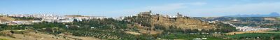
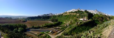
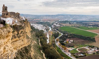
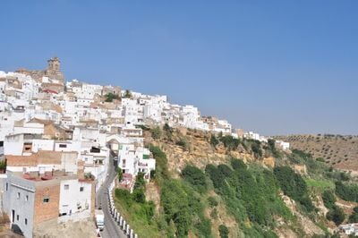
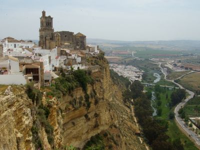
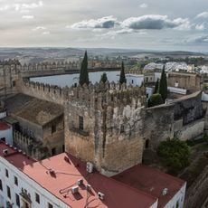
Arcos de la Frontera, Medieval hilltop settlement in Sierra de Cádiz, Spain

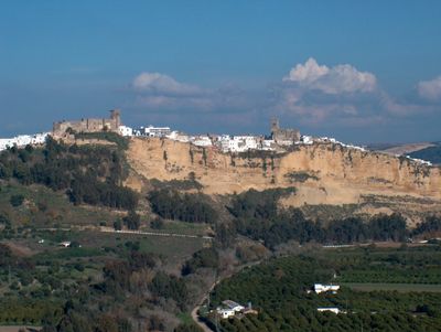
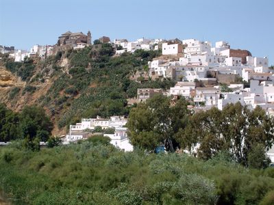
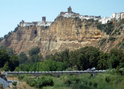
Arcos de la Frontera sits on a sandstone ridge at 185 meters (607 feet) elevation, with whitewashed buildings cascading down the cliffside toward the Guadalete River. The old town consists of narrow winding streets connecting residential areas to the Plaza del Cabildo, where churches and civic buildings stand at the center.

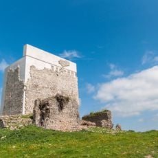
The settlement was originally called Colonia Arcensis during Roman times and later became the Moorish fortress of Medina Ar-kosch before Christian forces reclaimed it in 1250. After this reconquest, the town developed into a significant frontier post defending Christian kingdoms against Moorish lands.

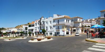
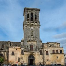
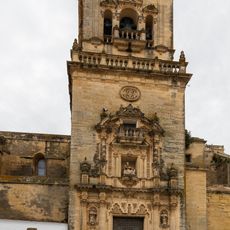
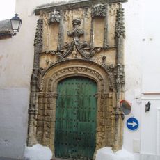
The Plaza del Cabildo in the old quarter serves as the social heart where locals gather daily, surrounded by notable religious structures like the Gothic Santa María Basilica and San Pedro Church. These spaces reflect how the community has organized itself around faith and civic life for centuries.

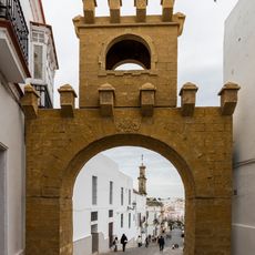
Visitors should park vehicles in designated areas outside the old town, as the narrow cobblestone streets present navigation challenges for modern cars. Exploring on foot is necessary, and comfortable shoes are recommended since streets are steep and uneven.

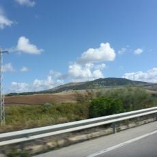
The limestone ridge formation creates natural defensive walls around the town, with portions dropping vertically to the Guadalete River. This geological feature made the location historically valuable as a naturally protected refuge for settlers.

The community of curious travelers

AroundUs brings together thousands of curated places, local tips, and hidden gems, enriched daily by 60,000 contributors worldwide.

Start exploring
Location
Capital city
Arcos de la Frontera
Elevation above the sea
185 m
Part of
Arcos de la Frontera notary district, Mancomunidad de Municipios de la Sierra de Cádiz, Sierra de Cádiz
Shares border with
Algar, Jerez de la Frontera, Espera, Bornos, Villamartín, Prado del Rey, El Bosque, Benaocaz, Ubrique, San José del Valle, Lebrija
GPS coordinates
36.74829,-5.80631
Latest update
December 14, 2025 18:02
« Arcos de la Frontera - Medieval hilltop settlement in Sierra de Cádiz, Spain » is provided by Around Us (aroundus.com). Images and texts are derived from Wikimedia project under a Creative Commons license. You are allowed to copy, distribute, and modify copies of this page, under the conditions set by the license, as long as this note is clearly visible.

Discover hidden gems everywhere you go!

From secret cafés to breathtaking viewpoints, skip the crowded tourist spots and find places that match your style. Our app makes it easy with voice search, smart filtering, route optimization, and insider tips from travelers worldwide. Download now for the complete mobile experience.

Around Us App Screenshot

A unique approach to discovering new places

Le Figaro

All the places worth exploring

France Info

A tailor-made excursion in just a few clicks

20 Minutes

Around Us
Travel Guide & Maps
Download

Send to your phone

QR Code
1

Open the camera app on your mobile.

2

Point at the QR code with your camera. A notification will appear.

3

Tap the notification to open the link.