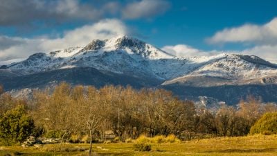
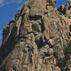
La Maliciosa, Mountain summit in Sierra de Guadarrama, Spain.
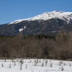
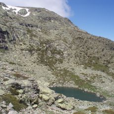
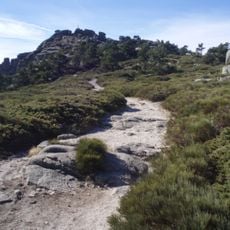
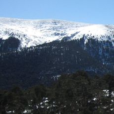
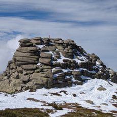
La Maliciosa is a mountain summit in the Sierra de Guadarrama rising to 2,227 meters, positioned between La Pedriza and the La Barranca valley. Its southern face drops steeply with rocky ravines, while the northern approach offers more gradual terrain.
The peak received its name because of the difficult climbing routes that once characterized it, particularly on the southern side. Over time, the name was shortened, while the northern approach gradually became established as the more accessible way up.
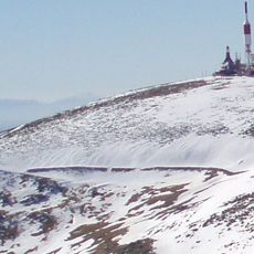
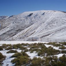
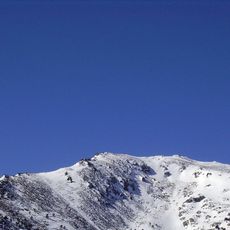
The mountain's snow-covered peak sometimes recalls a monk's silhouette, a detail that caught the attention of artists in earlier centuries. Local hikers still point out this shape when the white mantle settles on the summit.
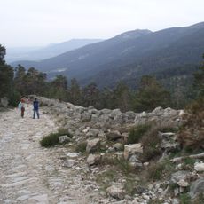
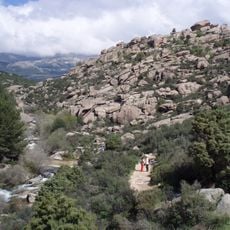
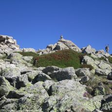
Several hiking trails reach the summit, and spring offers the most favorable climbing conditions with mild temperatures. The routes pass through pine forests and alpine meadows with varying difficulty levels.
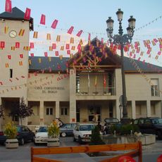
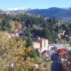
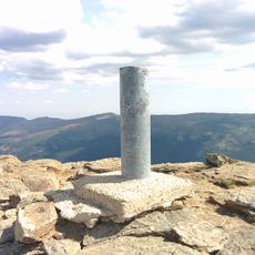
Four municipalities meet at the summit: Navacerrada, Becerril de la Sierra, El Boalo, and Manzanares el Real. Hikers can stand at a single point where four different territorial boundaries converge.
Location: Community of Madrid
Elevation above the sea: 2,227 m
GPS coordinates: 40.76715,-3.96858
Latest update: December 7, 2025 20:42
Peñalara
9.3 km
Guadarrama National Park
2.2 km
Bola del Mundo
2.2 km
Ventisquero de la Condesa
2.1 km
Fuenfría Roman road
8.1 km
Embalse de Navacerrada
6.3 km
Circo de Peñalara
7.9 km
El Boalo
6.7 km
Waterfall of Ducha de los Alemanes
7.6 km
Risco de El Pájaro
7.8 km
Cerro de Valdemartín
2.9 km
Alto del Telégrafo
4.3 km
Asómate de Hoyos
8.4 km
Sierra Norte de Guadarrama Natural Park
9.3 km
Iglesia de Santa María la Blanca
8.4 km
Loma de Pandasco
6.2 km
Centro de Visitantes del Valle de la Fuenfría
8.7 km
Zona arqueológica de La Pedriza
6.6 km
Church of Nuestra Señora de las Nieves
5.5 km
Iglesia de San Sebastián, Cercedilla
7.8 km
Bridge of Descalzo
8.3 km
Residencia de Navacerrada
3.6 km
Plaza de toros de Cercedilla
7.5 km
Plaza de toros de Navacerrada
6.4 km
Biblioteca Municipal de Cercedilla
8.1 km
Peñalara 1993©
9.3 km
Siete Picos
5.6 km
Hierro
4.7 kmVisited this place? Tap the stars to rate it and share your experience / photos with the community! Try now! You can cancel it anytime.
Discover hidden gems everywhere you go!
From secret cafés to breathtaking viewpoints, skip the crowded tourist spots and find places that match your style. Our app makes it easy with voice search, smart filtering, route optimization, and insider tips from travelers worldwide. Download now for the complete mobile experience.
A unique approach to discovering new places❞
— Le Figaro
All the places worth exploring❞
— France Info
A tailor-made excursion in just a few clicks❞
— 20 Minutes