Chamrousse

Log in to your account

AroundUs is a community-driven map of interesting places, built by curious explorers like you. It grows with every review, story, and photo you share.
Connect to save your favorite spots, contribute locations, and create personalized routes.
Continue with Google
Continue with Apple
Continue with X
Continue with Facebook
Continue with email
By continuing, you accept our Terms and Conditions and our Privacy Policy
Create an account
Add to collection
Map
Suggest a change
Share

Chamrousse, Ski resort in Belledonne mountains, France

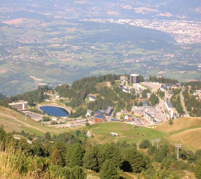
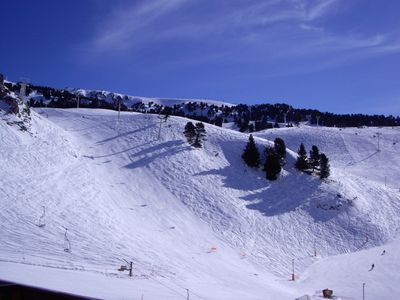
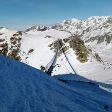
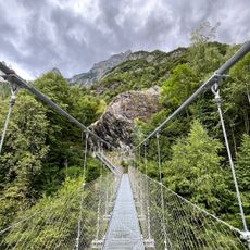
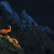
Chamrousse is a ski resort in the Belledonne mountains located at roughly 1,700 meters elevation in Isère, southeastern France. The area spreads across multiple zones with ski runs, lift systems, and winter sports facilities, along with hiking trails and nature paths available during warmer months.

The area gained international attention when it hosted alpine skiing events during the 1968 Winter Olympics. It developed into an established winter sports destination and became an independent commune in 1989.

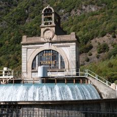
Residents here have built their identity around winter sports and mountain living, with skiing woven into the daily rhythm of the community. People gather at the base stations and refuge huts, making these spaces social centers beyond their practical purpose.

The area is divided into multiple zones accessible by road or lift systems, each with different difficulty levels for all skill ranges. The best visiting period runs from December through March when snow cover is deepest, though the resort remains active with open runs and trails during other seasons.

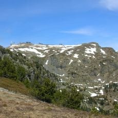
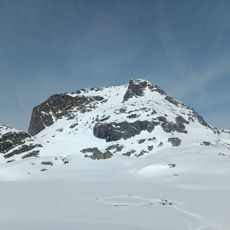
The Crête de la Croix, a peak within the area, offers panoramic views across surrounding mountain ranges and valleys that stand apart from typical ski run perspectives. On clear days, visitors can see the broader alpine landscape stretching far beyond the slopes.

Location: canton of Domène

Location: canton of Vizille

Location: Isère

Location: arrondissement of Grenoble

Inception: February 17, 1989

Elevation above the sea: 1,896 m

Shares border with: Livet-et-Gavet, Revel, Saint-Martin-d'Uriage, Séchilienne, Vaulnaveys-le-Haut

Phone: +33476899021

Email: mairie@chamrousse.com

Website: http://mairiechamrousse.com

GPS coordinates: 45.11167,5.87500

Latest update: December 20, 2025 14:53

Photos
Reviews

Visited this place? Tap the stars to rate it and share your experience / photos with the community! Try now! You can cancel it anytime.

« Chamrousse - Ski resort in Belledonne mountains, France » is provided by Around Us (aroundus.com). Images and texts are derived from Wikimedia project under a Creative Commons license. You are allowed to copy, distribute, and modify copies of this page, under the conditions set by the license, as long as this note is clearly visible.

Discover hidden gems everywhere you go!

From secret cafés to breathtaking viewpoints, skip the crowded tourist spots and find places that match your style. Our app makes it easy with voice search, smart filtering, route optimization, and insider tips from travelers worldwide. Download now for the complete mobile experience.

Around Us App Screenshot

A unique approach to discovering new places

Le Figaro

All the places worth exploring

France Info

A tailor-made excursion in just a few clicks

20 Minutes