La Garde-Freinet, Medieval village in Var, France
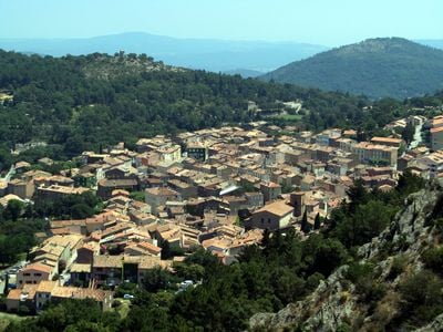
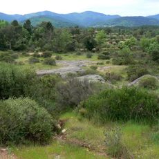
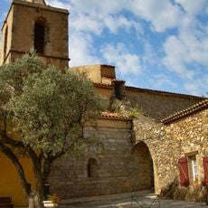
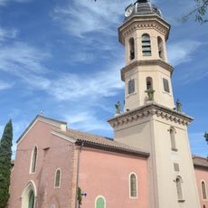
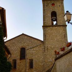
La Garde-Freinet is a mountain village in the Massif des Maures with stone houses lining narrow, winding streets at roughly 450 meters in elevation. Forests of cork oak and chestnut trees surround the settlement, giving it a sheltered feel within the wooded landscape.
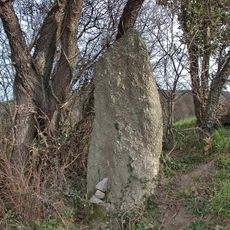
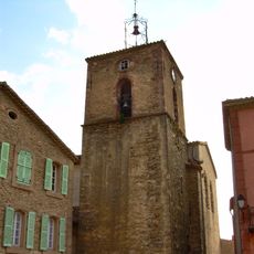
The settlement began in the 9th century as Fraxinet when Arab forces held it as a mountain fortress, then passed to French control in the 11th century. This shift changed it from a military stronghold into the residential mountain village it became.
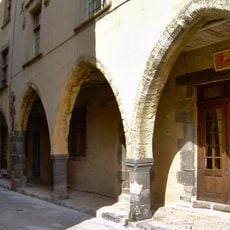
The village square today brings together artists and visitors, where local artisans still practice traditional crafts passed down through generations. Wednesday and Sunday markets show how the community keeps its connection to local food and goods.
The village is accessible by forest roads that wind through cork oak and chestnut woodlands toward Saint-Tropez, making for a scenic drive. The roads are steep and narrow, so sturdy shoes and careful driving are worth keeping in mind.
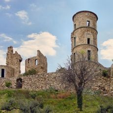
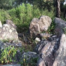
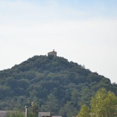
Fort Freinet stands at a high vantage point where visitors can look out across the Saint-Clément plains, the Argens valley, and toward the distant Alps on clear days. This overlook connects the site's defensive past with one of the broadest views in the region.
Location: Var
Location: arrondissement of Draguignan
Elevation above the sea: 268 m
Shares border with: Le Cannet-des-Maures, Collobrières, Grimaud, Les Mayons, Le Plan-de-la-Tour,
Address: 83680 La Garde-Freinet, France
Phone: +33494552100
Email: mairie@lagardefreinet.fr
Website: https://lgf83.fr
GPS coordinates: 43.31694,6.46917
Latest update: December 7, 2025 19:30
Chartreuse de la Verne
10.6 km
Château Aurélien de Fréjus
6.2 km
Azur Park
10.7 km
Réserve naturelle nationale de la plaine des Maures
6.7 km
Circuit du Luc
11.6 km
Château de Grimaud
6.3 km
Vidauban Golf club
8.6 km
ZooParc du Cannet des Maures
12.9 km
Signal de la Sauvette
11.7 km
Golf de Beauvallon
11.1 km
Drop-in Dracénie
12.6 km
Plage du Centre Ville
10.4 km
Chapelle des Pénitents
6.2 km
Menhirs des Terriers
11.8 km
Moulin Saint-Roch
6.2 km
Dolmens de Saint-Sébastien
8.4 km
Golf Up
8.4 km
Menhir du Pra-Bourdin
7.3 km
Plage du Gros Pins
11 km
Chapelle Sainte-Magdeleine de La Môle
10.1 km
Église Saint-Michel de Grimaud
6.5 km
Église Saint-Jean-Baptiste
12.7 km
La Croix des Maures
366 m
Église Saint-Clément de La Garde-Freinet
189 m
Maison, rue des Templiers
6.4 km
Chapelle Sainte-Brigitte de Vidauban
11.9 km
Église Saint-Martin du Plan-de-la-Tour
6.9 km
Chapelle Notre-Dame de la Queste
7.6 kmVisited this place? Tap the stars to rate it and share your experience / photos with the community! Try now! You can cancel it anytime.
Discover hidden gems everywhere you go!
From secret cafés to breathtaking viewpoints, skip the crowded tourist spots and find places that match your style. Our app makes it easy with voice search, smart filtering, route optimization, and insider tips from travelers worldwide. Download now for the complete mobile experience.
A unique approach to discovering new places❞
— Le Figaro
All the places worth exploring❞
— France Info
A tailor-made excursion in just a few clicks❞
— 20 Minutes