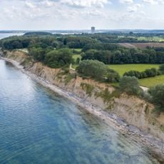
Brodtener Ufer, Steep coastal cliffs in Lübeck, Germany.
Brodtener Ufer is a steep coast along the Baltic Sea near Lübeck that stretches for several kilometers. The slopes drop sharply to the beach, creating a dramatic landscape with forest and open views across the water.
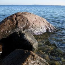
The cliff's boulders were quarried for centuries: Lübeck needed fieldstones for paving streets, building houses, waterworks and fortifications. In 1825 residents of Brodten complained and stone removal was banned to protect the slope, but the ban had to be renewed in 1841, 1876 and 1889. A 1901 map of Travemünde Bay records about 100 metres of land lost between 1810 and 1900.
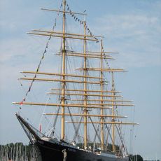
The name comes from the nearby village of Brodten and refers to the shoreline itself. Visitors watch sailboats and cargo ships entering Lübeck Bay, making it a popular spot for observing maritime traffic.
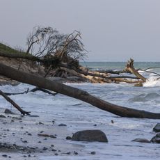
A hiking and cycling path runs along the top edge of the cliff. Access down to the beach is possible only at Niendorf/Ostsee, at Travemünde and via the stairs near the former Haus Seeblick north of Brodten; elsewhere descending the slope or walking along the break-off edge is life-threatening. After storms, collapses can block the beach, which is partly very stony.
The cliff retreats 50 to 100 cm a year, yet the boulders left on the beach act as breakwaters that slow the loss. From 1810 to 1900 the shoreline moved back about 100 metres, as a 1901 map of Travemünde Bay shows. The sand washed away builds the beaches of Niendorf and Travemünde and silts up the Trave fairway.
The community of curious travelers
AroundUs brings together thousands of curated places, local tips, and hidden gems, enriched daily by 94,663 contributors worldwide.