Enable Location

We need your location to show you interesting places around you

Discover nearby places

Find interesting locations and hidden gems around you

Precise directions

Get accurate directions and distances to places

Your location is never shared with other users. It's only used when you tap the location button.

Rotenfels

Log in to your account

Start exploring — it's free

Trusted by 62,236 travelers worldwide

Continue with Google
Continue with Apple
or

We will send you a code to connect

By continuing, you accept our Terms and Conditions and our Privacy Policy

Check your inbox

We've sent a pincode in your inbox. Please enter the code below.

Rotenfels

Rotenfels, Mountain summit in Bad Münster am Stein-Ebernburg, Germany.

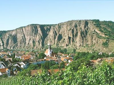
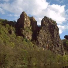
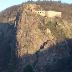
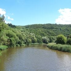
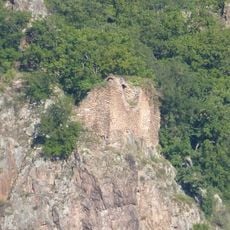
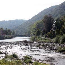
Rotenfels is a mountain massif in the Nahe Valley with steep rock faces and multiple peaks in Rhineland-Palatinate. The highest point reaches 327 meters and offers views across the surrounding forested landscape and river valley.

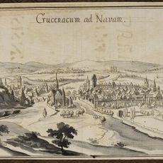
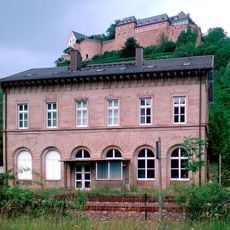
The area was settled in early times and became part of Germany's regional history. Throughout the centuries, the mountain remained a landmark in the cultural landscape of the middle Rhine valley.

The location draws hikers from the surrounding area who spend their time outdoors and connect with the natural environment. It shapes how local communities see themselves as nature enthusiasts and regularly attracts visitors exploring the region.

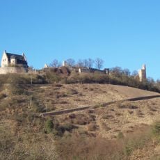
Several marked hiking trails lead to the summit, with parking available at the base of the mountain. The routes vary in steepness and take anywhere from thirty minutes to several hours depending on the path chosen.

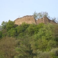
The massif consists of three distinctly different peaks that form varying silhouettes when viewed from the valley. This composition makes the mountain appear quite different depending on the viewing angle and location.

The community of curious travelers

AroundUs brings together thousands of curated places, local tips, and hidden gems, enriched daily by 60,000 contributors worldwide.

Start exploring
Elevation above the sea
327 m
GPS coordinates
49.81683,7.83545
Latest update
December 7, 2025 20:21
« Rotenfels - Mountain summit in Bad Münster am Stein-Ebernburg, Germany » is provided by Around Us (aroundus.com). Images and texts are derived from Wikimedia project under a Creative Commons license. You are allowed to copy, distribute, and modify copies of this page, under the conditions set by the license, as long as this note is clearly visible.

Discover hidden gems everywhere you go!

From secret cafés to breathtaking viewpoints, skip the crowded tourist spots and find places that match your style. Our app makes it easy with voice search, smart filtering, route optimization, and insider tips from travelers worldwide. Download now for the complete mobile experience.

Around Us App Screenshot

A unique approach to discovering new places

Le Figaro

All the places worth exploring

France Info

A tailor-made excursion in just a few clicks

20 Minutes

Around Us
Travel Guide & Maps
Download

Send to your phone

QR Code
1

Open the camera app on your mobile.

2

Point at the QR code with your camera. A notification will appear.

3

Tap the notification to open the link.