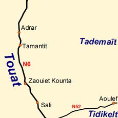
Adrar Province, Administrative province in Southwestern Algeria
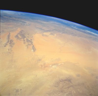
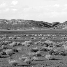
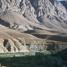
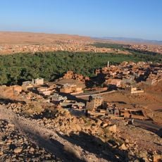
Adrar is a province in Southwestern Algeria that stretches across large desert areas and includes several historical oasis regions. The territory is shaped by different geographical zones, each showing distinct settlement patterns and natural features.
The province was created in 1974 from a reorganization of earlier administrative divisions. A major restructuring took place in 2019 that brought administrative changes to the area.
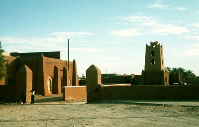
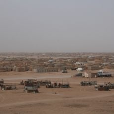
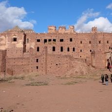
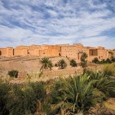
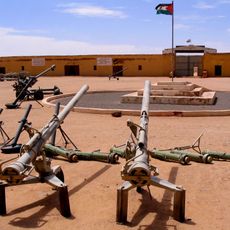
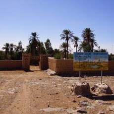
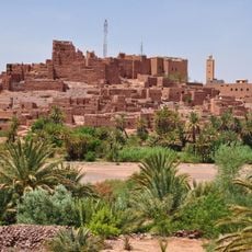
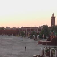
The region contains traditional oasis settlements spread across three distinct landscapes, each showing local building styles adapted to the desert environment. Visitors see earth-built structures and narrow streets that reflect how communities organize their daily lives.
Travelers can cross the region using the main highway and access the area through a local airport with connections to major cities. The best time to visit is during cooler months, as summer conditions are extreme.
The region experiences one of the world's driest climates with minimal annual rainfall. Despite these extreme conditions, people have long found ways to live and work within the oases.
Location: Algeria
Capital city: Adrar
Elevation above the sea: 276 m
Reference: 01
Shares border with: Beni Abbes Province, Bordj Baji Mokhtar Province, In Salah Province, Tamanrasset Province, Timimoun Province, Tindouf Province
GPS coordinates: 27.88056,-0.29722
Latest update: December 13, 2025 13:30
Ouzoud Falls
771.5 km
Sahrawi refugee camps
768.9 km
Sijilmasa
540.2 km
Gara Medouar
550.1 km
Dadès Gorges
680.4 km
Todgha Gorge
657.4 km
Bin el Ouidane Dam
757.9 km
Tuat
61.4 km
Telouet Kasbah
771.2 km
Ksar of Taourirt
724 km
Toubkal National Park
812.4 km
People's Liberation Army Museum
774.3 km
Priory of Our Lady of Atlas
684.2 km
Fezouata formation
605.7 km
Iriqui National Park
644.4 km
Hassan II Dam
695.1 km
Kasbah of Tifoultoute
732.1 km
El Mansour Ad Dahbi Reservoir
713.9 km
Cascades Ourika
804.6 km
Haut Atlas Oriental National Park
692.5 km
Imi-n-Ifri Formation
760.4 km
Djebel Aissa National Park
556 km
Site of Aït Ouaazik
569.2 km
Djebel Issa
560.3 km
Taourirt ta-n-Afella
682.2 km
Arak gorges
499.8 km
Guettioua Sandstone
737.8 km
Chapelle de Charles de Foucauld
309 kmVisited this place? Tap the stars to rate it and share your experience / photos with the community! Try now! You can cancel it anytime.
Discover hidden gems everywhere you go!
From secret cafés to breathtaking viewpoints, skip the crowded tourist spots and find places that match your style. Our app makes it easy with voice search, smart filtering, route optimization, and insider tips from travelers worldwide. Download now for the complete mobile experience.
A unique approach to discovering new places❞
— Le Figaro
All the places worth exploring❞
— France Info
A tailor-made excursion in just a few clicks❞
— 20 Minutes