Enable Location

We need your location to show you interesting places around you

Discover nearby places

Find interesting locations and hidden gems around you

Precise directions

Get accurate directions and distances to places

Your location is never shared with other users. It's only used when you tap the location button.

Sierra de Mijas

Log in to your account

Start exploring — it's free

Trusted by 63,803 travelers worldwide

Continue with Google
Continue with Apple
or

We will send you a code to connect

By continuing, you accept our Terms and Conditions and our Privacy Policy

Check your inbox

We've sent a pincode in your inbox. Please enter the code below.

Sierra de Mijas
Discussion Reviews 1 Photos
5.8k Popularity

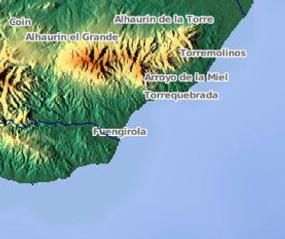
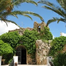
Sierra de Mijas, Mountain chain in Málaga Province, Spain.

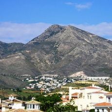
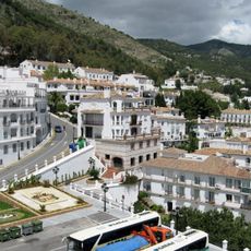
Sierra de Mijas is a mountain range situated between the Guadalhorce Valley and the Costa del Sol, with its highest peak reaching roughly 1,150 meters. The range features several summits and is crossed by hiking paths that lead to different viewpoints across the landscape.

The mountain range formed millions of years ago through geological uplift and served across the centuries as a natural boundary between coastal regions and inland areas. This geographic position heavily shaped how settlements developed and spread across the surrounding territories.

The mountain range shapes local livelihoods through its marble quarries, which have supplied builders across Andalusia for centuries. People in nearby villages continue to work with and depend on these stone resources today.

The range is accessible from several locations, with many hiking options starting from Mijas Pueblo at varying difficulty levels. The best period for hiking runs from October through April, when temperatures are more comfortable and you avoid the intense summer heat.

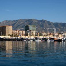
The range contains marble formations with a brilliant white color that can be spotted from the coast across considerable distances. These bright stone deposits make the mountain range a striking landmark in the landscape and are visible from the sea during clear weather.

The community of curious travelers

AroundUs brings together thousands of curated places, local tips, and hidden gems, enriched daily by 60,000 contributors worldwide.

Start exploring
Location
Elevation above the sea
1,150 m
Part of
Cordillera Penibética
GPS coordinates
36.61417,-4.65778
Latest update
December 10, 2025 16:23
Reviews
Share your experience

No review yet

Discussions
Start a discussion...

No discussion yet

« Sierra de Mijas - Mountain chain in Málaga Province, Spain » is provided by Around Us (aroundus.com). Images and texts are derived from Wikimedia project under a Creative Commons license. You are allowed to copy, distribute, and modify copies of this page, under the conditions set by the license, as long as this note is clearly visible.

Discover hidden gems everywhere you go!

From secret cafés to breathtaking viewpoints, skip the crowded tourist spots and find places that match your style. Our app makes it easy with voice search, smart filtering, route optimization, and insider tips from travelers worldwide. Download now for the complete mobile experience.

Around Us App Screenshot

A unique approach to discovering new places

Le Figaro

All the places worth exploring

France Info

A tailor-made excursion in just a few clicks

20 Minutes

Around Us
Travel Guide & Maps
Download

Send to your phone

QR Code
1

Open the camera app on your mobile.

2

Point at the QR code with your camera. A notification will appear.

3

Tap the notification to open the link.