Enable Location

We need your location to show you interesting places around you

Discover nearby places

Find interesting locations and hidden gems around you

Precise directions

Get accurate directions and distances to places

Your location is never shared with other users. It's only used when you tap the location button.

Lagunas de Ruidera Natural Park

Log in to your account

Save your favorite places
Create custom travel routes
Rate and review places
Access the full interactive map
Continue with Google
Continue with Apple
Continue with email
By continuing, you accept our Terms and Conditions and our Privacy Policy
Create an account

Lagunas de Ruidera Natural Park

Add to collection
Map
Suggest a change
Share

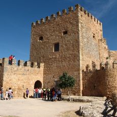
Lagunas de Ruidera Natural Park, Natural park in La Mancha, Spain

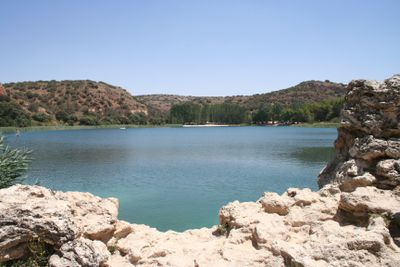
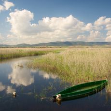
Lagunas de Ruidera Natural Park forms a natural corridor of fifteen connected water bodies joined by streams and small waterfalls that cross two provinces. Each lake has its own shape and depth, with shallow shores in some places and steeper banks in others.

The area received protected park status in 1979 to safeguard the chain of lakes and their ecological balance. A year later it was recognized as a biosphere reserve, and in 2011 it joined the international Ramsar list of wetlands.

The name Ruidera comes from an old Spanish word for water wheel, pointing to how people once harnessed the flowing water in this region. Local fishermen still use some stretches of the shore with small boats and wooden piers that keep the traditional craft alive.

You can reach the different lakes along national road N430, which runs parallel to the chain and offers several parking areas. The information center in Ruidera town provides maps and tips that help plan individual walks around the water.

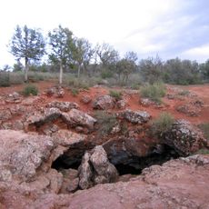
Below the surface lies a karst network of natural cavities that creates a drop of around 128 meters (420 feet) between the highest and lowest lake. This underground system feeds the lagoons with spring water and shapes the dynamics of the entire chain.

Location: Albacete Province

Location: Province of Ciudad Real

Inception: July 13, 1979

Elevation above the sea: 843 m

Address: Lagunas de Ruidera, 13248, Ciudad Real, Spain

Website: http://lagunasderuidera.net

GPS coordinates: 38.95941,-2.90039

Latest update: January 15, 2026 09:10

Photos
Castile-La Mancha: historic towns, castles, and natural parks in Spain

Castile-La Mancha covers a large highland area in the middle of Spain, between Madrid and Andalusia. This region includes towns with art and history, like Toledo, an old Spanish city with medieval streets and monuments that show the mixing of Christian, Jewish, and Muslim cultures. It also has...

Reviews

Visited this place? Tap the stars to rate it and share your experience / photos with the community! Try now! You can cancel it anytime.

« Lagunas de Ruidera Natural Park - Natural park in La Mancha, Spain » is provided by Around Us (aroundus.com). Images and texts are derived from Wikimedia project under a Creative Commons license. You are allowed to copy, distribute, and modify copies of this page, under the conditions set by the license, as long as this note is clearly visible.

Discover hidden gems everywhere you go!

From secret cafés to breathtaking viewpoints, skip the crowded tourist spots and find places that match your style. Our app makes it easy with voice search, smart filtering, route optimization, and insider tips from travelers worldwide. Download now for the complete mobile experience.

Around Us App Screenshot

A unique approach to discovering new places

Le Figaro

All the places worth exploring

France Info

A tailor-made excursion in just a few clicks

20 Minutes