Sayama Hills, Rolling country in Saitama Prefecture and Tokyo, Japan
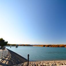
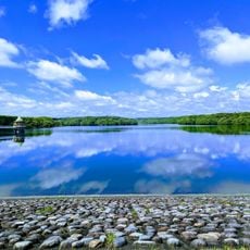
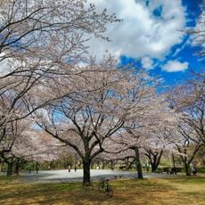
Sayama Hills is a rolling country area covering about 3,500 hectares across the border between Tokyo and Saitama Prefecture, featuring dense forests, traditional farmlands, and two lakes. The terrain shows a mix of wooded slopes, open cultivation areas, and smaller bodies of water that create a varied natural landscape.
The hills' wooded slopes and valley fields formed a satoyama worked for firewood, charcoal and leaf compost. In the late Taisho and early Showa years the Murayama and Yamaguchi reservoirs were built, submerging valley land while the hilltops became water-protection forest; railways were extended for the dams. After 1945 leisure development spread, and lowland fields became housing.
The name "Totoro's Forest" comes from Hayao Miyazaki's 1988 film My Neighbor Totoro, whose model was the easternmost edge around Mount Hachikoku, not the whole hills. Since 1990 the Totoro Fund has bought woodland plots, and by March 2018 it held 48 sites of over 8 hectares, run from the old farmhouse "Kurosuke's House" in Tokorozawa.
The hills span five cities and one town in Saitama and Tokyo, with the highest point at 194 m in the west, dropping to about 90 m in the east. Five Tokyo metropolitan parks lie on the Tokyo side, managed by the Seibu-Sayama Hills Partners. The Totoro's Hometown Foundation runs walks from the old farmhouse Kurosuke's House in Tokorozawa.
A foundation named after Totoro actively purchases forest sections to prevent development, protecting more than 1,600 plant and animal species in their natural habitat. This conservation work has enabled large areas to remain free from human construction over the long term.
The community of curious travelers
AroundUs brings together thousands of curated places, local tips, and hidden gems, enriched daily by 93,442 contributors worldwide.