Chest opened
+${chestReward.xp} XP
Explorer
NOUVEAU ×${chestReward.collectible.quantity}
tapez pour fermer
Chest locked

Open chests in the app

Around Us is built for your phone — chests unlock when you walk, explore and capture nearby places.

Enable Location

We need your location to show you interesting places around you

Discover nearby places

Find interesting locations and hidden gems around you

Precise directions

Get accurate directions and distances to places

Your location is never shared with other users. It's only used when you tap the location button.

Kanna River

Log in to your account

Start exploring — it's free

Trusted by 72,890 travelers worldwide

Continue with Google
Continue with Apple
or

We will send you a code to connect

By continuing, you accept our Terms and Conditions and our Privacy Policy

Check your inbox

We've sent a pincode in your inbox. Please enter the code below.

Kanna River
Discussion Reviews 1 Photos
11.7k Popularity

Kanna River, River system in Gunma and Saitama Prefectures, Japan.

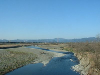
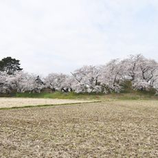
The Kanna River flows through Gunma and Saitama, shaping the landscape with valleys and natural habitats across central Japan. It winds through varied terrain and creates several reservoirs that serve the region.

The river has supported agriculture since ancient times, providing irrigation for rice fields and water for communities. This role in settlement and development shaped both prefectures across centuries.

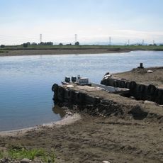
Local communities rely on the waterway for fishing and rice farming, making it central to daily life and seasonal rhythms in the region. This connection to water-based practices shapes how people here relate to their surroundings and organize their year.

Multiple access points along the river offer fishing opportunities, with designated areas and facilities in both prefectures. Routes that run parallel to the water provide regular parking and easier entry points.

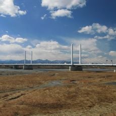
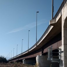
The Shimokubo Dam, built across this waterway, has Japan's longest crest and creates a lake spanning both prefectural borders. This remarkable structure stands out as an example of modern Japanese engineering.

The community of curious travelers

AroundUs brings together thousands of curated places, local tips, and hidden gems, enriched daily by 60,000 contributors worldwide.

Start exploring
Location
GPS coordinates
36.27660,139.14205
Latest update
December 7, 2025 20:49
Reviews
Share your experience

No review yet

Discussions
Start a discussion...

No discussion yet

« Kanna River - River system in Gunma and Saitama Prefectures, Japan » is provided by Around Us (aroundus.com). Images and texts are derived from Wikimedia project under a Creative Commons license. You are allowed to copy, distribute, and modify copies of this page, under the conditions set by the license, as long as this note is clearly visible.

Discover hidden gems everywhere you go!

From secret cafés to breathtaking viewpoints, skip the crowded tourist spots and find places that match your style. Our app makes it easy with voice search, smart filtering, route optimization, and insider tips from travelers worldwide. Download now for the complete mobile experience.

Around Us App Screenshot

A unique approach to discovering new places

Le Figaro

All the places worth exploring

France Info

A tailor-made excursion in just a few clicks

20 Minutes

Around Us
Travel Guide & Maps
Download

Send to your phone

QR Code
1

Open the camera app on your mobile.

2

Point at the QR code with your camera. A notification will appear.

3

Tap the notification to open the link.