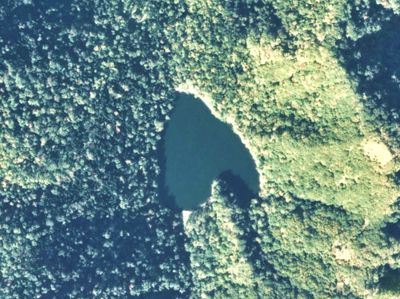
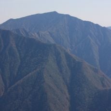
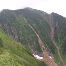
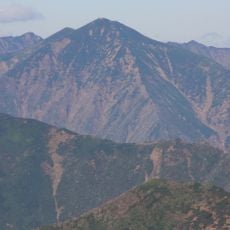
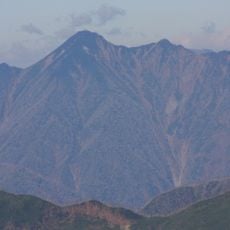
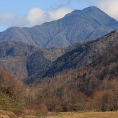
Lake Toyoni, Natural lake in Hidaka Range, Japan.
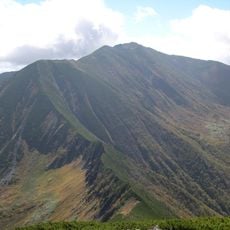
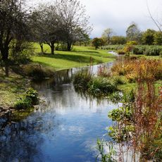
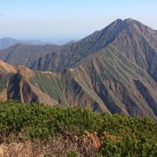
Lake Toyoni is a natural lake in the Hidaka Range located within a dense forest area, where emerald waters are surrounded by mountains at an elevation of 260 meters. The water body spans approximately 30 hectares, and the thick forests surrounding it give the location a secluded feel.
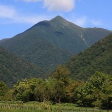
The lake was originally called Kamuito but was later renamed Lake Toyoni in honor of the nearby Mount Toyonidake. This renaming reflects the close connection between the water body and the surrounding mountain range.
The lake gained widespread recognition across Japan after appearing in a television commercial that highlighted its distinctive heart shape and turned it into a popular destination for photographs. Visitors often come to experience the form themselves or view aerial images of it.
The lake is accessible via forest trails through the surrounding woods, with the best visiting conditions depending on your preferred experience. October helicopter tours offer aerial views to observe the autumn colors from above.
The lake is the only natural water body within the Hidaka Range and features a heart-shaped outline visible from above. This unusual form makes it a distinctive feature of the mountain chain.
GPS coordinates: 42.08944,143.27139
Latest update: December 6, 2025 17:40
Heart-shaped geographic formations result from natural processes including erosion, coral growth, and tectonic activity. These features appear in various landscape types, from islands and atolls to lakes and coastlines. The distinctive shape typically becomes apparent only from aerial perspectives,...
Mount Poroshiri
85.3 km
Mount Apoi
20.4 km
Rokka Forest
68.4 km三嶋牧場
35.2 km
Niikappu mud volcano
85.3 km
ピョウタンの滝
62 km
Nakasatsunai Art Village
66.1 km
Shichiku Garden
76.6 km
Mount Apoi Geopark
20.4 km
Erimomisaki Lighthouse
18.4 km
Shinhidaka Ainu Museum
78.5 km
Pirika Nupuri
42.9 km
Tokachi Kako Bridge
73.6 kmTōjuin
29.4 km
Chūrui Naumann Elephant Museum
52.2 km日高中部消防組合
79.5 km小川の滝
65.9 km
Mount Kamuiekuuchikaushi
72.7 km
Mount Petegari
56.3 km
1839 Metre Summit
63 km
Mount Toyoni
3.5 km
Mount Rakko
24.3 km
Mount Soematsu
46.1 km
Mount Kamui
48.2 km
Taiki Aerospace Research Field
47.8 kmPoroshiri Ko
81.4 kmSamani Ko
27.7 kmShizunai Chōseichi
68 kmVisited this place? Tap the stars to rate it and share your experience / photos with the community! Try now! You can cancel it anytime.
Discover hidden gems everywhere you go!
From secret cafés to breathtaking viewpoints, skip the crowded tourist spots and find places that match your style. Our app makes it easy with voice search, smart filtering, route optimization, and insider tips from travelers worldwide. Download now for the complete mobile experience.
A unique approach to discovering new places❞
— Le Figaro
All the places worth exploring❞
— France Info
A tailor-made excursion in just a few clicks❞
— 20 Minutes