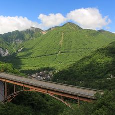
Mount Kamagamine, Mountain summit in Matsumoto, Japan.
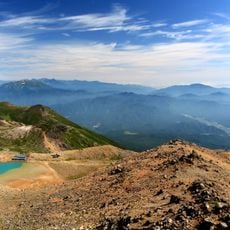
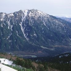
Mount Kamagamine is a 2,121 m peak on the border of Nagano and Gifu prefectures, south of Mount Norikura in the Hida Mountains. It is a bamboo-grass-covered wooded mountain with no maintained hiking trail. A second-order triangulation point stands on the summit, and the mountain lies on Japan's central divide, rising above the headwaters of the Hida and Kiso rivers.
The mountain lies on the boundary between Nagano and Gifu prefectures, south of Norikura-dake in the Hida Mountains. The Geographical Survey Institute lists Kamagamine as the southern limit of the "Southern Hida Mountains"; the higher Ontake-san to the south is classified separately as part of the Ontake range. A second-order triangulation point stands on the 2,121 m summit.
The name comes from the mountain's shape, which resembles an upturned cauldron (kama); over time the character for "cauldron" was replaced by the similar one for "sickle" (kama), giving the current spelling. The peak is listed among the Gifu Hyakuzan, a selection of 100 mountains in Gifu Prefecture.
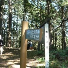
There is no maintained hiking trail to the summit; the mountain is covered in dwarf bamboo (kumazasa) and requires a bushwhack. The main approach is from the Nomugi Pass (野麦峠) side, between this peak and Norikura-dake; the Nomugi Pass O-tasuke Hut nearby does not offer overnight stays. A second pass, Nagamine Pass, lies toward Ontake-san.
The summit holds a second-order triangulation point, and the mountain marks Japan's central divide: streams on its slopes feed the Hida River and the Nishi River toward the Kiso, and the Nagawa toward the Azusa. The name came from a pot-like shape, later written with the character for sickle.
The community of curious travelers
AroundUs brings together thousands of curated places, local tips, and hidden gems, enriched daily by 94,323 contributors worldwide.