Enable Location

We need your location to show you interesting places around you

Discover nearby places

Find interesting locations and hidden gems around you

Precise directions

Get accurate directions and distances to places

Your location is never shared with other users. It's only used when you tap the location button.

Mount Yukikura

Log in to your account

Start exploring — it's free

Trusted by 65,745 travelers worldwide

Continue with Google
Continue with Apple
or

We will send you a code to connect

By continuing, you accept our Terms and Conditions and our Privacy Policy

Check your inbox

We've sent a pincode in your inbox. Please enter the code below.

Mount Yukikura
Discussion Reviews 1 Photos
3.7k Popularity

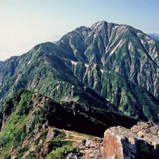
Mount Yukikura, Mountain summit in Itoigawa, Japan

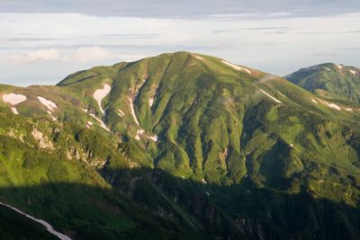
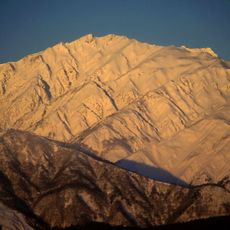
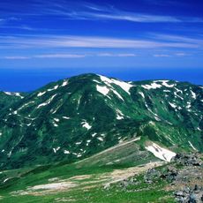
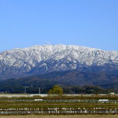
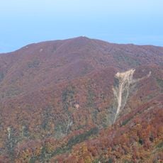
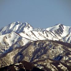
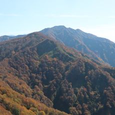
Mount Yukikura is a mountain summit in the Hida Mountains, sitting on the border between Niigata and Toyama Prefectures in Japan, and reaches 2,610 meters (8,560 ft). Its slopes shift from forested lower sections to rocky open terrain near the top.

The Hida Mountains, which this peak is part of, were traveled by Buddhist monks and mountain ascetics known as Yamabushi centuries ago. When Japan introduced modern administrative boundaries in the 19th century, the ridge became an official border line.

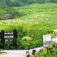
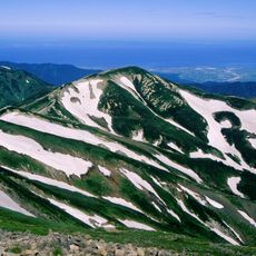
The name Yukikura roughly means "snow storehouse" in Japanese, a reference to the heavy snow that stays on its slopes long into spring. Visitors who arrive in early summer can still find large patches of snow along the upper trail sections.

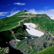
The climb itself is not technical, but it is physically demanding due to long stretches of rocky trail and significant elevation gain. Starting early in the morning gives enough time to descend safely before dark.

The summit ridge sits precisely on Japan's main watershed divide, meaning rain falling on one side drains toward the Sea of Japan and rain on the other side drains toward the Pacific. This line runs across the Hida range and is easiest to follow on foot at the open top of Yukikura.

The community of curious travelers

AroundUs brings together thousands of curated places, local tips, and hidden gems, enriched daily by 60,000 contributors worldwide.

Start exploring
Location
Location
Elevation above the sea
2,610.87 m
GPS coordinates
36.79466,137.75403
Latest update
March 3, 2026 14:01
Reviews
Share your experience

No review yet

Discussions
Start a discussion...

No discussion yet

« Mount Yukikura - Mountain summit in Itoigawa, Japan » is provided by Around Us (aroundus.com). Images and texts are derived from Wikimedia project under a Creative Commons license. You are allowed to copy, distribute, and modify copies of this page, under the conditions set by the license, as long as this note is clearly visible.

Discover hidden gems everywhere you go!

From secret cafés to breathtaking viewpoints, skip the crowded tourist spots and find places that match your style. Our app makes it easy with voice search, smart filtering, route optimization, and insider tips from travelers worldwide. Download now for the complete mobile experience.

Around Us App Screenshot

A unique approach to discovering new places

Le Figaro

All the places worth exploring

France Info

A tailor-made excursion in just a few clicks

20 Minutes

Around Us
Travel Guide & Maps
Download

Send to your phone

QR Code
1

Open the camera app on your mobile.

2

Point at the QR code with your camera. A notification will appear.

3

Tap the notification to open the link.