Enable Location

We need your location to show you interesting places around you

Discover nearby places

Find interesting locations and hidden gems around you

Precise directions

Get accurate directions and distances to places

Your location is never shared with other users. It's only used when you tap the location button.

Naniwa Bridge

Log in to your account

Start exploring — it's free

Trusted by 61,374 travelers worldwide

Continue with Google
Continue with Apple
or

We will send you a code to connect

By continuing, you accept our Terms and Conditions and our Privacy Policy

Check your inbox

We've sent a pincode in your inbox. Please enter the code below.

Naniwa Bridge

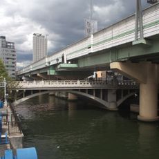
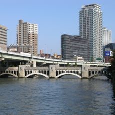
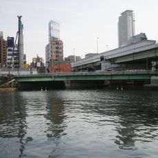
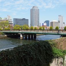
Naniwa Bridge, Arch road bridge in Chūō-ku and Kita-ku, Japan

Description

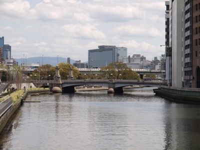
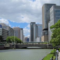
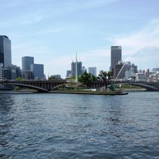
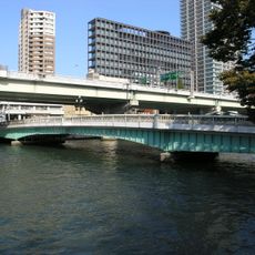
Naniwa Bridge is an arch road bridge connecting Chūō-ku and Kita-ku districts in central Osaka while spanning multiple waterways. The structure carries both vehicles and pedestrians across the waterways that separate the city districts.

History

The bridge began as a wooden structure built during the Edo period, then relocated to its present location in 1912 to make room for railway expansion. This move allowed Osaka's transportation network to develop alongside growing urban needs.

Culture

Four stone lions stand at the bridge ends in the Ah-Un configuration, with one showing an open mouth and the other with its mouth closed. These guardian figures are typical of traditional Japanese structures and define the bridge's character as visitors approach it.

Practical

The bridge sits near Kitahama Station and works as a key connection point for vehicles and pedestrians between districts. Access is straightforward, and visitors can walk or cross by car at any time to explore the surrounding area.

Did you know?

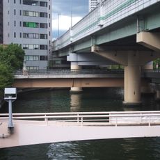
From this bridge, visitors can spot sixteen other bridges nearby, making it a particularly good vantage point for bridge-watching. Classical lampposts line the span and stone steps connect it directly to nearby Nakanoshima Park.

Location
Location
Length
189.7 m
Width
21.8 m
Part of
100 bridges in Japan, 50 bridges in Naniwa
GPS coordinates
34.69269,135.50714
Latest update
December 8, 2025 20:00

AroundUs brings together thousands of curated places, local tips, and hidden gems, enriched daily by 60,000 contributors worldwide. Discover all places nearby (Chūō-ku).

« Naniwa Bridge - Arch road bridge in Chūō-ku and Kita-ku, Japan » is provided by Around Us (aroundus.com). Images and texts are derived from Wikimedia project under a Creative Commons license. You are allowed to copy, distribute, and modify copies of this page, under the conditions set by the license, as long as this note is clearly visible.

Discover hidden gems everywhere you go!

From secret cafés to breathtaking viewpoints, skip the crowded tourist spots and find places that match your style. Our app makes it easy with voice search, smart filtering, route optimization, and insider tips from travelers worldwide. Download now for the complete mobile experience.

Around Us App Screenshot

A unique approach to discovering new places

Le Figaro

All the places worth exploring

France Info

A tailor-made excursion in just a few clicks

20 Minutes

Around Us
Travel Guide & Maps
Download

Send to your phone

QR Code
1

Open the camera app on your mobile.

2

Point at the QR code with your camera. A notification will appear.

3

Tap the notification to open the link.