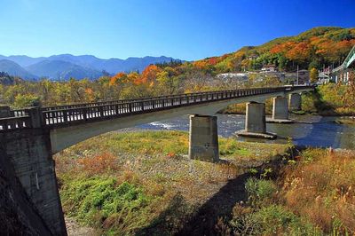
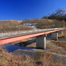
佐久良橋, Historic bridge in Kochi Prefecture, Japan
The Sakura Bridge crosses the Shimanto River with no side railings, allowing water to flow over the surface during high water periods. This design lets the river submerge the bridge without damaging its structure.
The bridge is one of roughly 47 submersible structures built along the Shimanto River system to manage seasonal flooding. These bridges were created to connect communities while allowing the river to move freely.
Local fishermen use the bridge as a fishing spot for river shrimp and eels, continuing practices that have shaped life along this waterway for many years. The bridge remains woven into daily community routines.
You can reach the bridge through a nearby parking area in Nakamura City, which is the closest submersible bridge to downtown. Plan to get wet if water levels are high, as there are no railings to keep you dry during crossings.
During high water periods, the bridge becomes partially submerged yet remains structurally sound, showing how a structure can be designed to yield to nature. This feature turns the crossing into a lesson in engineering that accepts rather than fights the river's seasonal power.
The community of curious travelers
AroundUs brings together thousands of curated places, local tips, and hidden gems, enriched daily by 60,000 contributors worldwide.