M2 Crimea Federal Highway, Federal highway in Central Russia
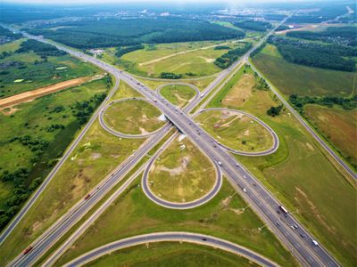
The M2 Crimea Federal Highway is a divided highway stretching 720 kilometers from Moscow southwestward through multiple Russian regions. It passes through Moscow, Tula, Oryol, Kursk, and Belgorod oblasts, serving as a primary transportation corridor in central Russia.
The highway opened in 1950 as part of Soviet Russia's post-war transportation development program. It became a key route connecting Moscow with southwestern regions and has remained central to traffic flow in this area.
The highway passes through five different administrative regions, each with distinct local traditions, from Moscow Oblast in the north to Belgorod Oblast.
The route has several service stations and rest areas spaced along its length for driver convenience. Plan for adequate travel time and check local conditions before departing, as weather can affect driving on this major corridor.
The route forms part of European Route E105, linking Russia to the broader European highway network. This international designation reflects its importance as a transcontinental corridor.
The community of curious travelers
AroundUs brings together thousands of curated places, local tips, and hidden gems, enriched daily by 60,000 contributors worldwide.