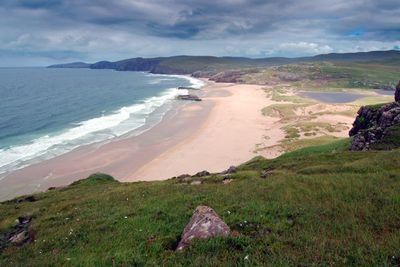
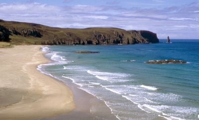
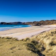
Sandwood Bay, Remote sandy bay in northwest Sutherland, Scotland.
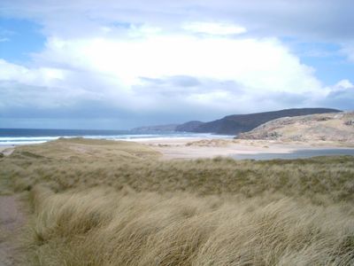
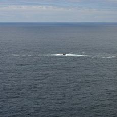
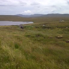
Sandwood Bay is a remote sandy bay in northwest Sutherland, Scotland. The shore stretches about a mile with golden sand backed by high dunes, and a freshwater lake called Sandwood Loch sits just behind the coastal edge.
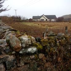
Pictish settlements once occupied the area in ancient times. People lived here as shepherds until the mid-20th century, after the Highland Clearances had already reshaped the region in the 1800s.
The name comes from Viking times, derived from "Sandvatn." Local stories about mermaids and a ghostly sailor are woven into how people understand this remote place.
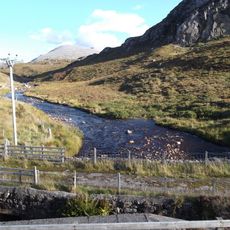
To reach the bay, walk about four miles from the Blairmore parking area. There are no facilities, shops, or services on site, so bring everything you need for your visit.
A World War II Spitfire crashed on the beach in 1941. Parts of its Rolls Royce engine still appear at low tide, a quiet remnant from wartime.
Location: Highland
GPS coordinates: 58.53960,-5.06230
Latest update: December 7, 2025 20:46
The Scottish Highlands span thousands of square miles in northern Scotland, offering striking landscapes of mountains, jagged coastlines, and remote lakes. This region retains villages that only recently gained road access, such as Rhenigidale on Harris Island, connected to the rest of the island in 1989. The Knoydart Peninsula remains accessible only by boat or on foot and has about a hundred residents. Notable sites include the Torridon hills, formed of red sandstone and rising roughly 1,000 meters (3,280 feet), the Bealach na Bà road which climbs to 626 meters (2,054 feet) with slopes up to 20 percent, and Sandwood Bay, a sandy beach reachable after several miles of walking. The Speyside Way stretches 85 miles (137 km) along the River Spey, passing through forests and moorlands near whisky distilleries. On the Isle of Skye, the Storr features needle-shaped rock formations, while Coire Lagan forms a glacial cirque carved into the rock. These sites highlight the region’s geological history and the ways of life that have persisted despite isolation.
Scotland offers photographers a wide range of landscapes and historical sites. This collection includes coastal formations like Bow Fiddle Rock and Sandwood Bay, medieval fortresses such as Edinburgh Castle and Stirling Castle, and mountains and glens like Glencoe and the Cairngorms. On the Isle of Skye you can find the Fairy Pools and Neist Point Lighthouse, while Glenfinnan Viaduct is known for its stone arches. Within Edinburgh itself are Arthur's Seat, an extinct volcano, Calton Hill with its monuments, and Dean Village, an old milling settlement by the water. The Kelpies near Falkirk are modern steel horse sculptures. Loch Ness stretches through the Highlands, and Eilean Donan Castle sits on a small island on the west coast. Along the shoreline are ruins like Dunnottar Castle on a rocky headland and Tantallon Castle overlooking the sea. Smaller places like Culross and Pittenweem show traditional architecture and harbors. The Clava Cairns are prehistoric burial sites near Inverness. On the northern coast is Smoo Cave, a cavern partly carved by the sea. Each location has its own light conditions and changes appearance with the seasons, from long summer evenings to low winter sun.
Cape Wrath Trail
105.1 km
Cape Wrath Lighthouse
10.2 km
Cranstackie
16.4 km
Beinn Spionnaidh
16.4 km
Eas na Glutachan
12.3 km
Easan Garbh
13.4 km
Sandwood Bay
547 m
Oldshoremore Beach
7 km
Duslic Rock
11.6 km
An Garbh-eilan military training ground
14.5 km
Kinlochbervie, Church Of Scotland Church
9 km
Achriesgill Bridge
11.9 km
Rhiconich Bridge
13.7 km
Drochaid Mhor, Bridge
14.9 km
Allt Na Guaille bridge
11.5 km
Cape Wrath, Lloyd's Signal Station: Cottages
10.1 km
Church Of Scotland Manse, Kinlochbervie
9 km
Stack Clò Kearvaig
11.4 km
Cape Wrath, Lloyd's Signal Station: Outbuilding
10.1 km
Cape Wrath, Lloyd's Signal Station: Lloyd's And Admiralty Signal Hut
10.1 km
Cape Wrath Lighthouse, Keepers' Cottages
10.2 km
Ach a'Chorrain,cairn E of the S end of Kyle of Durness
15.6 km
Kyle of Durness,hut circle 1000m SSW of Sarsgrum
15.4 km
Kyle of Durness,hut circle 750m SW of Sarsgrum
15.5 km
144, Oldshoremore
6.7 km
Byre, 144, Oldshoremore
6.7 km
Kyle of Durness,cairn 350m NNE of Sarsgrum
16.1 km
Oldshore More,corn mill
6.5 kmVisited this place? Tap the stars to rate it and share your experience / photos with the community! Try now! You can cancel it anytime.
Discover hidden gems everywhere you go!
From secret cafés to breathtaking viewpoints, skip the crowded tourist spots and find places that match your style. Our app makes it easy with voice search, smart filtering, route optimization, and insider tips from travelers worldwide. Download now for the complete mobile experience.
A unique approach to discovering new places❞
— Le Figaro
All the places worth exploring❞
— France Info
A tailor-made excursion in just a few clicks❞
— 20 Minutes