Ben Lawers, Mountain summit in Perth and Kinross, Scotland.
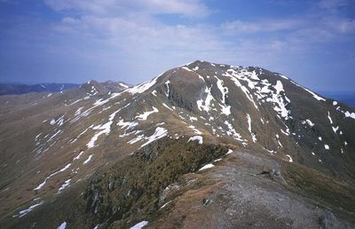
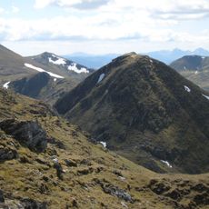
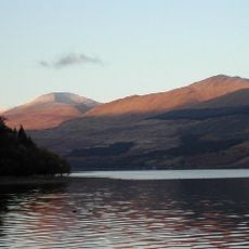
Ben Lawers is a mountain summit in the Scottish Highlands rising to 1,214 meters (3,984 feet). It forms part of a ridge with six other peaks of similar height and ranks among Scotland's highest mountains.
Military surveyor William Roy first recorded an ascent in 1776, beginning the documented history of exploration on the mountain. This early climb marked the start of wider interest in the peak.
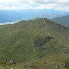
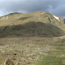
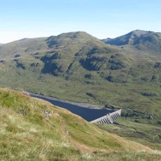
Herders have used the slopes for grazing for centuries, shaping how the land looks and is used today. You can see these patterns in the open grasslands and paths that follow the hillside.
A car park managed by the National Trust for Scotland sits roughly one mile below the main ridge, with paths leading to different heights on the mountain. Walking trails are marked and offer routes for various fitness levels.
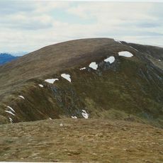
The mountain protects rare arctic-alpine plant species including alpine forget-me-not and mountain sandwort within a nature reserve. These plants typically grow in far northern regions, making their presence here unusual.
Location: Perth and Kinross
Elevation above the sea: 1,214 m
Website: https://nts.org.uk/visit/places/ben-lawers
GPS coordinates: 56.54490,-4.22087
Latest update: December 7, 2025 19:22
Finlarig Castle
9.7 km
Meggernie Castle
9.4 km
Moirlanich Longhouse
10.3 km
Beinn Ghlas
1.4 km
Meall nan Tarmachan
5.6 km
Killin Stone Circle
10.4 km
Càrn Gorm
8.6 km
Meall Garbh
2.5 km
An Stùc
1.7 km
Meall Garbh
10.3 km
Meall Greigh
4.5 km
Meall Corranaich
2.1 km
Dochart Viaduct
10.6 km
Meall a' Choire Léith
3.4 km
Lawers Dam
4.2 km
The Manse, Killin
10.3 km
Tullich Hill
8.3 km
Killin Parish Church
10.3 km
Burial-Ground, Killin Parish Church
10.2 km
Meall Dhuin Croisg
9.8 km
Ashlea, Main Street, Killin
10.7 km
St Fillan's Episcopal Church, Main Street, Killin
10.3 km
James Stewart Memorial Including Railings, Killin
10.3 km
Dreadnought Place Including Ancillary Structure And Boundary Walls, Main Street, Killin
10.4 km
Station House And Tarmachan Teashop, Larachbeag, Killin
10.3 km
Lynedoch Including Boundary Walls, Main Street, Killin
10.5 km
Dreadnought Place Including Ancillary Structure And Boundary Walls, Main Street, Killin
10.4 km
Cill mo Chormaig,church and burial ground
6.9 kmVisited this place? Tap the stars to rate it and share your experience / photos with the community! Try now! You can cancel it anytime.
Discover hidden gems everywhere you go!
From secret cafés to breathtaking viewpoints, skip the crowded tourist spots and find places that match your style. Our app makes it easy with voice search, smart filtering, route optimization, and insider tips from travelers worldwide. Download now for the complete mobile experience.
A unique approach to discovering new places❞
— Le Figaro
All the places worth exploring❞
— France Info
A tailor-made excursion in just a few clicks❞
— 20 Minutes