Carn Euny

Log in to your account

AroundUs is a community-driven map of interesting places, built by curious explorers like you. It grows with every review, story, and photo you share.
Connect to save your favorite spots, contribute locations, and create personalized routes.
By continuing, you accept our Terms and Conditions and our Privacy Policy
Add to collection
Map
Suggest a change
Share

Carn Euny, Archaeological site in Penwith peninsula, Cornwall, United Kingdom

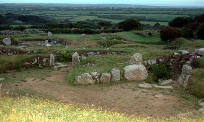
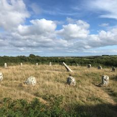
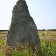
Carn Euny is an archaeological site with remains of several round stone dwellings arranged around paved courtyards, with walls preserved to roughly one meter in height. The structures sit on sloping ground and create a network of spaces that still clearly shows how the settlement was laid out.

The first settlement began around 200 BC with wooden buildings that were later replaced by sturdier stone structures. These stone buildings were constructed from the 1st century BC onward, and people lived here until roughly 400 AD when the community moved away.

The name comes from an old Celtic settlement, and visitors can see traces of how people arranged their living spaces around courtyards and shared areas. Walking through the site helps you understand how communities organized themselves around daily tasks like farming and caring for livestock.

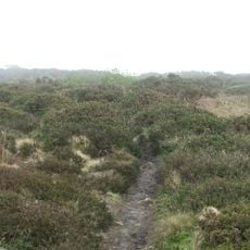
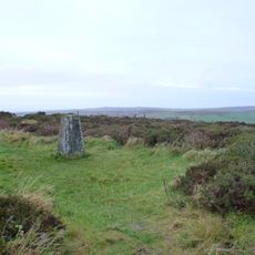
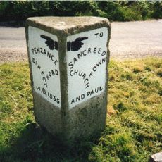
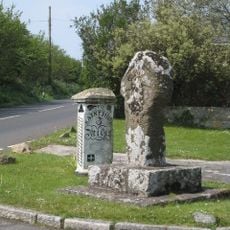
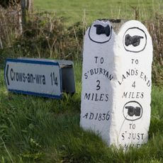
You can visit the site free of charge and park your vehicle in the nearby hamlet of Brane, with marked paths leading across farmland to reach the ruins. The ground is generally accessible on foot, though sturdy shoes are wise since you walk across fields to get there.

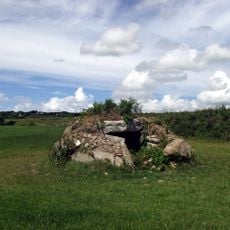
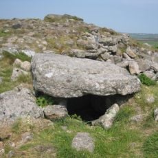
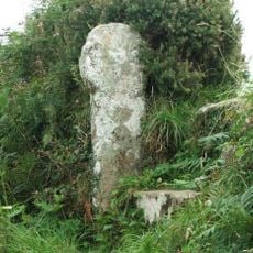
Beneath the surface lies an underground stone passage called a fogou that stretches for roughly 20 meters underground. This tunnel was built from massive stone slabs and represents a construction method found almost nowhere else in Britain.

Location: Cornwall

Inception: 200 BCE

Website: https://english-heritage.org.uk/visit/places/carn-euny-ancient-village

GPS coordinates: 50.10271,-5.63380

Latest update: December 10, 2025 20:06

Photos
Around this place
Show the full map
Boscawen-Un
United Kingdom

Boscawen-Un

1.8 km
Caer Bran
United Kingdom

Caer Bran

534 m
Church of Saint Credan
United Kingdom

Church of Saint Credan

1.8 km
Bartinney Castle
United Kingdom

Bartinney Castle

928 m
Sancreed Beacon
United Kingdom

Sancreed Beacon

1.3 km
Brane Barrow
United Kingdom

Brane Barrow

663 m
Standing stone known as the 'Blind Fiddler', 405m south east of Lesbew Farm
United Kingdom

Standing stone known as the 'Blind Fiddler', 405m south east of Lesbew Farm

2.4 km
Chapel Carn Brea Tomb
United Kingdom

Chapel Carn Brea Tomb

1.8 km
Wayside cross in Sancreed churchyard, 10m east of the church
United Kingdom

Wayside cross in Sancreed churchyard, 10m east of the church

1.9 km
Cross at approximately 10 metres south of Church of St Credan
United Kingdom

Cross at approximately 10 metres south of Church of St Credan

1.8 km
Milestone Approximately 135M Se Of The Firs
United Kingdom

Milestone Approximately 135M Se Of The Firs

1.6 km
Guide Stone Opposite Junction Of Turnpike Road And A3071
United Kingdom

Guide Stone Opposite Junction Of Turnpike Road And A3071

3 km
Milestone At Sw 43110 28029, 87M North-East Of Lower Hendra Cottages
United Kingdom

Milestone At Sw 43110 28029, 87M North-East Of Lower Hendra Cottages

3 km
Milestone Approximately 323M West Of Higher Botrea
United Kingdom

Milestone Approximately 323M West Of Higher Botrea

2.4 km
Cross (At Sw 395276) (The Witches' Cross)
United Kingdom

Cross (At Sw 395276) (The Witches' Cross)

1.4 km
Brane Cross
United Kingdom

Brane Cross

652 m
Guide Post (At Sw395276)
United Kingdom

Guide Post (At Sw395276)

1.4 km
Milestone At Sw402275
United Kingdom

Milestone At Sw402275

1.3 km
Wayside cross-head in Sancreed churchyard on churchyard wall by west gate
United Kingdom

Wayside cross-head in Sancreed churchyard on churchyard wall by west gate

1.8 km
Brea Milestone On B3306 South East Of St Just Aerodrome
United Kingdom

Brea Milestone On B3306 South East Of St Just Aerodrome

2.3 km
Leswidden Stone, 370m south west of Leswidden
United Kingdom

Leswidden Stone, 370m south west of Leswidden

1.4 km
Guide Post At Sw407318
United Kingdom

Guide Post At Sw407318

3 km
Guide Post At Sw406317
United Kingdom

Guide Post At Sw406317

2.9 km
Guidestone About 100 Metres West Of Sancreed Turning
United Kingdom

Guidestone About 100 Metres West Of Sancreed Turning

3.1 km
Crows-an-wra medieval wayside cross and a turnpike milestone.
United Kingdom

Crows-an-wra medieval wayside cross and a turnpike milestone.

1.4 km
Trevorgans Cross
United Kingdom

Trevorgans Cross

1.3 km
Round, courtyard house settlement and field system 140m WNW of Goldherring
United Kingdom

Round, courtyard house settlement and field system 140m WNW of Goldherring

1.1 km
Sancreed War Memorial
United Kingdom

Sancreed War Memorial

1.8 km
Show the full map
Reviews

Visited this place? Tap the stars to rate it and share your experience / photos with the community! Try now! You can cancel it anytime.

« Carn Euny - Archaeological site in Penwith peninsula, Cornwall, United Kingdom » is provided by Around Us (aroundus.com). Images and texts are derived from Wikimedia project under a Creative Commons license. You are allowed to copy, distribute, and modify copies of this page, under the conditions set by the license, as long as this note is clearly visible.

Discover hidden gems everywhere you go!

From secret cafés to breathtaking viewpoints, skip the crowded tourist spots and find places that match your style. Our app makes it easy with voice search, smart filtering, route optimization, and insider tips from travelers worldwide. Download now for the complete mobile experience.

Around Us App Screenshot

A unique approach to discovering new places

Le Figaro

All the places worth exploring

France Info

A tailor-made excursion in just a few clicks

20 Minutes