Boscawen-Un

Log in to your account

AroundUs is a community-driven map of interesting places, built by curious explorers like you. It grows with every review, story, and photo you share.
Connect to save your favorite spots, contribute locations, and create personalized routes.
Continue with Google
Continue with Apple
Continue with X
Continue with Facebook
Continue with email
By continuing, you accept our Terms and Conditions and our Privacy Policy
Create an account
Add to collection
Map
Suggest a change
Share

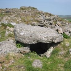
Boscawen-Un, Prehistoric stone circle in Cornwall, England

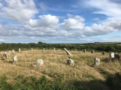
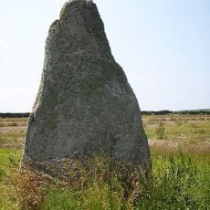
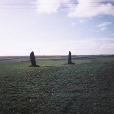
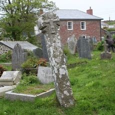
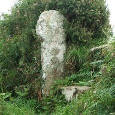
Boscawen-Un is a stone circle made of nineteen granite blocks arranged in an elliptical shape measuring about 25 meters by 22 meters. A leaning stone stands at the center of the formation.

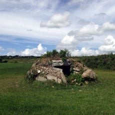
The site dates to around 2000 BC and shows evidence of Bronze Age burial practices. An adjacent burial mound contains urns from this ancient period.

The name comes from Cornish and refers to an old settlement in the area. People gather here today for traditional ceremonies and experience the site as a connection to ancient traditions.

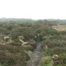
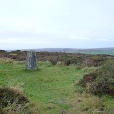
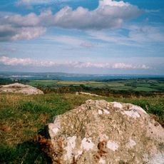
The stone circle sits on farmland and is reached via a marked path from the main road between Penzance and Land's End. It is best to wear sturdy footwear and be prepared for changeable weather.

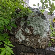
The central stone bears rare carvings that depict axes. Such engravings appear at only a handful of other locations in the area.

Location: Cornwall

GPS coordinates: 50.08983,-5.61932

Latest update: December 6, 2025 17:40

Photos
Stone circles: England, Scotland, Ireland, Germany and across Europe & USA

Stone circles stand among humanity's earliest architectural accomplishments, constructed by prehistoric communities across Europe and beyond over thousands of years. These circular arrangements of standing stones served multiple purposes, functioning as astronomical observatories where ancient...

Around this place
Carn Euny
United Kingdom

Carn Euny

1.8 km
Drift Reservoir
United Kingdom

Drift Reservoir

2.9 km
St Buryan's Church
United Kingdom

St Buryan's Church

1.6 km
Caer Bran
United Kingdom

Caer Bran

1.7 km
Church of Saint Credan
United Kingdom

Church of Saint Credan

2.2 km
Bartinney Castle
United Kingdom

Bartinney Castle

2.6 km
Sancreed Beacon
United Kingdom

Sancreed Beacon

2.1 km
Brane Barrow
United Kingdom

Brane Barrow

1.4 km
Standing stone known as the 'Blind Fiddler', 405m south east of Lesbew Farm
United Kingdom

Standing stone known as the 'Blind Fiddler', 405m south east of Lesbew Farm

1.6 km
Two standing stones known as the Long Stones, 280m south east of Higher Drift Farm
United Kingdom

Two standing stones known as the Long Stones, 280m south east of Higher Drift Farm

2.7 km
Chapel Carn Brea Tomb
United Kingdom

Chapel Carn Brea Tomb

2.7 km
Wayside cross in Sancreed churchyard, 10m east of the church
United Kingdom

Wayside cross in Sancreed churchyard, 10m east of the church

2.2 km
Cross (At Sw 395276) (The Witches' Cross)
United Kingdom

Cross (At Sw 395276) (The Witches' Cross)

1.7 km
Milestone Approximately 135M Se Of The Firs
United Kingdom

Milestone Approximately 135M Se Of The Firs

813 m
Cross at approximately 10 metres south of Church of St Credan
United Kingdom

Cross at approximately 10 metres south of Church of St Credan

2.1 km
Milestone At Sw 43110 28029, 87M North-East Of Lower Hendra Cottages
United Kingdom

Milestone At Sw 43110 28029, 87M North-East Of Lower Hendra Cottages

2 km
Churchyard Walls And Adjoining War Memorial
United Kingdom

Churchyard Walls And Adjoining War Memorial

1.7 km
Guide Post At Sw 401248
United Kingdom

Guide Post At Sw 401248

2.7 km
Brane Cross
United Kingdom

Brane Cross

1.4 km
Wayside cross-head in Sancreed churchyard on churchyard wall by west gate
United Kingdom

Wayside cross-head in Sancreed churchyard on churchyard wall by west gate

2.1 km
Guide Post (At Sw395276)
United Kingdom

Guide Post (At Sw395276)

1.7 km
Milestone At Sw402275
United Kingdom

Milestone At Sw402275

1 km
Round, courtyard house settlement and field system 140m WNW of Goldherring
United Kingdom

Round, courtyard house settlement and field system 140m WNW of Goldherring

820 m
Churchyard cross in St Buryan churchyard
United Kingdom

Churchyard cross in St Buryan churchyard

1.7 km
Crows-an-wra medieval wayside cross and a turnpike milestone.
United Kingdom

Crows-an-wra medieval wayside cross and a turnpike milestone.

1.7 km
Trevorgans Cross
United Kingdom

Trevorgans Cross

1.2 km
St Buryan churchtown cross
United Kingdom

St Buryan churchtown cross

1.7 km
Sancreed War Memorial
United Kingdom

Sancreed War Memorial

2.1 km
Show the full map
Reviews

Visited this place? Tap the stars to rate it and share your experience / photos with the community! Try now! You can cancel it anytime.

« Boscawen-Un - Prehistoric stone circle in Cornwall, England » is provided by Around Us (aroundus.com). Images and texts are derived from Wikimedia project under a Creative Commons license. You are allowed to copy, distribute, and modify copies of this page, under the conditions set by the license, as long as this note is clearly visible.

Discover hidden gems everywhere you go!

From secret cafés to breathtaking viewpoints, skip the crowded tourist spots and find places that match your style. Our app makes it easy with voice search, smart filtering, route optimization, and insider tips from travelers worldwide. Download now for the complete mobile experience.

Around Us App Screenshot

A unique approach to discovering new places

Le Figaro

All the places worth exploring

France Info

A tailor-made excursion in just a few clicks

20 Minutes