Enable Location

We need your location to show you interesting places around you

Discover nearby places

Find interesting locations and hidden gems around you

Precise directions

Get accurate directions and distances to places

Your location is never shared with other users. It's only used when you tap the location button.

Boleigh Fogou

Log in to your account

Start exploring — it's free

Trusted by 61,998 travelers worldwide

Continue with Google
Continue with Apple
or

We will send you a code to connect

By continuing, you accept our Terms and Conditions and our Privacy Policy

Check your inbox

We've sent a pincode in your inbox. Please enter the code below.

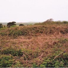
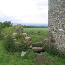
Boleigh Fogou, Underground stone chamber in St Buryan, England.

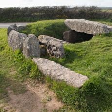
Boleigh Fogou is an underground stone chamber in St Buryan with two rooms connected by a passage. The walls are lined with carefully placed stones and topped with corbelled roofs that support the weight of the earth above.

This fogou was built during the Iron Age through the Romano-British period and shows how people lived in early Cornwall. Its construction reveals the building techniques and practical knowledge of those who created it centuries ago.

The name comes from Cornish and means cave, reflecting a local tradition of building underground passages in this region. This construction style shows how people adapted to their surroundings by creating spaces beneath the ground.

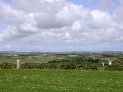
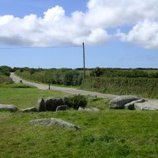
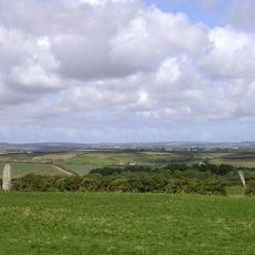
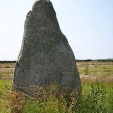
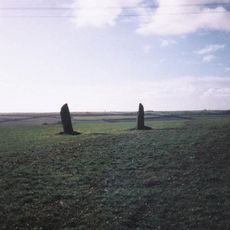
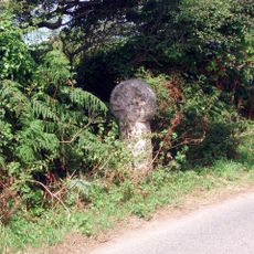
You can reach this site from Penzance by taking the B3315 toward Land's End, near the Pipers standing stones. The ground is uneven and can be muddy, so wear sturdy footwear when exploring the underground chambers.

Excavations uncovered Iron Age pottery and carvings on the walls, suggesting the space had ritual or symbolic uses beyond everyday living. Multiple entranceways set this structure apart from other similar underground chambers found nearby.

The community of curious travelers

AroundUs brings together thousands of curated places, local tips, and hidden gems, enriched daily by 60,000 contributors worldwide.

Start exploring
Location
GPS coordinates
50.07160,-5.58293
Latest update
December 14, 2025 14:25
Around this place
The Merry Maidens
United Kingdom

The Merry Maidens

833 m
Boscawen-Un
United Kingdom

Boscawen-Un

3.3 km
Tater Du Lighthouse
United Kingdom

Tater Du Lighthouse

2.2 km
St Buryan's Church
United Kingdom

St Buryan's Church

2.9 km
Tregiffian Burial Chamber
United Kingdom

Tregiffian Burial Chamber

1 km
St Loy's Cove
United Kingdom

St Loy's Cove

2.5 km
St Pol de Léon's Church, Paul
United Kingdom

St Pol de Léon's Church, Paul

3.3 km
The Pipers
United Kingdom

The Pipers

421 m
Round, courtyard house, stone hut circle settlement and field system 275m north of Castallack Carn
United Kingdom

Round, courtyard house, stone hut circle settlement and field system 275m north of Castallack Carn

1.1 km
Standing stone known as the 'Blind Fiddler', 405m south east of Lesbew Farm
United Kingdom

Standing stone known as the 'Blind Fiddler', 405m south east of Lesbew Farm

3.2 km
Two standing stones known as the Long Stones, 280m south east of Higher Drift Farm
United Kingdom

Two standing stones known as the Long Stones, 280m south east of Higher Drift Farm

3.1 km
Tresvennack Pillar
United Kingdom

Tresvennack Pillar

2.7 km
Church of St Clement (methodist )
United Kingdom

Church of St Clement (methodist )

3.3 km
The Ship Inn
United Kingdom

The Ship Inn

3.4 km
King's Arms Inn
United Kingdom

King's Arms Inn

3.3 km
Boskenna Gate Cross
United Kingdom

Boskenna Gate Cross

2 km
Churchyard Walls And Adjoining War Memorial
United Kingdom

Churchyard Walls And Adjoining War Memorial

2.8 km
Milestone At Sw 43110 28029, 87M North-East Of Lower Hendra Cottages
United Kingdom

Milestone At Sw 43110 28029, 87M North-East Of Lower Hendra Cottages

2.9 km
Kerris Manor Farmhouse Including Front Garden Walls And Rear Courtyard Walls
United Kingdom

Kerris Manor Farmhouse Including Front Garden Walls And Rear Courtyard Walls

2 km
Mounting Block Near South Gateway Of Churchyard Of Church Of St Buryan
United Kingdom

Mounting Block Near South Gateway Of Churchyard Of Church Of St Buryan

2.8 km
Cross At Sw4611725135 (Kemyel Drea Cross)
United Kingdom

Cross At Sw4611725135 (Kemyel Drea Cross)

2.4 km
Prehistoric entrance grave 900m north west of Tregiffian Farm
United Kingdom

Prehistoric entrance grave 900m north west of Tregiffian Farm

1 km
Boskenna Cross
United Kingdom

Boskenna Cross

1.5 km
St Buryan churchtown cross
United Kingdom

St Buryan churchtown cross

2.9 km
Churchyard cross in St Buryan churchyard
United Kingdom

Churchyard cross in St Buryan churchyard

2.8 km
Kerris Cross
United Kingdom

Kerris Cross

2.1 km
Keigwin Little Keigwin
United Kingdom

Keigwin Little Keigwin

3.3 km
Cross at SW419242
United Kingdom

Cross at SW419242

2.1 km
Show the full map
« Boleigh Fogou - Underground stone chamber in St Buryan, England » is provided by Around Us (aroundus.com). Images and texts are derived from Wikimedia project under a Creative Commons license. You are allowed to copy, distribute, and modify copies of this page, under the conditions set by the license, as long as this note is clearly visible.

Discover hidden gems everywhere you go!

From secret cafés to breathtaking viewpoints, skip the crowded tourist spots and find places that match your style. Our app makes it easy with voice search, smart filtering, route optimization, and insider tips from travelers worldwide. Download now for the complete mobile experience.

Around Us App Screenshot

A unique approach to discovering new places

Le Figaro

All the places worth exploring

France Info

A tailor-made excursion in just a few clicks

20 Minutes

Around Us
Travel Guide & Maps
Download

Send to your phone

QR Code
1

Open the camera app on your mobile.

2

Point at the QR code with your camera. A notification will appear.

3

Tap the notification to open the link.