Monkland Canal, Industrial canal system in Glasgow, United Kingdom
The Monkland Canal is a waterway that runs through Glasgow, connecting industrial areas and communities across the city. The system includes several branches and sections that once served factories and works in different neighborhoods.
The waterway was built in the late 1700s to move coal from mining areas north of Glasgow into the city for industrial use. This project transformed trade patterns and allowed the region's industries to grow and develop.
The canal system transformed local transportation methods, enabling efficient coal and iron movement while supporting the development of numerous industrial communities along its route.
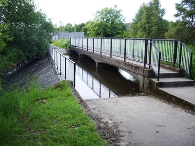
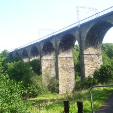
Some sections of the canal are accessible today for walking or fishing along the banks. The quieter stretches are found in less built-up areas where you can see the water and vegetation more easily.
A special engineering solution at Blackhill was an inclined plane that allowed boats to climb steep height differences without using traditional locks. This clever system was remarkable for its time and shows the innovative thinking of the early industrial period.
Location: Glasgow City
GPS coordinates: 55.84100,-3.97300
Latest update: December 10, 2025 15:57
Cliftonhill
3.2 km
Carfin Grotto
4.1 km
Airdrie Public Observatory
2.8 km
Broomfield Park
2.5 km
Motherwell Cathedral
5.6 km
Dalziel Park
5 km
Drumpellier country park
5.8 km
Summerlee, Museum of Scottish Industrial Life
4.6 km
North Lanarkshire Heritage Centre
5.8 km
Airdrie Library
2.9 km
Coatbridge College
3.8 km
Coatbridge Library
4.3 km
Airdrie, Stirling Street, Sir John Wilson Town Hall
2.8 km
Bellshill Central Parish church
3.6 km
Coatbridge, Dunbeth Road, Municipal Buildings
4 km
Airdrie Town House
2.9 km
Whitelaw memorial fountain
4.2 km
Showcase Cinemas Coatbridge
5.8 km
Motherwell, Forgewood, Jerviston Railway Viaduct
4.3 km
Monkland Canal, Coatbridge Cross Railway Bridge
4.3 km
Airdrie, Wellwynd, West Parish Church Of Scotland
2.9 km
Monkland Canal, Caledonian Railway Bridge, Coatbridge
4.3 km
Coatdyke, Centenary Avenue, Railway Viaduct
3.1 km
Big Heids
711 m
Airdrie, 16 And 18 North Bridge Street
3.2 km
Coatbridge, Hozier Street, St Mary's Church, Presbytery
3.3 km
New Monkland, Parish Church, Watch House
5.3 km
Coatbridge Central Station building
4.4 kmVisited this place? Tap the stars to rate it and share your experience / photos with the community! Try now! You can cancel it anytime.
Discover hidden gems everywhere you go!
From secret cafés to breathtaking viewpoints, skip the crowded tourist spots and find places that match your style. Our app makes it easy with voice search, smart filtering, route optimization, and insider tips from travelers worldwide. Download now for the complete mobile experience.
A unique approach to discovering new places❞
— Le Figaro
All the places worth exploring❞
— France Info
A tailor-made excursion in just a few clicks❞
— 20 Minutes