Chest opened
+${chestReward.xp} XP
Explorer
NOUVEAU ×${chestReward.collectible.quantity}
tapez pour fermer
Chest locked

Open chests in the app

Around Us is built for your phone — chests unlock when you walk, explore and capture nearby places.

Enable Location

We need your location to show you interesting places around you

Discover nearby places

Find interesting locations and hidden gems around you

Precise directions

Get accurate directions and distances to places

Your location is never shared with other users. It's only used when you tap the location button.

A40 road

Log in to your account

Start exploring — it's free

Trusted by 72,887 travelers worldwide

Continue with Google
Continue with Apple
or

We will send you a code to connect

By continuing, you accept our Terms and Conditions and our Privacy Policy

Check your inbox

We've sent a pincode in your inbox. Please enter the code below.

A40 road
Discussion Reviews 1 Photos
27.9k Popularity

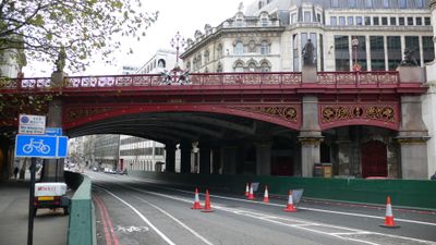
A40 road, Major trunk road in Greater London and Buckinghamshire, England

The A40 is a major road running from central London through multiple regions, connecting urban areas with towns and countryside toward Wales. It passes through bustling city streets like Oxford Street, divided highways, and quieter stretches as it extends beyond the capital.

The road was reshaped after World War II when planners redirected it from its earlier route through western suburbs and incorporated new sections to improve traffic flow. This expansion created a more direct path linking London's center to outlying areas.

Oxford Street, the main shopping area along this route, draws shoppers and locals daily who browse stores and stop at cafés between the chain retailers. The street serves as a social gathering place where people meet, rest, and experience central London's commercial character.

The elevated Westway section moves traffic above street level, helping drivers avoid traffic lights and ground-level crossings through densely built areas. During peak hours this section can become congested, so planning travel time around quieter periods helps avoid delays.

The Westway, completed in 1970, stands as an elevated highway running above an established neighborhood, channeling traffic over residential areas between Paddington and North Kensington. This unusual solution of building a major road above existing homes created a distinctive landmark in London's landscape.

The community of curious travelers

AroundUs brings together thousands of curated places, local tips, and hidden gems, enriched daily by 60,000 contributors worldwide.

Start exploring
Location
Location
Location
Location
Location
Location
Location
Location
Location
GPS coordinates
51.87824,-2.03084
Latest update
December 20, 2025 13:07
Reviews
Share your experience

No review yet

Discussions
Start a discussion...

No discussion yet

« A40 road - Major trunk road in Greater London and Buckinghamshire, England » is provided by Around Us (aroundus.com). Images and texts are derived from Wikimedia project under a Creative Commons license. You are allowed to copy, distribute, and modify copies of this page, under the conditions set by the license, as long as this note is clearly visible.

Discover hidden gems everywhere you go!

From secret cafés to breathtaking viewpoints, skip the crowded tourist spots and find places that match your style. Our app makes it easy with voice search, smart filtering, route optimization, and insider tips from travelers worldwide. Download now for the complete mobile experience.

Around Us App Screenshot

A unique approach to discovering new places

Le Figaro

All the places worth exploring

France Info

A tailor-made excursion in just a few clicks

20 Minutes

Around Us
Travel Guide & Maps
Download

Send to your phone

QR Code
1

Open the camera app on your mobile.

2

Point at the QR code with your camera. A notification will appear.

3

Tap the notification to open the link.