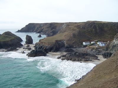
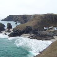
Kynance Cove, Coastal cove near Mullion and Landewednack, Cornwall, United Kingdom
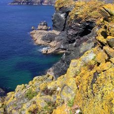
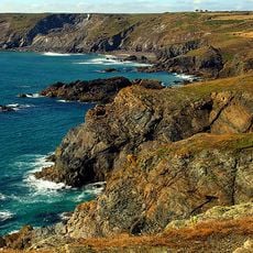
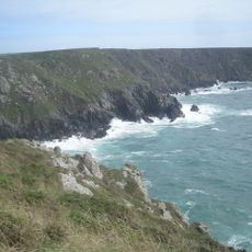
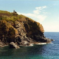
Kynance Cove is a sandy beach surrounded by tall dark serpentine rock cliffs along Cornwall's southern coast. The steep rocky formations create a narrow opening to the sea and frame the turquoise waters below.
The cove formed through coastal erosion over centuries and became known during the 1800s as a fishing site. Its remote location made it valuable for local maritime activities throughout that period.
Local residents maintain traditional maritime practices through seasonal fishing activities and preservation of the natural coastal environment.
The path down is steep and requires sure footing, particularly when wet or windy. A cafe near the car park serves drinks and light meals for visitors throughout the day.
At low tide, hidden caves and smaller beaches appear between the rocks that vanish completely when the water returns. This twice-daily transformation reveals entirely different sections of the coastline.
The community of curious travelers
AroundUs brings together thousands of curated places, local tips, and hidden gems, enriched daily by 60,000 contributors worldwide.
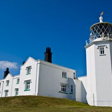
![Lizard Wireless Station Including Base Of Aerial Mast To North [Formerly Known As Marconi Bungalow]](https://img7.digsty.com/sSoN-IgmHOKdyYmOeejS-9tV3-48s3bomb_bIhjzrXM/rs:fill:230:230:1/g:fp:0.5:0.5/czM6Ly9hcm91bmR1cy8xNC8xNjU2ODMxNzgtZDYzY2M1MTYuanBn.jpg)