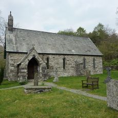
Brown Pike, Mountain summit in Lake District, England
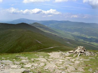
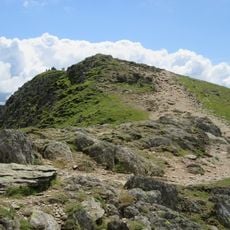
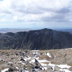
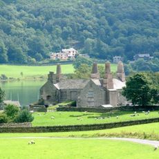
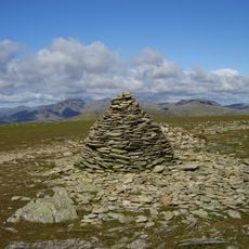
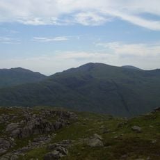
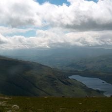
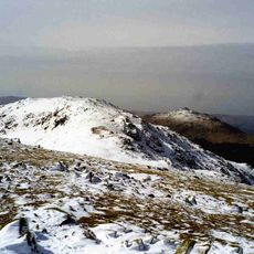
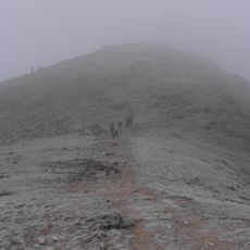
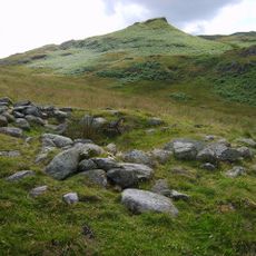
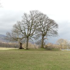
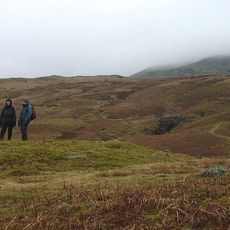
Brown Pike is a mountain summit in the Lake District, England, standing at 682 meters above sea level. A stone cairn marks the top, and from here you can see neighboring peaks like Buck Pike, Dow Crag, and Old Man of Coniston across the fell landscape.
The mountain is classified within the Birkett Hills system, which catalogs Lake District peaks according to specific elevation thresholds. This classification helped establish it as a recognized climbing destination within the region's fell-walking tradition.
Local mountaineers regularly conduct group expeditions to Brown Pike as part of the tradition of climbing all significant peaks in the Lake District region.
Walking paths connect this summit to nearby peaks, making it easy to plan a route that includes multiple tops in the same visit. Weather conditions at this elevation can change quickly, so check forecasts before heading out and dress in layers.
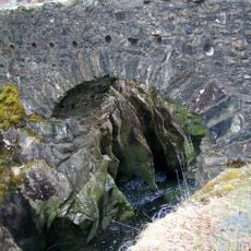
The summit displays exposed slate and granite rock formations shaped by thousands of years of weathering and frost action. These geological patterns reveal how the peak was carved by ice-age processes that are still reshaping the fell landscape today.
GPS coordinates: 54.35941,-3.13878
Latest update: December 14, 2025 20:32
Old Man of Coniston
1.7 km
Dow Crag
1.2 km
Ruskin Museum
4.2 km
Coniston Hall
4.4 km
Coniston copper mines
3.4 km
Brim Fell
2.2 km
Great Carrs
4.5 km
Seathwaite Tarn
2.4 km
Grey Friar
3.8 km
Birks Bridge
3.8 km
St Luke's Church, Torver
3.3 km
Holy Trinity Church, Seathwaite
3.2 km
Buck Pike
646 m
Low Water Beck
3.1 km
Church House Public House
3.3 km
Church of St Andrew
4.3 km
Memorial cross to John Ruskin approximately 23 metres east of St Andrew's Church
4.3 km
Coniston War Memorial
4.2 km
Privy approximately 13 metres to south of Coniston Hall, Coniston
4.4 km
Lodge and former stable approximately 70 metres to south of Brantwood, Coniston
5.2 km
Dike, circles and cairns on Bleaberry Haws
2.3 km
Two bloomeries, 340m and 570m NNE of Hoathwaite Landing on Coniston Water
4.3 km
Eye Catcher Approximately 202 Metres North East Of Sheperd Bridge
4.7 km
Dixon Ground Farmhouse and outbuilding
4 km
S.V. Gondola Stores
4.4 km
Cairns and enclosure on The Rigg, Banishead
1.9 km
Bowanstead
3.9 km
Barn to north west of Dixon Ground Farmhouse
4 kmVisited this place? Tap the stars to rate it and share your experience / photos with the community! Try now! You can cancel it anytime.
Discover hidden gems everywhere you go!
From secret cafés to breathtaking viewpoints, skip the crowded tourist spots and find places that match your style. Our app makes it easy with voice search, smart filtering, route optimization, and insider tips from travelers worldwide. Download now for the complete mobile experience.
A unique approach to discovering new places❞
— Le Figaro
All the places worth exploring❞
— France Info
A tailor-made excursion in just a few clicks❞
— 20 Minutes