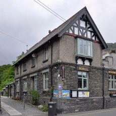
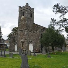
Old Man of Coniston, Fell in Furness Fells, England
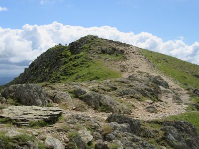
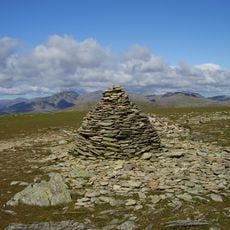
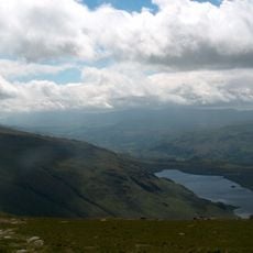
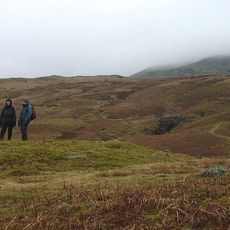
The Old Man of Coniston is a fell in England's Lake District and rises with steep faces on three of its sides. Its summit features both a natural ground point and a man-made plinth that mark the highest point in the Furness Fells.
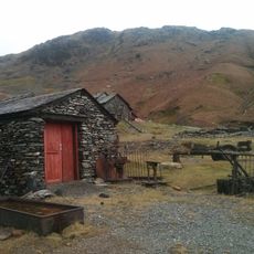
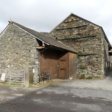
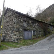
The mountain saw intensive copper mining throughout the 19th century, leaving behind shafts and structures on its northeastern slopes. These mining remnants continue to shape the appearance of the landscape today.
The mountain carries a name rooted in local tales about a giant and holds a special place in Lake District folklore. Its name appears in regional stories and connects visitors to the area's storytelling traditions.
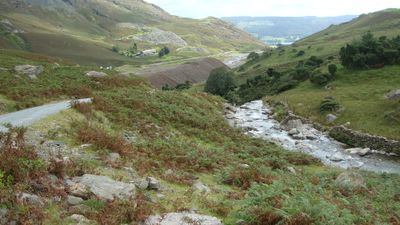
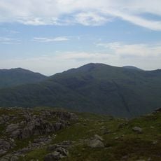
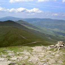
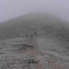
Multiple marked trails lead from Coniston village to the summit, with parking available at Walna Scar Road serving as convenient starting points. The routes vary in difficulty and offer options suitable for different experience levels.
The summit has two different height markers: a natural ground point and a man-made plinth standing slightly higher. This detail often surprises visitors who discover that the highest point in Furness Fells is actually a constructed feature rather than a purely natural peak.
Location: Cumbria
Elevation above the sea: 803 m
GPS coordinates: 54.37000,-3.11900
Latest update: December 20, 2025 01:14
Dow Crag
1.1 km
Ruskin Museum
2.8 km
Coniston Hall
3.4 km
Coniston copper mines
1.7 km
Brim Fell
879 m
Great Carrs
3.2 km
Seathwaite Tarn
2.5 km
Grey Friar
3 km
St Luke's Church, Torver
3.7 km
Brown Pike
1.7 km
Buck Pike
1.3 km
Low Water Beck
1.4 km
Church House Public House
3.6 km
Church of St Andrew
2.9 km
Memorial cross to John Ruskin approximately 23 metres east of St Andrew's Church
2.9 km
Low Yewdale Farmhouse and Cottage
4 km
Coniston War Memorial
2.8 km
Dike, circles and cairns on Bleaberry Haws
3.4 km
Two bloomeries, 340m and 570m NNE of Hoathwaite Landing on Coniston Water
3.6 km
Privy approximately 13 metres to south of Coniston Hall, Coniston
3.4 km
Eye Catcher Approximately 202 Metres North East Of Sheperd Bridge
3.2 km
Boon Crag Farmhouse
4.2 km
Cairns and enclosure on The Rigg, Banishead
1.5 km
Dixon Ground Farmhouse and outbuilding
2.6 km
S.V. Gondola Stores
2.9 km
High Bank Ground Farmhouse and barn
4.2 km
Bowanstead
2.8 km
Barn to north west of Dixon Ground Farmhouse
2.6 kmVisited this place? Tap the stars to rate it and share your experience / photos with the community! Try now! You can cancel it anytime.
Discover hidden gems everywhere you go!
From secret cafés to breathtaking viewpoints, skip the crowded tourist spots and find places that match your style. Our app makes it easy with voice search, smart filtering, route optimization, and insider tips from travelers worldwide. Download now for the complete mobile experience.
A unique approach to discovering new places❞
— Le Figaro
All the places worth exploring❞
— France Info
A tailor-made excursion in just a few clicks❞
— 20 Minutes