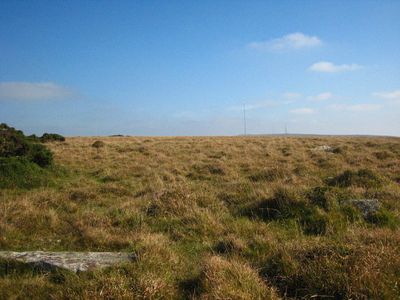
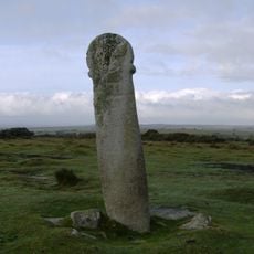
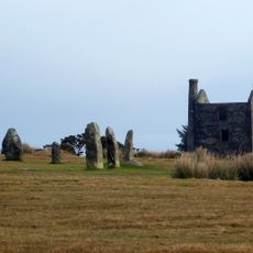
Craddock Moor stone circle, Bronze Age stone circle in Cornwall, England.
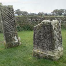
Craddock Moor stone circle is a Bronze Age stone circle on open moorland in Cornwall measuring about 13 meters across. Sixteen stones are scattered on the ground with one remaining upright, creating a visible ring on the elevated terrain.
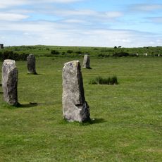
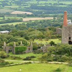
This stone circle was built around 2000 BC during the Bronze Age as part of a larger network of monuments across Bodmin Moor. It demonstrates how ancient peoples deliberately shaped the landscape for ritual and astronomical purposes.
The stones are positioned to align with Brown Willy summit and create a sightline toward the midsummer sunset across the moorland. Walking around the circle, visitors can observe how the arrangement frames the distant landscape.
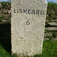
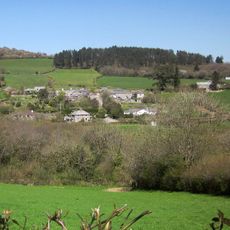
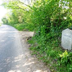
Access is via a footpath from The Hurlers car park, located about half a mile southeast of the stone circle, crossing open moorland. The ground is generally flat and easy to walk on, though visitors should be prepared for changing weather conditions on the exposed terrain.
The stone circle forms part of a linear arrangement spanning the moorland, connecting it with nearby structures including an embanked enclosure and a stone row. This connected layout suggests that Bronze Age peoples designed this area as a unified ritual landscape.
GPS coordinates: 50.51990,-4.47170
Latest update: December 13, 2025 12:24
Hurlers Stone Circles
1 km
Trethevy Quoit
3.2 km
Rillaton Barrow
1.1 km
Phoenix United Mine
1.9 km
King Doniert's Stone
3.2 km
Church of St Clarus
3.7 km
Church of St Torney
5.3 km
Golitha Falls
4.1 km
St Cleer Holy Well
3.5 km
The Longstone medieval wayside cross 750m SW of Minions
1.4 km
Berriowbridge Bridge
4.6 km
Prince Of Wales Engine House At Phoenix United Mine
1.8 km
Guidestone, Treworgey Manor drive to house
5.3 km
The Crow's Nest
2.9 km
Milestone 20 Metres To West Of Botternell Farm
4 km
Milestone At Sx 279 724
3.1 km
The Hurlers: three stone circles with paired outlying stones
1 km
Milestone At Sx 2659 6707
5 km
Milestone 650 Metres To North West Of North Hill Village
5.5 km
The Doniert Stone, accompanying cross shaft and underground chamber 650m SW of Common Moor
3.2 km
Treworgey Retaining Walls To Main Drive
5.4 km
Milestone At Sx 280 709
3.3 km
Milestone At Sx 278 735
3.5 km
Darley Farmhouse
3.1 km
Milestone At Higher Roscraddoc (Ngr Sx2753367900)
4.7 km
Brick Kiln And Chimney South West Of Carkeet Farmhouse
3.3 km
Treweatha Farmhouse
5.5 km
Milestone 160 Metres To North Of East Berriow
4.8 kmVisited this place? Tap the stars to rate it and share your experience / photos with the community! Try now! You can cancel it anytime.
Discover hidden gems everywhere you go!
From secret cafés to breathtaking viewpoints, skip the crowded tourist spots and find places that match your style. Our app makes it easy with voice search, smart filtering, route optimization, and insider tips from travelers worldwide. Download now for the complete mobile experience.
A unique approach to discovering new places❞
— Le Figaro
All the places worth exploring❞
— France Info
A tailor-made excursion in just a few clicks❞
— 20 Minutes