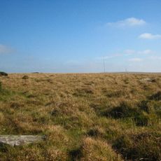
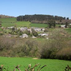
Rillaton Barrow, Bronze Age burial mound in Linkinhorne, England.
Rillaton Barrow is a Bronze Age burial mound located near Linkinhorne that consists of an earthen mound constructed over a central stone burial chamber. The structure rises noticeably from the surrounding landscape and retains its original form to the present day.
The mound was built between 2900 and 800 BC, during a period when communities across Britain constructed such burial structures for their dead. This practice remained widespread over many centuries, reflecting stable burial traditions across extended periods.
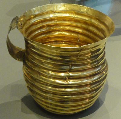
The mound served as a burial place for community members of high standing, as evidenced by the valuable objects left with the dead. These grave goods reveal something about the crafts and trade networks that connected Bronze Age settlements across the region.
The site is a protected monument under English law and therefore strictly safeguarded. Anyone wishing to conduct research or excavation work must obtain permission from English Heritage beforehand.
The mound ranks among the most intact Bronze Age burial structures in Cornwall, having preserved its original form over thousands of years. This exceptional survival makes it a rare example of how these mounds originally appeared.
Location: Linkinhorne
GPS coordinates: 50.52110,-4.45566
Latest update: December 12, 2025 16:40
Hurlers Stone Circles
562 m
Trethevy Quoit
3.1 km
Phoenix United Mine
823 m
Craddock Moor stone circle
1.1 km
King Doniert's Stone
3.9 km
Church of St Clarus
4 km
Church of St Torney
4.9 km
Golitha Falls
4.9 km
The Longstone medieval wayside cross 750m SW of Minions
1.4 km
Berriowbridge Bridge
4 km
St Cleer Holy Well
3.8 km
Prince Of Wales Engine House At Phoenix United Mine
607 m
Guidepost
4.6 km
Guidepost 10 Metres To East Of Moorlands
5.4 km
Guidestone At Sx 302 740
4.8 km
The Doniert Stone, accompanying cross shaft and underground chamber 650m SW of Common Moor
3.9 km
Milestone At Sx 279 724
2 km
The Crow's Nest
2.6 km
Milestone At Sx 2659 6707
4.9 km
Milestone 650 Metres To North West Of North Hill Village
5.2 km
Milestone 20 Metres To West Of Botternell Farm
3.2 km
Milestone At Sx 280 709
2.2 km
Milestone At Sx 278 735
2.5 km
Darley Farmhouse
2.1 km
Milestone At Higher Roscraddoc (Ngr Sx2753367900)
4.3 km
Brick Kiln And Chimney South West Of Carkeet Farmhouse
4.3 km
The Hurlers: three stone circles with paired outlying stones
562 m
Milestone 160 Metres To North Of East Berriow
4.3 kmVisited this place? Tap the stars to rate it and share your experience / photos with the community! Try now! You can cancel it anytime.
Discover hidden gems everywhere you go!
From secret cafés to breathtaking viewpoints, skip the crowded tourist spots and find places that match your style. Our app makes it easy with voice search, smart filtering, route optimization, and insider tips from travelers worldwide. Download now for the complete mobile experience.
A unique approach to discovering new places❞
— Le Figaro
All the places worth exploring❞
— France Info
A tailor-made excursion in just a few clicks❞
— 20 Minutes