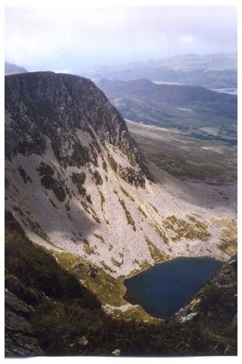
Cyfrwy, Mountain summit in Gwynedd, Wales
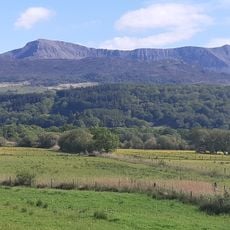
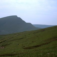
Cyfrwy is a mountain summit in Gwynedd with steep rocky faces on its northern and eastern sides, forming part of the Cadair Idris range within Snowdonia National Park. The peak stands at 811 meters and is characterized by sharp ridges and exposed rock formations that shape its distinctive silhouette.
This peak has long served as a landmark in Snowdonia's mountains and was used by Welsh shepherds across generations as a navigation point on the high moorlands. The mountain has been a familiar reference point in this region for centuries.
The Welsh name Cyfrwy relates to the mountain's physical shape, showing how geographic names in this region were traditionally chosen to describe what people saw. Locals still use these names as part of their everyday understanding of the landscape.
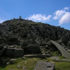
Access to the summit is usually via the Pony Path, which connects to the wider Cadair Idris trail network and demands sturdy footwear and waterproof clothing. The terrain is steep and open to the elements, so visitors should expect that descent requires as much care as the ascent.
The Cyfrwy Arete is a technical rock passage with sharp edges that runs between this summit and neighboring peaks, creating an intense section for experienced scrambler. This feature offers a more challenging alternative to those who want to explore beyond the main trail.
The community of curious travelers
AroundUs brings together thousands of curated places, local tips, and hidden gems, enriched daily by 60,000 contributors worldwide.