Chest opened
+${chestReward.xp} XP
Explorer
NOUVEAU ×${chestReward.collectible.quantity}
tapez pour fermer
Chest locked

Open chests in the app

Around Us is built for your phone — chests unlock when you walk, explore and capture nearby places.

Enable Location

We need your location to show you interesting places around you

Discover nearby places

Find interesting locations and hidden gems around you

Precise directions

Get accurate directions and distances to places

Your location is never shared with other users. It's only used when you tap the location button.

East Londonderry

Log in to your account

Start exploring — it's free

Trusted by 72,876 travelers worldwide

Continue with Google
Continue with Apple
or

We will send you a code to connect

By continuing, you accept our Terms and Conditions and our Privacy Policy

Check your inbox

We've sent a pincode in your inbox. Please enter the code below.

Discussion Reviews 1 Photos
13.8k Popularity

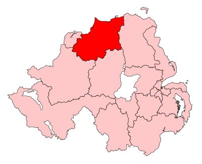
East Londonderry, Parliamentary constituency in County Londonderry, Northern Ireland.

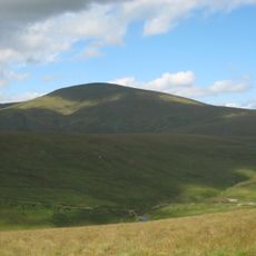
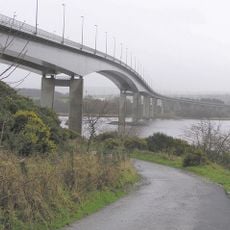
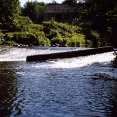
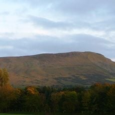
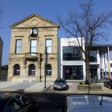
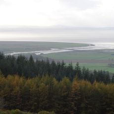
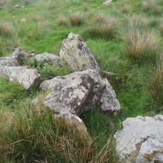
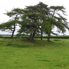
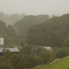
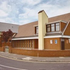
East Londonderry is an electoral constituency in County Londonderry in Northern Ireland that reaches from the Sperrin Mountains to the Atlantic coast. The district includes several towns and combines rural mountain areas with coastal communities.

The constituency was created in 1983 through a boundary reorganization that merged parts of neighboring constituencies in Londonderry, Mid Ulster, and North Antrim. This redistricting established the present political and geographic structure.

The area displays demographic diversity with 42.5 percent Catholic and 48.7 percent Protestant residents according to the 2021 Census data.

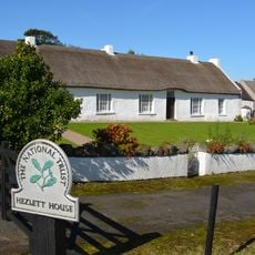
The area is represented by five elected members in the Northern Ireland Assembly who handle regional matters and public services. Visitors can explore the various towns and landscapes that make up this constituency.

In the 2024 Westminster election, Gregory Campbell secured victory with only 179 votes difference, marking the narrowest majority in Northern Ireland.

The community of curious travelers

AroundUs brings together thousands of curated places, local tips, and hidden gems, enriched daily by 60,000 contributors worldwide.

Start exploring
GPS coordinates
54.97400,-6.93700
Latest update
December 7, 2025 20:24
Around this place
Mussenden Temple
United Kingdom

Mussenden Temple

23 km
Foyle Bridge
United Kingdom

Foyle Bridge

23.2 km
Downhill House
United Kingdom

Downhill House

22.7 km
Binevenagh
United Kingdom

Binevenagh

15.7 km
Sawel Mountain
United Kingdom

Sawel Mountain

18.4 km
HMS Ferret
United Kingdom

HMS Ferret

24.1 km
Dungiven Castle
United Kingdom

Dungiven Castle

5.6 km
Altinaghree Castle
United Kingdom

Altinaghree Castle

22.4 km
Boom Hall
United Kingdom

Boom Hall

23.6 km
Roe Valley Country Park
United Kingdom

Roe Valley Country Park

5.7 km
Aughlish
United Kingdom

Aughlish

10.9 km
Benbradagh
United Kingdom

Benbradagh

5.2 km
Liffock House
United Kingdom

Liffock House

22.3 km
Roe Valley Arts & Cultural Centre
United Kingdom

Roe Valley Arts & Cultural Centre

8.7 km
Roe Estuary Nature Reserve
United Kingdom

Roe Estuary Nature Reserve

15.1 km
Macosquin Abbey
United Kingdom

Macosquin Abbey

19.8 km
Tirnony Dolmen
United Kingdom

Tirnony Dolmen

20.4 km
Court Tomb von Ervey
United Kingdom

Court Tomb von Ervey

16.6 km
Passage Tomb von Moneydig
United Kingdom

Passage Tomb von Moneydig

20.9 km
Straidarran House Clagan Road Claudy Co Londonderry Bt47 4db
United Kingdom

Straidarran House Clagan Road Claudy Co Londonderry Bt47 4db

13.4 km
Limavady Baptist Church
United Kingdom

Limavady Baptist Church

8.3 km
St. John's R C Church Kyle's Brae Coleraine Co.londonderry
United Kingdom

St. John's R C Church Kyle's Brae Coleraine Co.londonderry

23.8 km
Roe Valley Hospital (former Workhouse) Benevenagh Avenue Limavady Co Londonderry Bt49 Oaq
United Kingdom

Roe Valley Hospital (former Workhouse) Benevenagh Avenue Limavady Co Londonderry Bt49 Oaq

8.2 km
St. Columba's Church Draperstown Magherafelt Co.londonderry
United Kingdom

St. Columba's Church Draperstown Magherafelt Co.londonderry

22.2 km
Ballykelly Presbyterian Church Main Street Ballykelly Limavady Co Londonderry Bt49 9hs
United Kingdom

Ballykelly Presbyterian Church Main Street Ballykelly Limavady Co Londonderry Bt49 9hs

9.2 km
Mausoleum Downhill Demesne Castlerock Co. Londonderry
United Kingdom

Mausoleum Downhill Demesne Castlerock Co. Londonderry

22.4 km
Banagher Old Church
United Kingdom

Banagher Old Church

8 km
Walled Garden & Dovecote / Ice-house Downhill Demesne Seacoast Road Castlerock Co. Londonderry Bt51 4rp
United Kingdom

Walled Garden & Dovecote / Ice-house Downhill Demesne Seacoast Road Castlerock Co. Londonderry Bt51 4rp

22.5 km
Show the full map
Reviews
Share your experience

No review yet

Discussions
Start a discussion...

No discussion yet

« East Londonderry - Parliamentary constituency in County Londonderry, Northern Ireland » is provided by Around Us (aroundus.com). Images and texts are derived from Wikimedia project under a Creative Commons license. You are allowed to copy, distribute, and modify copies of this page, under the conditions set by the license, as long as this note is clearly visible.

Discover hidden gems everywhere you go!

From secret cafés to breathtaking viewpoints, skip the crowded tourist spots and find places that match your style. Our app makes it easy with voice search, smart filtering, route optimization, and insider tips from travelers worldwide. Download now for the complete mobile experience.

Around Us App Screenshot

A unique approach to discovering new places

Le Figaro

All the places worth exploring

France Info

A tailor-made excursion in just a few clicks

20 Minutes

Around Us
Travel Guide & Maps
Download

Send to your phone

QR Code
1

Open the camera app on your mobile.

2

Point at the QR code with your camera. A notification will appear.

3

Tap the notification to open the link.