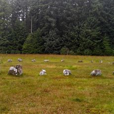
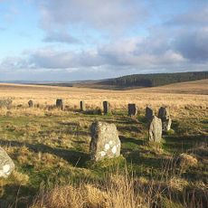
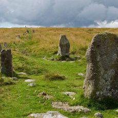
Grey Wethers, Bronze Age stone circles in Dartmoor, England
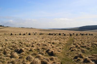
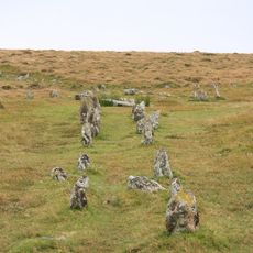
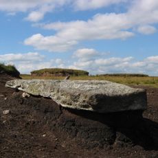
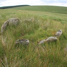
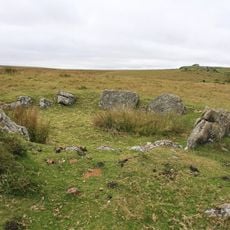
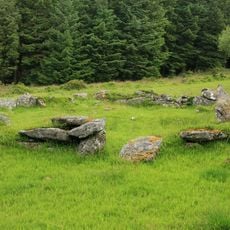
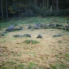
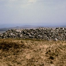
Grey Wethers consists of two stone circles positioned on Dartmoor's high ground, each roughly 30 meters across. One circle contains around 20 granite stones while the other holds around 30, forming distinctive rings of weathered boulders that still stand intact today.
These circles were built during the Bronze Age, with excavations revealing charcoal deposits at ground level inside both rings. The charcoal suggests people gathered here for fire-related rituals or ceremonies that held significance in their society.
The name comes from how local shepherds saw the stones as sheep appearing in the mist, with 'wether' being an old English word for a castrated ram. This naming reflects the intimate connection between the people who lived on the moor and the landscape around them.
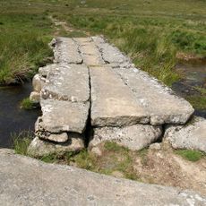
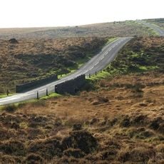
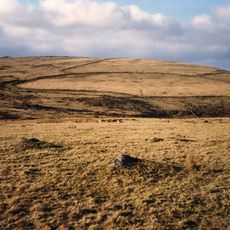
The site sits on open moorland and can be reached by marked trails from the Fernworthy Forest car park across rolling terrain. The area is exposed to the elements, so visitors should prepare for changing weather and bring provisions since shelter and facilities are not available nearby.
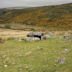
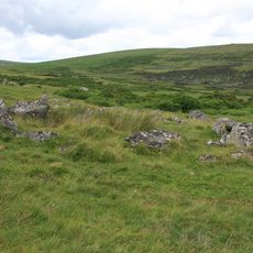
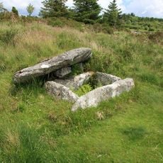
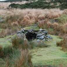
This site stands at a higher elevation than any other prehistoric monument on Dartmoor and forms part of a larger complex with several burial mounds nearby. The combination of two large circles alongside additional smaller structures made this a special gathering place for ancient communities.
Location: Devon
Part of: Two stone circles known as The Grey Wethers, three round cairns, two ring cairns and an oval enclosure in Great Stannon Newtake
Website: https://megalithic.co.uk/article.php?x=263950&y=83150
GPS coordinates: 50.63196,-3.92620
Latest update: December 10, 2025 20:01
Cranmere Pool
4.4 km
Postbridge Clapper Bridge
4.3 km
Shovel Down
3.2 km
Cut Hill Stone Row
4 km
Fernworthy Circle
1.9 km
Roundy Park prehistoric enclosure and cairn with cist, 560m north east of Archerton
3.5 km
Teignhead Clapper Bridge
1.3 km
Church of St Gabriel
4.2 km
Fernworthy Reservoir
2.9 km
Bennett's Cross
4.4 km
Two stone circles known as The Grey Wethers, three round cairns, two ring cairns and an oval enclosure in Great Stannon Newtake
167 m
Statts Bridge
3.9 km
Stone alignment, cairns, enclosed prehistoric settlement and a length of reave on Hurston Ridge
3.5 km
Post Bridge
4.3 km
Milestone At Sx 678 813
4.3 km
Broadun prehistoric enclosed settlement, 780m NNW of Archerton
3.2 km
Kerbed cairn and cist 635m south west of The Grey Wethers
635 m
Two stone hut circles and part of a coaxial field system at Frenchbeer Rock
4 km
Round cairn 780m south of the Thirlstone
3.1 km
Coaxial fields and prehistoric settlements 180m north and 350m north west of Hartland Tor
3 km
Stone alignment, hut circle settlement, medieval long house and post-medieval farmstead at Assycombe
2.1 km
Partially enclosed stone hut circle settlement 780m south west of Metherall
2.7 km
Cairn and cist on the northern side of Fernworthy Reservoir, 660m north west of Metherall
3.1 km
The North Teign coaxial field system (western part) and associated later remains at Shovel Down, Stonetor Hill and Long Ridge
3.1 km
Round cairn on Watern Tor
3.8 km
Tinners' building in Great Stannon Newtake, 810m north west of Stannon Tor
1.7 km
Milestone, Statts Bridge, 300m SW of bridge
3.8 km
Milestone, St Gabriel's Church, 80m NE of church, opp. Beechwood
4.1 kmVisited this place? Tap the stars to rate it and share your experience / photos with the community! Try now! You can cancel it anytime.
Discover hidden gems everywhere you go!
From secret cafés to breathtaking viewpoints, skip the crowded tourist spots and find places that match your style. Our app makes it easy with voice search, smart filtering, route optimization, and insider tips from travelers worldwide. Download now for the complete mobile experience.
A unique approach to discovering new places❞
— Le Figaro
All the places worth exploring❞
— France Info
A tailor-made excursion in just a few clicks❞
— 20 Minutes