Enable Location

We need your location to show you interesting places around you

Discover nearby places

Find interesting locations and hidden gems around you

Precise directions

Get accurate directions and distances to places

Your location is never shared with other users. It's only used when you tap the location button.

Hurst Hill

Log in to your account

Start exploring — it's free

Trusted by 61,450 travelers worldwide

Continue with Google
Continue with Apple
or

We will send you a code to connect

By continuing, you accept our Terms and Conditions and our Privacy Policy

Check your inbox

We've sent a pincode in your inbox. Please enter the code below.

Hurst Hill

Hurst Hill, Summit in West Pennine Moors, Lancashire, England

Description

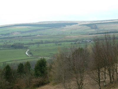
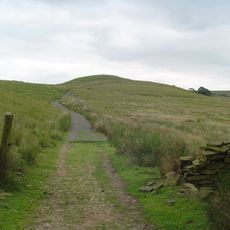
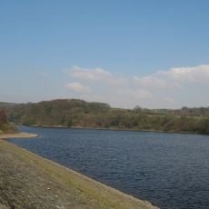
Hurst Hill is a summit in the West Pennine Moors that rises to about 317 meters above sea level. The landscape here opens up into moorland with paths connecting to nearby peaks across the ridge system.

History

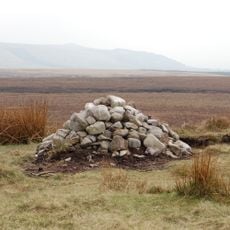
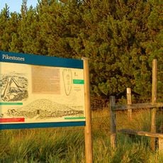
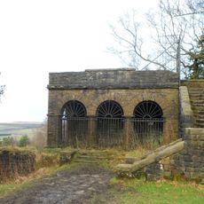
The summit sits between notable landmarks that suggest early human activity in the moorland region. The surrounding areas have been part of the local landscape for countless generations.

Culture

The untouched nature of Hurst Hill represents the preservation of ancient British landscapes, as no archaeological excavations have been conducted on this site.

Practical

The terrain is best explored on foot using established paths that cross the moorland. With proper footwear and attention to weather conditions, reaching the summit is straightforward.

Did you know?

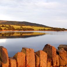
On clear days, you can see toward the distant coast from this vantage point, which serves as a visual landmark within the broader moorland. This far-reaching perspective helps visitors understand their location within the wider landscape.

GPS coordinates
53.65601,-2.56362
Latest update
December 14, 2025 14:21

AroundUs brings together thousands of curated places, local tips, and hidden gems, enriched daily by 60,000 contributors worldwide. Discover all places nearby (United Kingdom).

Around this place
Anglezarke Reservoir
United Kingdom

Anglezarke Reservoir

2.1 km
Rivington Hall
United Kingdom

Rivington Hall

3.5 km
Rivington Hall Barn
United Kingdom

Rivington Hall Barn

3.4 km
Great Hill
United Kingdom

Great Hill

2.1 km
Round Loaf
United Kingdom

Round Loaf

1 km
Rivington Unitarian Chapel
United Kingdom

Rivington Unitarian Chapel

3.4 km
Rivington Church
United Kingdom

Rivington Church

3.5 km
Yarrow Reservoir
United Kingdom

Yarrow Reservoir

2.2 km
Upper Rivington Reservoir
United Kingdom

Upper Rivington Reservoir

3.1 km
Pikestones
United Kingdom

Pikestones

695 m
High Bullough Reservoir
United Kingdom

High Bullough Reservoir

1.4 km
Church of St Barnabas
United Kingdom

Church of St Barnabas

3.7 km
Canal Bridge Number 76
United Kingdom

Canal Bridge Number 76

3.3 km
Loggia, Summerhouse And Associated Staircases In Rivington Gardens At Sd 6392 1431
United Kingdom

Loggia, Summerhouse And Associated Staircases In Rivington Gardens At Sd 6392 1431

3.7 km
Canal Bridge Number 77 (Bagganley Bridge)
United Kingdom

Canal Bridge Number 77 (Bagganley Bridge)

3.4 km
Wellington Bomber Z8799 Crash site Memorial, Rivington
United Kingdom

Wellington Bomber Z8799 Crash site Memorial, Rivington

1.4 km
Pigeon Tower, Staircases, Stone Arches, Stone Screen And Two Gate Piers In Rivington Gardens At Sd 6397 1433
United Kingdom

Pigeon Tower, Staircases, Stone Arches, Stone Screen And Two Gate Piers In Rivington Gardens At Sd 6397 1433

3.7 km
Wilcocks Farmhouse
United Kingdom

Wilcocks Farmhouse

2.3 km
Manor House
United Kingdom

Manor House

1 km
Bellhouse Circa 10 Metres West Of Church Of Holy Trinity
United Kingdom

Bellhouse Circa 10 Metres West Of Church Of Holy Trinity

3.4 km
Canal Bridge Number 75 At Sd 595 163
United Kingdom

Canal Bridge Number 75 At Sd 595 163

3.6 km
Fisher House
United Kingdom

Fisher House

3.4 km
Leeds Liverpool Canal, Railway Bridge Over Leeds Liverpool Canal At Sd 595 162
United Kingdom

Leeds Liverpool Canal, Railway Bridge Over Leeds Liverpool Canal At Sd 595 162

3.7 km
Warth Farmhouse
United Kingdom

Warth Farmhouse

1.9 km
Mounting Block In School Yard Circa 15 Metres West Of Rivington School
United Kingdom

Mounting Block In School Yard Circa 15 Metres West Of Rivington School

3.5 km
Moses Cocker's Farmhouse
United Kingdom

Moses Cocker's Farmhouse

2.8 km
Milestone, Piccadilly Cottages
United Kingdom

Milestone, Piccadilly Cottages

3.7 km
Milestone, Old Man's Hill
United Kingdom

Milestone, Old Man's Hill

3.8 km
Show the full map
« Hurst Hill - Summit in West Pennine Moors, Lancashire, England » is provided by Around Us (aroundus.com). Images and texts are derived from Wikimedia project under a Creative Commons license. You are allowed to copy, distribute, and modify copies of this page, under the conditions set by the license, as long as this note is clearly visible.

Discover hidden gems everywhere you go!

From secret cafés to breathtaking viewpoints, skip the crowded tourist spots and find places that match your style. Our app makes it easy with voice search, smart filtering, route optimization, and insider tips from travelers worldwide. Download now for the complete mobile experience.

Around Us App Screenshot

A unique approach to discovering new places

Le Figaro

All the places worth exploring

France Info

A tailor-made excursion in just a few clicks

20 Minutes

Around Us
Travel Guide & Maps
Download

Send to your phone

QR Code
1

Open the camera app on your mobile.

2

Point at the QR code with your camera. A notification will appear.

3

Tap the notification to open the link.