Enable Location

We need your location to show you interesting places around you

Discover nearby places

Find interesting locations and hidden gems around you

Precise directions

Get accurate directions and distances to places

Your location is never shared with other users. It's only used when you tap the location button.

Milecastle 50

Log in to your account

Start exploring — it's free

Trusted by 62,883 travelers worldwide

Continue with Google
Continue with Apple
or

We will send you a code to connect

By continuing, you accept our Terms and Conditions and our Privacy Policy

Check your inbox

We've sent a pincode in your inbox. Please enter the code below.

Milecastle 50
Discussion Reviews 1 Photos
1.3k Popularity

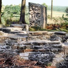
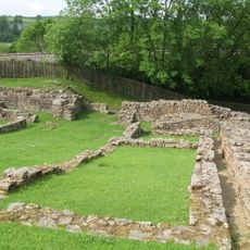
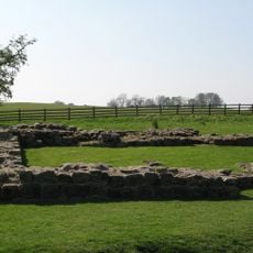
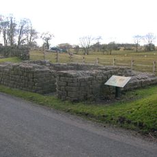
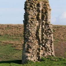
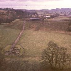
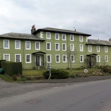
Milecastle 50, Roman defensive structure near Birdoswald, England.

Milecastle 50 is a Roman defensive structure located along Hadrian's Wall near Birdoswald, with a rectangular design that measured approximately 72 feet by 55 feet (22.12 meters by 16.76 meters). The interior held two separate rooms, each equipped with its own hearth for heating and daily operations.

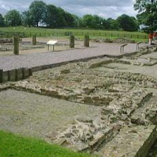
This milecastle was constructed during Emperor Hadrian's reign in the 2nd century as part of the frontier wall system. It functioned as a military checkpoint that monitored movement across the Roman border for several generations.

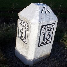
The garrison of 20 to 30 auxiliary soldiers monitored the movement of people, goods, and livestock between Roman Britain and the northern territories.

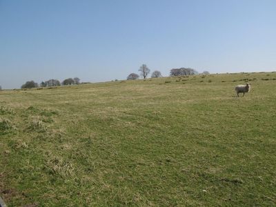
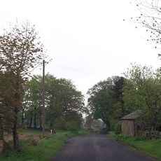
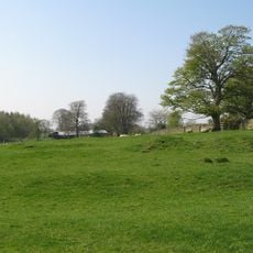
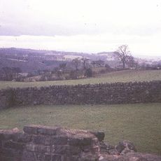
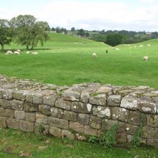
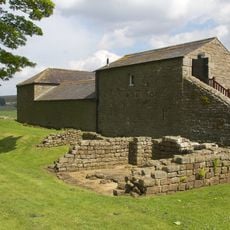
No visible remains of this structure survive at the site today, but you can explore the location by following nearby walking paths along Hadrian's Wall. The site is easy to reach and fits naturally into a longer hike through the border region.

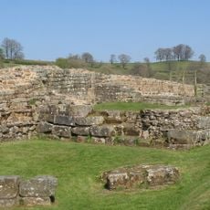
Rather than being replaced with stone like many similar structures, this site retained its original turf construction, making it a rare survivor of early Roman building methods. A new stone wall was later built approximately 200 meters to the north, leaving the older structure undisturbed.

The community of curious travelers

AroundUs brings together thousands of curated places, local tips, and hidden gems, enriched daily by 60,000 contributors worldwide.

Start exploring
Part of
Hadrian's Wall
GPS coordinates
54.98716,-2.61608
Latest update
December 14, 2025 18:15
Around this place
Borders of the Roman Empire
United Kingdom

Borders of the Roman Empire

1.1 km
Banna
United Kingdom

Banna

869 m
Hadrian's Wall
United Kingdom

Hadrian's Wall

968 m
Birdoswald
United Kingdom

Birdoswald

869 m
Milecastle 48
United Kingdom

Milecastle 48

2.7 km
Milecastle 49
United Kingdom

Milecastle 49

1.4 km
Leahill Turret
United Kingdom

Leahill Turret

2.5 km
Milecastle 52
United Kingdom

Milecastle 52

2.9 km
Milecastle 51
United Kingdom

Milecastle 51

1.5 km
Triermain Castle
United Kingdom

Triermain Castle

1.4 km
St. Mary Magdalene's Church, Gilsland
United Kingdom

St. Mary Magdalene's Church, Gilsland

3 km
Willowford Bridge
United Kingdom

Willowford Bridge

1.6 km
Church of St Cuthbert
United Kingdom

Church of St Cuthbert

1.8 km
St Cuthbert's church, Upper Denton
United Kingdom

St Cuthbert's church, Upper Denton

1 km
Poltross Burn Viaduct
United Kingdom

Poltross Burn Viaduct

2.8 km
The Hill
United Kingdom

The Hill

1.9 km
Hadrian's Wall and vallum and their associated features between Poltross Burn and the River Irthing in wall mile 48
United Kingdom

Hadrian's Wall and vallum and their associated features between Poltross Burn and the River Irthing in wall mile 48

2.2 km
Dinmont House
United Kingdom

Dinmont House

2.7 km
Hadrian's Wall and vallum between the field boundary west of Coombe Crag and Banks Green Cottage and the road to Lanercost at Banks in wall miles 51 and 52
United Kingdom

Hadrian's Wall and vallum between the field boundary west of Coombe Crag and Banks Green Cottage and the road to Lanercost at Banks in wall miles 51 and 52

2.8 km
Bastle at Upper Denton
United Kingdom

Bastle at Upper Denton

1 km
Hadrians Wall Milecastle And Turrets Hadrians Wall, Milecastle And Turrets
United Kingdom

Hadrians Wall Milecastle And Turrets Hadrians Wall, Milecastle And Turrets

3.2 km
Orchard House
United Kingdom

Orchard House

2.7 km
1-4, Hall Terrace
United Kingdom

1-4, Hall Terrace

2.7 km
Milestone West Of At Temon Bridge At Ngr Ny 6080 63660
United Kingdom

Milestone West Of At Temon Bridge At Ngr Ny 6080 63660

2.4 km
Farmbuildings Situated 30 Metres North North West Of Birdoswald Farmhouse Or Tenement
United Kingdom

Farmbuildings Situated 30 Metres North North West Of Birdoswald Farmhouse Or Tenement

856 m
Milestone East Of Low Row At Ngr Ny 59580 63080
United Kingdom

Milestone East Of Low Row At Ngr Ny 59580 63080

3.1 km
Spa Villa
United Kingdom

Spa Villa

3.2 km
Willowford And Adjoining Farm Buildings
United Kingdom

Willowford And Adjoining Farm Buildings

1.9 km
Show the full map
« Milecastle 50 - Roman defensive structure near Birdoswald, England » is provided by Around Us (aroundus.com). Images and texts are derived from Wikimedia project under a Creative Commons license. You are allowed to copy, distribute, and modify copies of this page, under the conditions set by the license, as long as this note is clearly visible.

Discover hidden gems everywhere you go!

From secret cafés to breathtaking viewpoints, skip the crowded tourist spots and find places that match your style. Our app makes it easy with voice search, smart filtering, route optimization, and insider tips from travelers worldwide. Download now for the complete mobile experience.

Around Us App Screenshot

A unique approach to discovering new places

Le Figaro

All the places worth exploring

France Info

A tailor-made excursion in just a few clicks

20 Minutes

Around Us
Travel Guide & Maps
Download

Send to your phone

QR Code
1

Open the camera app on your mobile.

2

Point at the QR code with your camera. A notification will appear.

3

Tap the notification to open the link.