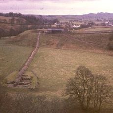
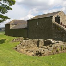
Milecastle 51, Roman fortification site on Hadrian's Wall, England
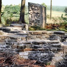
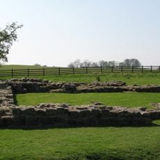
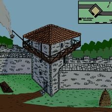
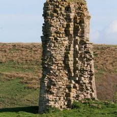
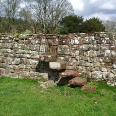
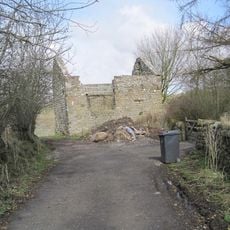
Milecastle 51 is a small Roman military fortification on Hadrian's Wall and features stonework standing approximately 1.75 meters high within a rectangular layout. The remains today provide clear evidence of the fortification technique that was distributed along the northern frontier line.
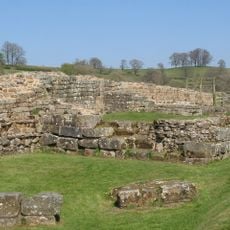
The site was built around 122 CE as part of Emperor Hadrian's defensive system stretching across northern Britain. It was one of many similar structures the empire constructed along its borders during this period.
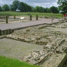
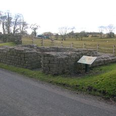
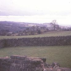
The structure shows Roman military engineering with a gateway design that controlled movement along the empire's northern frontier. Visitors can still see how this practical solution monitored trade and troop movements.
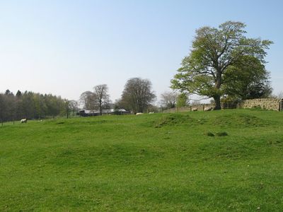
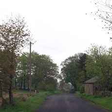
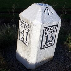
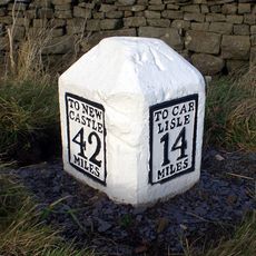
The site is accessible via the Hadrian's Wall Path, with several walking routes connecting to nearby archaeological remains. Visitors should wear sturdy footwear and be prepared for changing weather typical of the region.
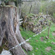
Several sections of the original stonework remain visible and show directly how Roman builders constructed frontier fortifications. These visible traces help visitors understand the construction techniques used nearly 2000 years ago.
Part of: Hadrian's Wall
GPS coordinates: 54.98238,-2.63741
Latest update: December 14, 2025 18:00
Borders of the Roman Empire
2.6 km
Banna
2.3 km
Hadrian's Wall
2.4 km
Birdoswald
2.3 km
Milecastle 49
2.9 km
Leahill Turret
997 m
Pike Hill Signal Tower
1.8 km
Milecastle 52
1.5 km
Milecastle 50
1.5 km
Triermain Castle
1.3 km
Willowford Bridge
3.1 km
St Mary Magdalene
4.1 km
Church of St Cuthbert
907 m
St Cuthbert's church, Upper Denton
2.3 km
Walls to the North of Lanercost Priory
4.1 km
Hadrian's Wall and vallum between Banks Green Cottage and the road to Lanercost at Banks and the road to Garthside in wall miles 52, 53 and 54
4.1 km
The Hill
3.4 km
Hadrian's Wall and vallum and their associated features between Poltross Burn and the River Irthing in wall mile 48
3.6 km
Bastle at Upper Denton
2.3 km
Hadrian's Wall and vallum between the field boundary west of Coombe Crag and Banks Green Cottage and the road to Lanercost at Banks in wall miles 51 and 52
1.4 km
1-4, Hall Terrace
4.1 km
Northrigghill
1.9 km
Milestone At Ngr Ny58130 62460
3.3 km
Milestone West Of At Temon Bridge At Ngr Ny 6080 63660
2.5 km
Farmbuildings Situated 30 Metres North North West Of Birdoswald Farmhouse Or Tenement
2.3 km
Willowford And Adjoining Farm Buildings
3.3 km
Milestone East Of Low Row At Ngr Ny 59580 63080
2.4 km
Cross Base North West of Lanercost Priory
4.1 kmVisited this place? Tap the stars to rate it and share your experience / photos with the community! Try now! You can cancel it anytime.
Discover hidden gems everywhere you go!
From secret cafés to breathtaking viewpoints, skip the crowded tourist spots and find places that match your style. Our app makes it easy with voice search, smart filtering, route optimization, and insider tips from travelers worldwide. Download now for the complete mobile experience.
A unique approach to discovering new places❞
— Le Figaro
All the places worth exploring❞
— France Info
A tailor-made excursion in just a few clicks❞
— 20 Minutes