Banna

Log in to your account

AroundUs is a community-driven map of interesting places, built by curious explorers like you. It grows with every review, story, and photo you share.
Connect to save your favorite spots, contribute locations, and create personalized routes.
By continuing, you accept our Terms and Conditions and our Privacy Policy
Add to collection
Map
Suggest a change
Share

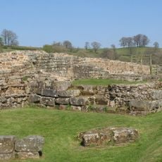
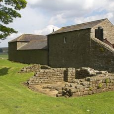
Banna, Roman fort near Waterhead, Great Britain

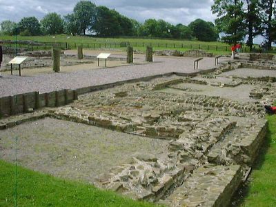
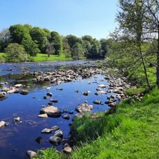
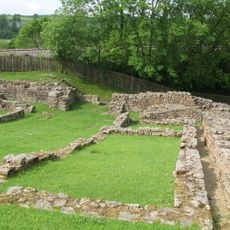
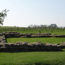
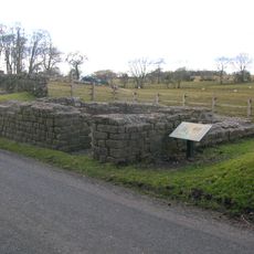
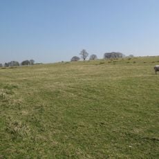
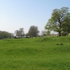
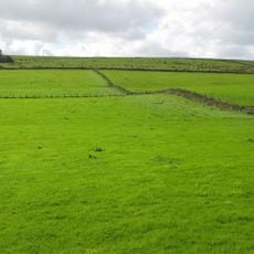
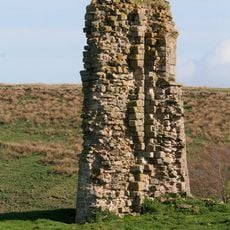
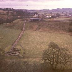
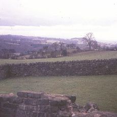
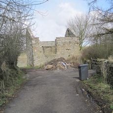
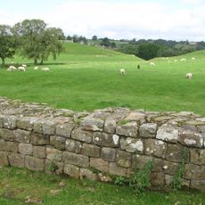
Banna is a Roman fort positioned on a triangular plateau bordered by cliffs that overlooks the River Irthing and the surrounding Cumbrian landscape. The site contains remains of military buildings, including barracks, storage facilities, and administrative structures from the Roman period.

The fort was founded around 112 AD and served as part of Rome's northern frontier defense system for more than three centuries. Archaeological evidence shows that occupation continued even after Roman withdrawal from the region.

The fort housed soldiers from across the empire who carried out daily duties and brought their families to this remote outpost. The layout of the structures reveals how life was organized within this military community.

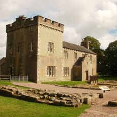
Access to the fort follows well-marked paths across the elevated plateau, allowing visitors to explore the remains and take in the surrounding views. A visitor center nearby displays excavated items and information panels to help understand what you see on the ground.

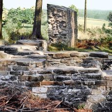
Excavations in the late 1980s and early 1990s uncovered two large timber halls built hundreds of years after the Romans left. This discovery shows the plateau remained a gathering place of importance to later communities.

Location: Waterhead

Operator: English Heritage

Part of: Birdoswald Roman fort and the section of Hadrian's Wall and vallum between the River Irthing and the field boundaries east of milecastle 50

Website: https://english-heritage.org.uk/visit/places/birdoswald-roman-fort-hadrians-wall

GPS coordinates: 54.98975,-2.60324

Latest update: December 6, 2025 16:03

Photos
Historic sites and nature spots in Cumbria

Cumbria holds centuries of history within its borders. Medieval churches stand in villages like Bassenthwaite and Beetham, their stones speaking of centuries past. Ancient stone circles such as Swinside Stone Circle and Long Meg and Her Daughters dot the countryside, reaching back to prehistoric...

Around this place
Borders of the Roman Empire
United Kingdom

Borders of the Roman Empire

349 m
Hadrian's Wall
United Kingdom

Hadrian's Wall

100 m
Birdoswald
United Kingdom

Birdoswald

6 m
Milecastle 48
United Kingdom

Milecastle 48

1.9 km
Milecastle 49
United Kingdom

Milecastle 49

540 m
Leahill Turret
United Kingdom

Leahill Turret

3.3 km
Milecastle 50
United Kingdom

Milecastle 50

869 m
Milecastle 51
United Kingdom

Milecastle 51

2.3 km
Milecastle 47
United Kingdom

Milecastle 47

3.4 km
Triermain Castle
United Kingdom

Triermain Castle

2.1 km
St. Mary Magdalene's Church, Gilsland
United Kingdom

St. Mary Magdalene's Church, Gilsland

2.1 km
Willowford Bridge
United Kingdom

Willowford Bridge

733 m
Church of St Cuthbert
United Kingdom

Church of St Cuthbert

2.6 km
St Cuthbert's church, Upper Denton
United Kingdom

St Cuthbert's church, Upper Denton

788 m
Poltross Burn Viaduct
United Kingdom

Poltross Burn Viaduct

1.9 km
The Hill
United Kingdom

The Hill

1.1 km
Hadrian's Wall and vallum and their associated features between Poltross Burn and the River Irthing in wall mile 48
United Kingdom

Hadrian's Wall and vallum and their associated features between Poltross Burn and the River Irthing in wall mile 48

1.3 km
Dinmont House
United Kingdom

Dinmont House

1.8 km
Hadrian's Wall and vallum between the field boundary west of Coombe Crag and Banks Green Cottage and the road to Lanercost at Banks in wall miles 51 and 52
United Kingdom

Hadrian's Wall and vallum between the field boundary west of Coombe Crag and Banks Green Cottage and the road to Lanercost at Banks in wall miles 51 and 52

3.7 km
Bastle at Upper Denton
United Kingdom

Bastle at Upper Denton

768 m
Hadrians Wall Milecastle And Turrets Hadrians Wall, Milecastle And Turrets
United Kingdom

Hadrians Wall Milecastle And Turrets Hadrians Wall, Milecastle And Turrets

2.3 km
Orchard House
United Kingdom

Orchard House

1.8 km
1-4, Hall Terrace
United Kingdom

1-4, Hall Terrace

1.8 km
Milestone West Of At Temon Bridge At Ngr Ny 6080 63660
United Kingdom

Milestone West Of At Temon Bridge At Ngr Ny 6080 63660

2.7 km
Farmbuildings Situated 30 Metres North North West Of Birdoswald Farmhouse Or Tenement
United Kingdom

Farmbuildings Situated 30 Metres North North West Of Birdoswald Farmhouse Or Tenement

28 m
Milestone East Of Low Row At Ngr Ny 59580 63080
United Kingdom

Milestone East Of Low Row At Ngr Ny 59580 63080

3.7 km
Spa Villa
United Kingdom

Spa Villa

2.4 km
Willowford And Adjoining Farm Buildings
United Kingdom

Willowford And Adjoining Farm Buildings

993 m
Show the full map
Reviews

Visited this place? Tap the stars to rate it and share your experience / photos with the community! Try now! You can cancel it anytime.

« Banna - Roman fort near Waterhead, Great Britain » is provided by Around Us (aroundus.com). Images and texts are derived from Wikimedia project under a Creative Commons license. You are allowed to copy, distribute, and modify copies of this page, under the conditions set by the license, as long as this note is clearly visible.

Discover hidden gems everywhere you go!

From secret cafés to breathtaking viewpoints, skip the crowded tourist spots and find places that match your style. Our app makes it easy with voice search, smart filtering, route optimization, and insider tips from travelers worldwide. Download now for the complete mobile experience.

Around Us App Screenshot

A unique approach to discovering new places

Le Figaro

All the places worth exploring

France Info

A tailor-made excursion in just a few clicks

20 Minutes