Enable Location

We need your location to show you interesting places around you

Discover nearby places

Find interesting locations and hidden gems around you

Precise directions

Get accurate directions and distances to places

Your location is never shared with other users. It's only used when you tap the location button.

Borders of the Roman Empire

Log in to your account

Start exploring — it's free

Trusted by 61,456 travelers worldwide

Continue with Google
Continue with Apple
or

We will send you a code to connect

By continuing, you accept our Terms and Conditions and our Privacy Policy

Check your inbox

We've sent a pincode in your inbox. Please enter the code below.

Borders of the Roman Empire

Borders of the Roman Empire, Political border and UNESCO World Heritage Site in England and Germany.

Description

The borders of the Roman Empire were defense lines composed of military roads, fortifications, and forts that separated imperial territories from outside lands. They combined natural barriers like rivers with constructed structures to create effective frontier defenses.

History

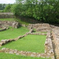
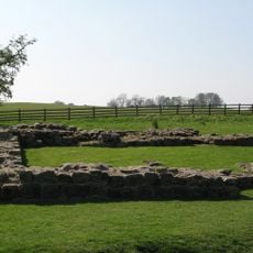
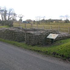
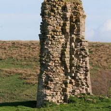
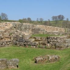
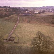
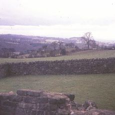
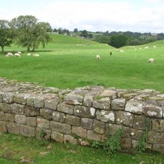
The Romans began constructing frontier defenses early but greatly strengthened them in the second century with stone walls and numerous fortified positions across territories. These massive defense systems protected the empire from external threats for centuries.

Culture

The border zones shaped how European populations developed through trade routes, military posts, and places where Roman and non-Roman peoples met. These areas show how people from different worlds lived and worked alongside each other.

Practical

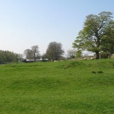
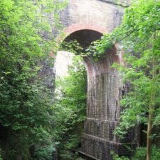
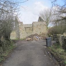
Many museums and archaeological sites display preserved remains of these ancient fortifications, some with reconstructed structures to walk through. The sites span multiple countries, so planning ahead helps travelers visit the sections that interest them most.

Did you know?

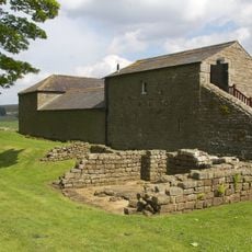
The Saalburg Roman Fort near Frankfurt presents a complete reconstruction of a frontier garrison with original foundations and archaeological finds on display. This reconstruction helps visitors understand what daily life was like for soldiers stationed at the border.

Part of
Roman Empire
GPS coordinates
54.99261,-2.60100
Latest update
December 14, 2025 19:06

AroundUs brings together thousands of curated places, local tips, and hidden gems, enriched daily by 60,000 contributors worldwide. Discover all places nearby (United Kingdom).

Around this place
Banna
United Kingdom

Banna

349 m
Hadrian's Wall
United Kingdom

Hadrian's Wall

305 m
Birdoswald
United Kingdom

Birdoswald

353 m
Milecastle 48
United Kingdom

Milecastle 48

1.8 km
Milecastle 49
United Kingdom

Milecastle 49

434 m
Leahill Turret
United Kingdom

Leahill Turret

3.6 km
Milecastle 50
United Kingdom

Milecastle 50

1.1 km
Milecastle 51
United Kingdom

Milecastle 51

2.6 km
Milecastle 47
United Kingdom

Milecastle 47

3.3 km
Triermain Castle
United Kingdom

Triermain Castle

2.2 km
St. Mary Magdalene's Church, Gilsland
United Kingdom

St. Mary Magdalene's Church, Gilsland

1.8 km
Willowford Bridge
United Kingdom

Willowford Bridge

588 m
Church of St Cuthbert
United Kingdom

Church of St Cuthbert

2.9 km
St Cuthbert's church, Upper Denton
United Kingdom

St Cuthbert's church, Upper Denton

1.1 km
Raf Spadeadam: Blue Streak Rocket
United Kingdom

Raf Spadeadam: Blue Streak Rocket

3.7 km
Poltross Burn Viaduct
United Kingdom

Poltross Burn Viaduct

1.8 km
The Hill
United Kingdom

The Hill

814 m
Hadrian's Wall and vallum and their associated features between Poltross Burn and the River Irthing in wall mile 48
United Kingdom

Hadrian's Wall and vallum and their associated features between Poltross Burn and the River Irthing in wall mile 48

1.2 km
Dinmont House
United Kingdom

Dinmont House

1.7 km
Hadrian's Wall and vallum between the field boundary west of Coombe Crag and Banks Green Cottage and the road to Lanercost at Banks in wall miles 51 and 52
United Kingdom

Hadrian's Wall and vallum between the field boundary west of Coombe Crag and Banks Green Cottage and the road to Lanercost at Banks in wall miles 51 and 52

4 km
Bastle at Upper Denton
United Kingdom

Bastle at Upper Denton

1.1 km
Hadrians Wall Milecastle And Turrets Hadrians Wall, Milecastle And Turrets
United Kingdom

Hadrians Wall Milecastle And Turrets Hadrians Wall, Milecastle And Turrets

2.2 km
Orchard House
United Kingdom

Orchard House

1.6 km
1-4, Hall Terrace
United Kingdom

1-4, Hall Terrace

1.7 km
Farmbuildings Situated 30 Metres North North West Of Birdoswald Farmhouse Or Tenement
United Kingdom

Farmbuildings Situated 30 Metres North North West Of Birdoswald Farmhouse Or Tenement

342 m
Milestone West Of At Temon Bridge At Ngr Ny 6080 63660
United Kingdom

Milestone West Of At Temon Bridge At Ngr Ny 6080 63660

3 km
Spa Villa
United Kingdom

Spa Villa

2.1 km
Willowford And Adjoining Farm Buildings
United Kingdom

Willowford And Adjoining Farm Buildings

838 m
Show the full map
« Borders of the Roman Empire - Political border and UNESCO World Heritage Site in England and Germany » is provided by Around Us (aroundus.com). Images and texts are derived from Wikimedia project under a Creative Commons license. You are allowed to copy, distribute, and modify copies of this page, under the conditions set by the license, as long as this note is clearly visible.

Discover hidden gems everywhere you go!

From secret cafés to breathtaking viewpoints, skip the crowded tourist spots and find places that match your style. Our app makes it easy with voice search, smart filtering, route optimization, and insider tips from travelers worldwide. Download now for the complete mobile experience.

Around Us App Screenshot

A unique approach to discovering new places

Le Figaro

All the places worth exploring

France Info

A tailor-made excursion in just a few clicks

20 Minutes

Around Us
Travel Guide & Maps
Download

Send to your phone

QR Code
1

Open the camera app on your mobile.

2

Point at the QR code with your camera. A notification will appear.

3

Tap the notification to open the link.