Birdoswald

Log in to your account

AroundUs is a community-driven map of interesting places, built by curious explorers like you. It grows with every review, story, and photo you share.
Connect to save your favorite spots, contribute locations, and create personalized routes.
Continue with Google
Continue with Apple
Continue with X
Continue with Facebook
Continue with email
By continuing, you accept our Terms and Conditions and our Privacy Policy
Create an account
Add to collection
Map
Suggest a change
Share

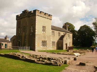
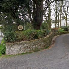
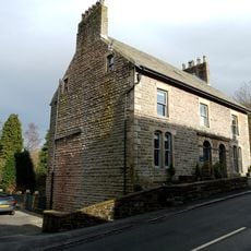
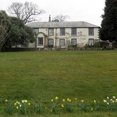
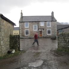
Birdoswald, Grade II listed farmhouse in Waterhead, England.

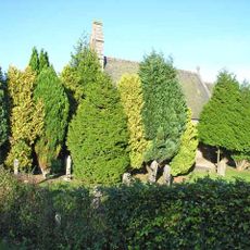
Birdoswald is a farmhouse with thick stone walls made from rubble masonry and roofs covered in Welsh slate, typical of buildings in this region. It features a two-story tower on the western side and a central porch as its main entrance.

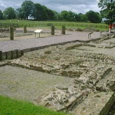
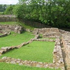
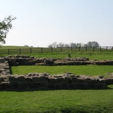
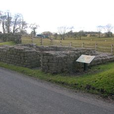
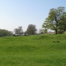
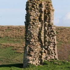
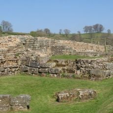
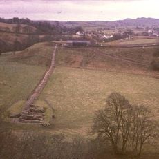
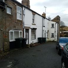
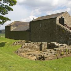
The property began as a farm in medieval times when a family established their operations here and later gave portions of their land to a nearby monastery. Beneath its foundations lie remains of a Roman military fort that existed centuries before the farm was built.

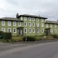
The farmhouse shows how rural living spaces evolved across different periods, with architectural features from several centuries visible when you walk through it. The mix of building styles tells a story about how families adapted to their environment over time.

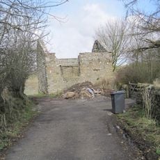
The property now houses an information center and museum spaces where you can learn about the Roman fort and the occupation period of this area. It serves as a good place to stop and understand the history before or after exploring the surrounding landscape.

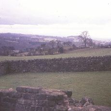
The building sits directly on the foundations of an ancient Roman military fort called Banna, with old stone layers actually incorporated into the walls you see today. This makes it a remarkable example of how new structures were literally built on top of ancient empire ruins.

Location: Waterhead

GPS coordinates: 54.98970,-2.60320

Latest update: December 10, 2025 20:08

Photos
Around this place
Borders of the Roman Empire
United Kingdom

Borders of the Roman Empire

353 m
Banna
United Kingdom

Banna

6 m
Hadrian's Wall
United Kingdom

Hadrian's Wall

99 m
Milecastle 48
United Kingdom

Milecastle 48

1.9 km
Milecastle 49
United Kingdom

Milecastle 49

538 m
Leahill Turret
United Kingdom

Leahill Turret

3.3 km
Milecastle 50
United Kingdom

Milecastle 50

869 m
Milecastle 51
United Kingdom

Milecastle 51

2.3 km
Milecastle 47
United Kingdom

Milecastle 47

3.4 km
Triermain Castle
United Kingdom

Triermain Castle

2.1 km
St. Mary Magdalene's Church, Gilsland
United Kingdom

St. Mary Magdalene's Church, Gilsland

2.1 km
Willowford Bridge
United Kingdom

Willowford Bridge

732 m
Church of St Cuthbert
United Kingdom

Church of St Cuthbert

2.6 km
St Cuthbert's church, Upper Denton
United Kingdom

St Cuthbert's church, Upper Denton

782 m
Poltross Burn Viaduct
United Kingdom

Poltross Burn Viaduct

1.9 km
The Hill
United Kingdom

The Hill

1.1 km
Hadrian's Wall and vallum and their associated features between Poltross Burn and the River Irthing in wall mile 48
United Kingdom

Hadrian's Wall and vallum and their associated features between Poltross Burn and the River Irthing in wall mile 48

1.3 km
Dinmont House
United Kingdom

Dinmont House

1.8 km
Bastle at Upper Denton
United Kingdom

Bastle at Upper Denton

762 m
Hadrian's Wall and vallum between the field boundary west of Coombe Crag and Banks Green Cottage and the road to Lanercost at Banks in wall miles 51 and 52
United Kingdom

Hadrian's Wall and vallum between the field boundary west of Coombe Crag and Banks Green Cottage and the road to Lanercost at Banks in wall miles 51 and 52

3.7 km
Spa Villa
United Kingdom

Spa Villa

2.4 km
Orchard House
United Kingdom

Orchard House

1.8 km
1-4, Hall Terrace
United Kingdom

1-4, Hall Terrace

1.8 km
Milestone West Of At Temon Bridge At Ngr Ny 6080 63660
United Kingdom

Milestone West Of At Temon Bridge At Ngr Ny 6080 63660

2.7 km
Farmbuildings Situated 30 Metres North North West Of Birdoswald Farmhouse Or Tenement
United Kingdom

Farmbuildings Situated 30 Metres North North West Of Birdoswald Farmhouse Or Tenement

34 m
Willowford And Adjoining Farm Buildings
United Kingdom

Willowford And Adjoining Farm Buildings

992 m
Hadrians Wall Milecastle And Turrets Hadrians Wall, Milecastle And Turrets
United Kingdom

Hadrians Wall Milecastle And Turrets Hadrians Wall, Milecastle And Turrets

2.3 km
Milestone, Gap Shields
United Kingdom

Milestone, Gap Shields

3 km
Show the full map
Reviews

Visited this place? Tap the stars to rate it and share your experience / photos with the community! Try now! You can cancel it anytime.

« Birdoswald - Grade II listed farmhouse in Waterhead, England » is provided by Around Us (aroundus.com). Images and texts are derived from Wikimedia project under a Creative Commons license. You are allowed to copy, distribute, and modify copies of this page, under the conditions set by the license, as long as this note is clearly visible.

Discover hidden gems everywhere you go!

From secret cafés to breathtaking viewpoints, skip the crowded tourist spots and find places that match your style. Our app makes it easy with voice search, smart filtering, route optimization, and insider tips from travelers worldwide. Download now for the complete mobile experience.

Around Us App Screenshot

A unique approach to discovering new places

Le Figaro

All the places worth exploring

France Info

A tailor-made excursion in just a few clicks

20 Minutes