Pike Hill Signal Tower

Log in to your account

AroundUs is a community-driven map of interesting places, built by curious explorers like you. It grows with every review, story, and photo you share.
Connect to save your favorite spots, contribute locations, and create personalized routes.
Continue with Google
Continue with Apple
Continue with X
Continue with Facebook
Continue with email
By continuing, you accept our Terms and Conditions and our Privacy Policy
Create an account

Pike Hill Signal Tower

Add to collection
Map
Suggest a change
Share

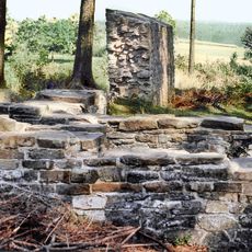
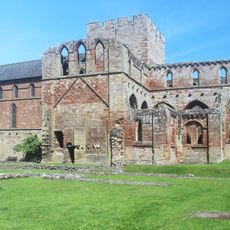
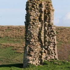
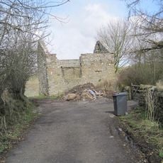
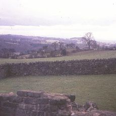
Pike Hill Signal Tower, Roman signal tower in Waterhead, England

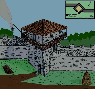
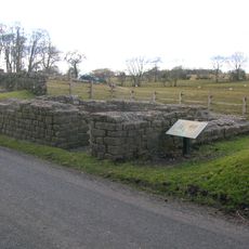
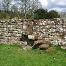
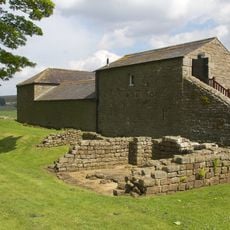
Pike Hill Signal Tower is a Roman military structure built from stone with walls about 6 meters across, constructed on a mortared foundation set deep into the ground. The surviving remains show how strongly this outpost was built to last.

The tower was built during the early Roman occupation of Britain, before the construction of Hadrian's Wall in the early second century. It was part of an earlier defense line called the Stanegate, which the Romans used before they built the more famous stone wall.

The tower served as a communication point within a network that connected Roman soldiers across the frontier and allowed them to send messages quickly. These outposts were important for how troops organized their daily work and watched the landscape.

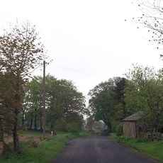
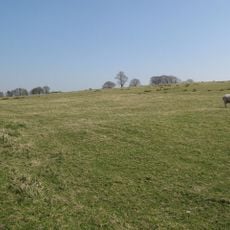
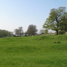
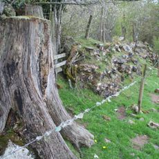
You can reach the tower remains by following a footpath from Banks East Turret car park, and it is best to wear suitable shoes for the ground conditions. The terrain can be wet and muddy, so come prepared for outdoor walking.

The tower stands at an unusual angle to Hadrian's Wall and displays stonework that was built with particular care. This level of craftsmanship sets it apart from many other fortifications along the Roman frontier.

Location: Waterhead

Part of: Hadrian's Wall and vallum between the field boundary west of Coombe Crag and Banks Green Cottage and the road to Lanercost at Banks in wall miles 51 and 52

Website: https://english-heritage.org.uk/visit/places/pike-hill-signal-tower-hadrians-wall

GPS coordinates: 54.97595,-2.66294

Latest update: December 14, 2025 12:22

Photos
Around this place
Borders of the Roman Empire
United Kingdom

Borders of the Roman Empire

4.4 km
Naworth Castle
United Kingdom

Naworth Castle

2.8 km
Banna
United Kingdom

Banna

4.1 km
Lanercost Priory
United Kingdom

Lanercost Priory

2.3 km
Hadrian's Wall
United Kingdom

Hadrian's Wall

4.2 km
Birdoswald
United Kingdom

Birdoswald

4.1 km
Leahill Turret
United Kingdom

Leahill Turret

784 m
Milecastle 52
United Kingdom

Milecastle 52

301 m
Milecastle 50
United Kingdom

Milecastle 50

3.2 km
Milecastle 51
United Kingdom

Milecastle 51

1.8 km
Triermain Castle
United Kingdom

Triermain Castle

2.7 km
St Mary Magdalene
United Kingdom

St Mary Magdalene

2.3 km
Church of St Cuthbert
United Kingdom

Church of St Cuthbert

1.8 km
St Cuthbert's church, Upper Denton
United Kingdom

St Cuthbert's church, Upper Denton

4 km
Gateway Arch West of Lanercost Priory
United Kingdom

Gateway Arch West of Lanercost Priory

2.5 km
Lanercost Bridge
United Kingdom

Lanercost Bridge

2.7 km
Hadrian's Wall and vallum between Banks Green Cottage and the road to Lanercost at Banks and the road to Garthside in wall miles 52, 53 and 54
United Kingdom

Hadrian's Wall and vallum between Banks Green Cottage and the road to Lanercost at Banks and the road to Garthside in wall miles 52, 53 and 54

2.3 km
Walls to the North of Lanercost Priory
United Kingdom

Walls to the North of Lanercost Priory

2.3 km
The Vicarage
United Kingdom

The Vicarage

2.4 km
Bastle at Upper Denton
United Kingdom

Bastle at Upper Denton

4 km
Hadrian's Wall and vallum between the field boundary west of Coombe Crag and Banks Green Cottage and the road to Lanercost at Banks in wall miles 51 and 52
United Kingdom

Hadrian's Wall and vallum between the field boundary west of Coombe Crag and Banks Green Cottage and the road to Lanercost at Banks in wall miles 51 and 52

397 m
Northrigghill
United Kingdom

Northrigghill

468 m
Milestone West Of At Temon Bridge At Ngr Ny 6080 63660
United Kingdom

Milestone West Of At Temon Bridge At Ngr Ny 6080 63660

3.6 km
Milestone At Ngr Ny58130 62460
United Kingdom

Milestone At Ngr Ny58130 62460

2.4 km
Farmbuildings Situated 30 Metres North North West Of Birdoswald Farmhouse Or Tenement
United Kingdom

Farmbuildings Situated 30 Metres North North West Of Birdoswald Farmhouse Or Tenement

4.1 km
Milestone At Ngr Ny 56690 61990
United Kingdom

Milestone At Ngr Ny 56690 61990

3 km
Milestone East Of Low Row At Ngr Ny 59580 63080
United Kingdom

Milestone East Of Low Row At Ngr Ny 59580 63080

2.6 km
Cross Base North West of Lanercost Priory
United Kingdom

Cross Base North West of Lanercost Priory

2.3 km
Show the full map
Reviews

Visited this place? Tap the stars to rate it and share your experience / photos with the community! Try now! You can cancel it anytime.

« Pike Hill Signal Tower - Roman signal tower in Waterhead, England » is provided by Around Us (aroundus.com). Images and texts are derived from Wikimedia project under a Creative Commons license. You are allowed to copy, distribute, and modify copies of this page, under the conditions set by the license, as long as this note is clearly visible.

Discover hidden gems everywhere you go!

From secret cafés to breathtaking viewpoints, skip the crowded tourist spots and find places that match your style. Our app makes it easy with voice search, smart filtering, route optimization, and insider tips from travelers worldwide. Download now for the complete mobile experience.

Around Us App Screenshot

A unique approach to discovering new places

Le Figaro

All the places worth exploring

France Info

A tailor-made excursion in just a few clicks

20 Minutes