Enable Location

We need your location to show you interesting places around you

Discover nearby places

Find interesting locations and hidden gems around you

Precise directions

Get accurate directions and distances to places

Your location is never shared with other users. It's only used when you tap the location button.

Moyry Castle

Log in to your account

Start exploring — it's free

Trusted by 62,864 travelers worldwide

Continue with Google
Continue with Apple
or

We will send you a code to connect

By continuing, you accept our Terms and Conditions and our Privacy Policy

Check your inbox

We've sent a pincode in your inbox. Please enter the code below.

Moyry Castle

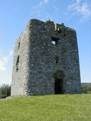
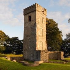
Moyry Castle, Military fortress in County Armagh, Northern Ireland.

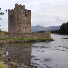
Moyry Castle is a stone fortress in County Armagh, Northern Ireland, featuring a rectangular tower that rises three stories with rounded corners. The thick walls contain gun loops and musketry loopholes for defense, with each floor having a fireplace built into the north wall.

Lord Mountjoy built this fortress in 1601 to control the strategic Moyry Pass during his military campaign in Ulster. This passage, also known as the Gap of the North, was a key location for military control in the region.

The name Moyry comes from the Irish term Maġ Rí, meaning plain of the king. This title still shapes how people understand the location's role in the regional landscape today.

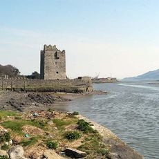
The castle sits on Kilnasaggart Road in Jonesborough and can be viewed from the Belfast-Dublin railway line. The structure is best observed from various spots along the road for clear views.

The musketry loopholes are not evenly distributed across all walls, but instead concentrated in specific areas of the structure. This uneven placement shows the specific defensive strategies that were planned when building the fortress.

The community of curious travelers

AroundUs brings together thousands of curated places, local tips, and hidden gems, enriched daily by 60,000 contributors worldwide.

Start exploring
GPS coordinates
54.07030,-6.38528
Latest update
December 8, 2025 21:06
« Moyry Castle - Military fortress in County Armagh, Northern Ireland » is provided by Around Us (aroundus.com). Images and texts are derived from Wikimedia project under a Creative Commons license. You are allowed to copy, distribute, and modify copies of this page, under the conditions set by the license, as long as this note is clearly visible.

Discover hidden gems everywhere you go!

From secret cafés to breathtaking viewpoints, skip the crowded tourist spots and find places that match your style. Our app makes it easy with voice search, smart filtering, route optimization, and insider tips from travelers worldwide. Download now for the complete mobile experience.

Around Us App Screenshot

A unique approach to discovering new places

Le Figaro

All the places worth exploring

France Info

A tailor-made excursion in just a few clicks

20 Minutes

Around Us
Travel Guide & Maps
Download

Send to your phone

QR Code
1

Open the camera app on your mobile.

2

Point at the QR code with your camera. A notification will appear.

3

Tap the notification to open the link.